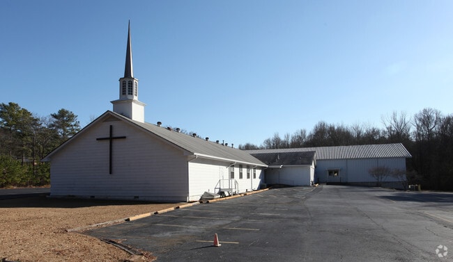
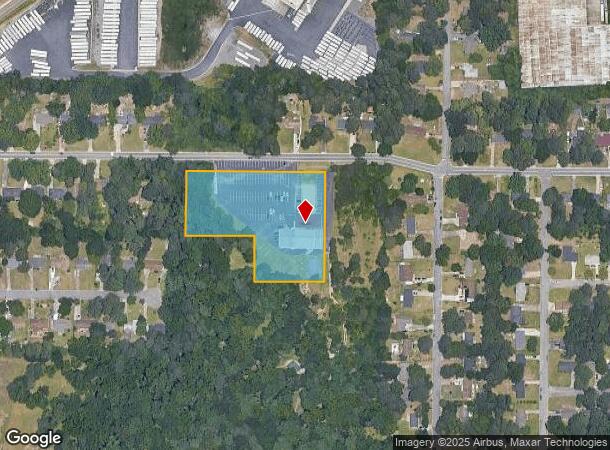
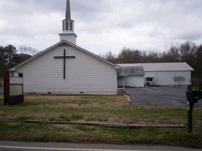
Property Record
1921 Rock Cut Pl, Conley, GA 30288

NEARBY LISTINGS FOR SALE OR LEASE
Property Detail
1921 Rock Cut Pl
12-0238A-00A-002
Rocklane Estates
Religious
Clayton
A
Georgia
13063C0039F
35-38
0
2.90 AC
2025
North Clayton/Airport
040410
Atlanta
15,179 SF
Atlanta-Sandy Springs-Roswell, GA
DEMOGRAPHICS near 1921 Rock Cut Pl
1 Mile
3 Mile
5 Mile
2024 Total Population
4,216
43,093
143,344
2029 Population
4,141
43,511
144,771
Pop Growth 2024-2029
(1.78%)
+ 0.97%
+ 1.00%
Average Age
36
36
37
2024 Total Households
1,425
14,803
49,637
HH Growth 2024-2029
(1.68%)
+ 1.27%
+ 1.15%
Median Household Inc
$49,396
$50,862
$52,053
Avg Household Size
2.90
2.80
2.80
2024 Avg HH Vehicles
2.00
2.00
2.00
Median Home Value
$221,376
$173,325
$177,319
Median Year Built
1983
1980
1981
Nearby Places
Map Layers
Map Styles
 Street
 Aerial
- Restaurants
- Banks
- Shops
- Fitness
- Groceries
PUBLIC TRANSPORTATION
AIRPORT
Hartsfield - Jackson Atlanta International
DRIVE
WALK
Distance
Hartsfield - Jackson Atlanta International
16 min
6.9 mi
Freight Ports
Georgia Ports - Savannah
DRIVE
WALK
Distance
Georgia Ports - Savannah
265 min
237.3 mi
Nearby Properties
Address
Land Use
TOTAL SIZE
Lot Size
Zoning
Address
Land Use
TOTAL SIZE
Lot Size
Zoning
666,576 SF
63.38 AC
I
Address
Land Use
TOTAL SIZE
Lot Size
Zoning
570,146 SF
42.33 AC
I
Address
Land Use
TOTAL SIZE
Lot Size
Zoning
20,964 SF
70.93 AC
I
Address
Land Use
TOTAL SIZE
Lot Size
Zoning
42,671 SF
56.11 AC
I
Address
Land Use
TOTAL SIZE
Lot Size
Zoning
848,420 SF
48.96 AC
I
Address
Land Use
TOTAL SIZE
Lot Size
Zoning
873,223 SF
60.88 AC
I
Address
Land Use
TOTAL SIZE
Lot Size
Zoning
797,738 SF
54.98 AC
WH
Address
Land Use
TOTAL SIZE
Lot Size
Zoning
210,538 SF
101.40 AC
X
Address
Land Use
TOTAL SIZE
Lot Size
Zoning
659,547 SF
31.20 AC
HI
Address
Land Use
TOTAL SIZE
Lot Size
Zoning
105,260 SF
12.67 AC
C
Address
Land Use
TOTAL SIZE
Lot Size
Zoning
321,464 SF
23.11 AC
HI
Address
Land Use
TOTAL SIZE
Lot Size
Zoning
161,920 SF
14.26 AC
I
Address
Land Use
TOTAL SIZE
Lot Size
Zoning
332,442 SF
28.80 AC
HI
Address
Land Use
TOTAL SIZE
Lot Size
Zoning
24.09 AC
I
Address
Land Use
TOTAL SIZE
Lot Size
Zoning
229,829 SF
24.15 AC
HI
Address
Land Use
TOTAL SIZE
Lot Size
Zoning
365,298 SF
22.51 AC
I
Address
Land Use
TOTAL SIZE
Lot Size
Zoning
343,585 SF
24.04 AC
LI
Address
Land Use
TOTAL SIZE
Lot Size
Zoning
220,000 SF
54.68 AC
I
Address
Land Use
TOTAL SIZE
Lot Size
Zoning
308,683 SF
41.30 AC
C
Address
Land Use
TOTAL SIZE
Lot Size
Zoning
59,807 SF
43.70 AC
X
Address
Land Use
TOTAL SIZE
Lot Size
Zoning
259,168 SF
29.08 AC
GB
Address
Land Use
TOTAL SIZE
Lot Size
Zoning
312,798 SF
21.38 AC
HI
Address
Land Use
TOTAL SIZE
Lot Size
Zoning
402,544 SF
20.43 AC
I1
Address
Land Use
TOTAL SIZE
Lot Size
Zoning
44,365 SF
17.77 AC
M
Address
Land Use
TOTAL SIZE
Lot Size
Zoning
272,376 SF
17.73 AC
MXI
Address
Land Use
TOTAL SIZE
Lot Size
Zoning
399,000 SF
30.50 AC
WH
Address
Land Use
TOTAL SIZE
Lot Size
Zoning
250 SF
13.40 AC
C
Address
Land Use
TOTAL SIZE
Lot Size
Zoning
400,000 SF
42.87 AC
HI
Address
Land Use
TOTAL SIZE
Lot Size
Zoning
232 SF
21.38 AC
C
Address
Land Use
TOTAL SIZE
Lot Size
Zoning
143,970 SF
19.44 AC
INDP
The World's #1 Commercial Real Estate Marketplace
Connect with us
© 2025 CoStar Group
The information above has been obtained from sources believed reliable. While we do not doubt its accuracy we have not verified it and make no guarantee, warranty or representation about it. It is your responsibility to independently confirm its accuracy and completeness. Any projections, opinions, assumptions, or estimates used are for example only and do not represent the current or future performance of the property. The value of this transaction to you depends on tax and other factors which should be evaluated by your tax, financial, and legal advisors. You and your advisors should conduct a careful, independent investigation of the property to determine to your satisfaction the suitability of the property for your needs.