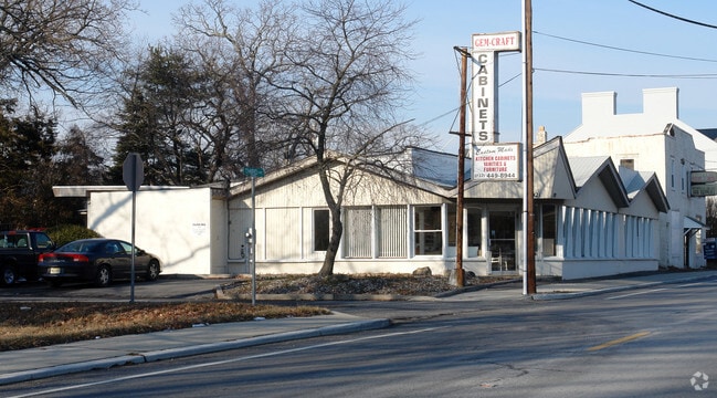
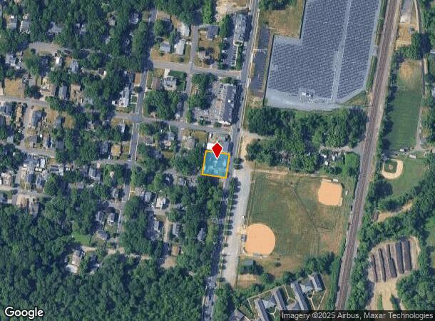
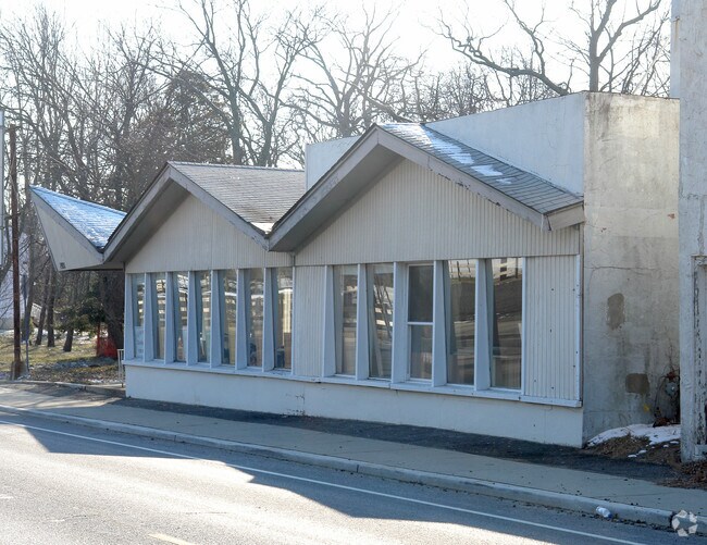
Property Record
1921 State Route 71, Belmar, NJ 07719
NEARBY LISTINGS FOR SALE OR LEASE
Property Detail
1921 State Route 71
New York-Jersey City-White Plains, NY-NJ
America World Camp Meeting
52-00010-0000-00003
ADDITIONAL LOTS: GW
Storebuilding
Monmouth
AE
New Jersey
34025C0341G
3
2024
0.23 AC
2025
Southern Monmouth
808502
Northern New Jersey
4,420 SF
DEMOGRAPHICS near 1921 State Route 71
1 Mile
3 Mile
5 Mile
2024 Total Population
15,001
59,176
126,403
2029 Population
15,368
60,383
128,505
Pop Growth 2024-2029
+ 2.45%
+ 2.04%
+ 1.66%
Average Age
45
46
45
2024 Total Households
6,753
25,762
54,473
HH Growth 2024-2029
+ 2.30%
+ 2.04%
+ 1.79%
Median Household Inc
$99,703
$103,290
$98,933
Avg Household Size
2.20
2.20
2.20
2024 Avg HH Vehicles
2.00
2.00
2.00
Median Home Value
$651,800
$652,156
$602,841
Median Year Built
1964
1964
1964
Nearby Places
Map Layers
Map Styles
 Street
 Aerial
- Restaurants
- Banks
- Shops
- Fitness
- Groceries
PUBLIC TRANSPORTATION
COMMUTER RAIL
Belmar (North Jersey Coast Line - NJ Transit Commuter Rail (NJ Transit))
DRIVE
WALK
Distance
Belmar (North Jersey Coast Line - NJ Transit Commuter Rail (NJ Transit))
4 min
1.3 mi
Spring Lake (North Jersey Coast Line - NJ Transit Commuter Rail (NJ Transit))
DRIVE
WALK
Distance
Spring Lake (North Jersey Coast Line - NJ Transit Commuter Rail (NJ Transit))
4 min
1.3 mi
Nearby Properties
Address
Land Use
TOTAL SIZE
Lot Size
Zoning
Address
Land Use
TOTAL SIZE
Lot Size
Zoning
22,660 SF
164.35 AC
4
Address
Land Use
TOTAL SIZE
Lot Size
Zoning
26,282 SF
4.59 AC
C
Address
Land Use
TOTAL SIZE
Lot Size
Zoning
2,596 SF
54.13 AC
SF10
Address
Land Use
TOTAL SIZE
Lot Size
Zoning
5,776 SF
25.50 AC
PB
Address
Land Use
TOTAL SIZE
Lot Size
Zoning
739,651 SF
27.89 AC
C
Address
Land Use
TOTAL SIZE
Lot Size
Zoning
1,846 SF
23.23 AC
R-2
Address
Land Use
TOTAL SIZE
Lot Size
Zoning
23,868 SF
137.35 AC
R-1
Address
Land Use
TOTAL SIZE
Lot Size
Zoning
4,078 SF
0.01 AC
3
Address
Land Use
TOTAL SIZE
Lot Size
Zoning
3.46 AC
3
Address
Land Use
TOTAL SIZE
Lot Size
Zoning
190,893 SF
36.69 AC
POS
Address
Land Use
TOTAL SIZE
Lot Size
Zoning
17.66 AC
1E
Address
Land Use
TOTAL SIZE
Lot Size
Zoning
49,657 SF
11.22 AC
HB80
Address
Land Use
TOTAL SIZE
Lot Size
Zoning
20,959 SF
3.10 AC
R-1
Address
Land Use
TOTAL SIZE
Lot Size
Zoning
3.44 AC
R-2
Address
Land Use
TOTAL SIZE
Lot Size
Zoning
3,094 SF
277.60 AC
C
Address
Land Use
TOTAL SIZE
Lot Size
Zoning
254,714 SF
3.40 AC
WPRA
Address
Land Use
TOTAL SIZE
Lot Size
Zoning
9.30 AC
SF05
Address
Land Use
TOTAL SIZE
Lot Size
Zoning
3.44 AC
SF05
Address
Land Use
TOTAL SIZE
Lot Size
Zoning
8.82 AC
R2
Address
Land Use
TOTAL SIZE
Lot Size
Zoning
49,170 SF
8.38 AC
HB80
Address
Land Use
TOTAL SIZE
Lot Size
Zoning
45,236 SF
48.30 AC
POS
Address
Land Use
TOTAL SIZE
Lot Size
Zoning
27,328 SF
6.79 AC
HB12
Address
Land Use
TOTAL SIZE
Lot Size
Zoning
26.05 AC
SF10
Address
Land Use
TOTAL SIZE
Lot Size
Zoning
0.86 AC
R-1
Address
Land Use
TOTAL SIZE
Lot Size
Zoning
7.39 AC
R2
Address
Land Use
TOTAL SIZE
Lot Size
Zoning
8.76 AC
R1
Address
Land Use
TOTAL SIZE
Lot Size
Zoning
86,051 SF
9.41 AC
HB12
Address
Land Use
TOTAL SIZE
Lot Size
Zoning
6.43 AC
SF05
Address
Land Use
TOTAL SIZE
Lot Size
Zoning
111,580 SF
25 AC
POS
Address
Land Use
TOTAL SIZE
Lot Size
Zoning
8.83 AC
R-2
The World's #1 Commercial Real Estate Marketplace
Connect with us
© 2025 CoStar Group
The information above has been obtained from sources believed reliable. While we do not doubt its accuracy we have not verified it and make no guarantee, warranty or representation about it. It is your responsibility to independently confirm its accuracy and completeness. Any projections, opinions, assumptions, or estimates used are for example only and do not represent the current or future performance of the property. The value of this transaction to you depends on tax and other factors which should be evaluated by your tax, financial, and legal advisors. You and your advisors should conduct a careful, independent investigation of the property to determine to your satisfaction the suitability of the property for your needs.