Property Record
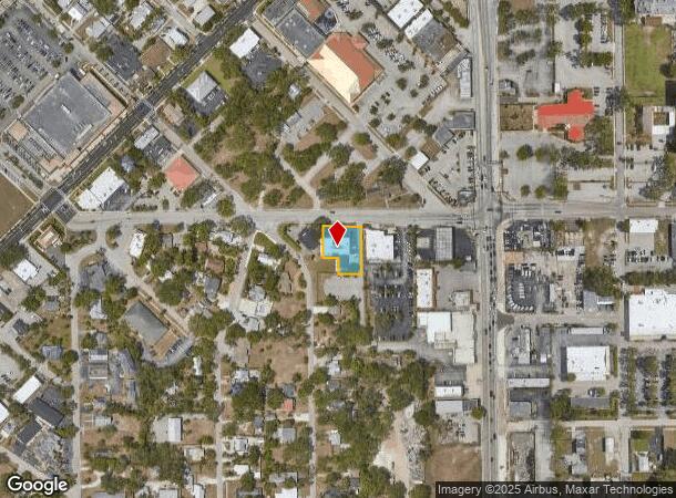
1922 Victoria Ave, Fort Myers, FL 33901
Current Lease Availabilities
NEARBY LISTINGS FOR SALE OR LEASE
Property Detail
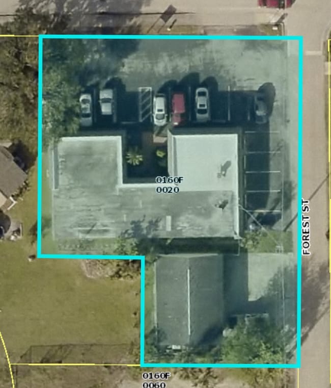
1922 Victoria Ave
Cape Coral-Fort Myers, FL
Altamont Park
23-44-24-P2-0160F.0020
ALTAMONT PARK BLK F PB 5 PG 12 LOTS 2 + 3 + E 72 FT OF LOTS 4 + 5
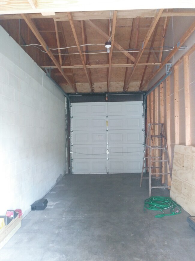
Officebuilding
Lee
X
Florida
12071C0288H
2-5
2024
0.36 AC
2025
City of Ft Myers
000800
Southwest Florida
4,604 SF
DEMOGRAPHICS near 1922 Victoria Ave
1 Mile
3 Mile
5 Mile
2024 Total Population
8,929
56,235
164,923
2029 Population
10,711
66,338
195,381
Pop Growth 2024-2029
+ 19.96%
+ 17.97%
+ 18.47%
Average Age
47
42
43
2024 Total Households
4,405
23,688
68,152
HH Growth 2024-2029
+ 20.27%
+ 17.70%
+ 18.21%
Median Household Inc
$33,150
$43,952
$50,927
Avg Household Size
1.90
2.30
2.30
2024 Avg HH Vehicles
1.00
1.00
2.00
Median Home Value
$364,590
$258,190
$234,719
Median Year Built
1984
1982
1986
Nearby Places
- Restaurants
- Banks
- Shops
- Fitness
- Groceries
PUBLIC TRANSPORTATION
AIRPORT
Southwest Florida International
DRIVE
WALK
Distance
Southwest Florida International
25 min
14.3 mi
Punta Gorda
DRIVE
WALK
Distance
Punta Gorda
34 min
23.4 mi
Freight Ports
Port Manatee
DRIVE
WALK
Distance
Port Manatee
114 min
95.1 mi
Nearby Properties
Address
Land Use
TOTAL SIZE
Lot Size
Zoning
Address
Land Use
TOTAL SIZE
Lot Size
Zoning
770,753 SF
5.87 AC
PUD
Address
Land Use
TOTAL SIZE
Lot Size
Zoning
536,175 SF
8.42 AC
PO
Address
Land Use
TOTAL SIZE
Lot Size
Zoning
4.48 AC
U-CTR
Address
Land Use
TOTAL SIZE
Lot Size
Zoning
429,703 SF
16.24 AC
PUD
Address
Land Use
TOTAL SIZE
Lot Size
Zoning
646,502 SF
6.11 AC
PUD
Address
Land Use
TOTAL SIZE
Lot Size
Zoning
552,157 SF
4.20 AC
PUD
Address
Land Use
TOTAL SIZE
Lot Size
Zoning
723,322 SF
1.73 AC
PUD
Address
Land Use
TOTAL SIZE
Lot Size
Zoning
98,242 SF
17.43 AC
RS-7
Address
Land Use
TOTAL SIZE
Lot Size
Zoning
749,922 SF
41.78 AC
C1
Address
Land Use
TOTAL SIZE
Lot Size
Zoning
305,224 SF
17.11 AC
CG
Address
Land Use
TOTAL SIZE
Lot Size
Zoning
284,371 SF
12.61 AC
CG
Address
Land Use
TOTAL SIZE
Lot Size
Zoning
243,841 SF
3.17 AC
CIVIC
Address
Land Use
TOTAL SIZE
Lot Size
Zoning
376,949 SF
49.70 AC
RM16
Address
Land Use
TOTAL SIZE
Lot Size
Zoning
281,781 SF
12.60 AC
C1
Address
Land Use
TOTAL SIZE
Lot Size
Zoning
163,618 SF
1.32 AC
CIVIC
Address
Land Use
TOTAL SIZE
Lot Size
Zoning
357,679 SF
26.43 AC
PUD
Address
Land Use
TOTAL SIZE
Lot Size
Zoning
211,446 SF
7.81 AC
C1
Address
Land Use
TOTAL SIZE
Lot Size
Zoning
551,003 SF
3.24 AC
PUD
Address
Land Use
TOTAL SIZE
Lot Size
Zoning
319,765 SF
47.40 AC
RS7
Address
Land Use
TOTAL SIZE
Lot Size
Zoning
11.64 AC
C-1
Address
Land Use
TOTAL SIZE
Lot Size
Zoning
250,169 SF
10.67 AC
CI
Address
Land Use
TOTAL SIZE
Lot Size
Zoning
294,203 SF
30.22 AC
RM16
Address
Land Use
TOTAL SIZE
Lot Size
Zoning
333,282 SF
25.70 AC
C1
Address
Land Use
TOTAL SIZE
Lot Size
Zoning
107,306 SF
1.91 AC
CIVIC
Address
Land Use
TOTAL SIZE
Lot Size
Zoning
16.49 AC
C1
Address
Land Use
TOTAL SIZE
Lot Size
Zoning
305,410 SF
1.38 AC
U-CTR
Address
Land Use
TOTAL SIZE
Lot Size
Zoning
76,154 SF
2.88 AC
U-CTR
Address
Land Use
TOTAL SIZE
Lot Size
Zoning
390,391 SF
27.17 AC
C1
Address
Land Use
TOTAL SIZE
Lot Size
Zoning
115,004 SF
1.91 AC
CIVIC
Address
Land Use
TOTAL SIZE
Lot Size
Zoning
264,395 SF
20.78 AC
C1
The World's #1 Commercial Real Estate Marketplace
Connect with us
© 2025 CoStar Group
The information above has been obtained from sources believed reliable. While we do not doubt its accuracy we have not verified it and make no guarantee, warranty or representation about it. It is your responsibility to independently confirm its accuracy and completeness. Any projections, opinions, assumptions, or estimates used are for example only and do not represent the current or future performance of the property. The value of this transaction to you depends on tax and other factors which should be evaluated by your tax, financial, and legal advisors. You and your advisors should conduct a careful, independent investigation of the property to determine to your satisfaction the suitability of the property for your needs.