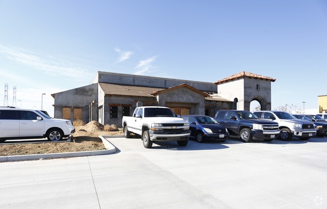
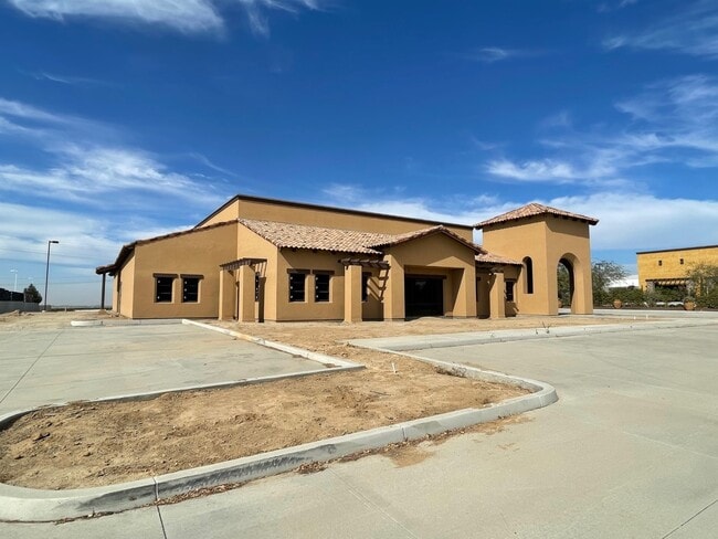
Property Record
19229 Flightpath Way, Bakersfield, CA 93308

Property Detail
19229 Flightpath Way
482-170-23-00-1
PAR 2 PMW 10-19
Auditorium
KERN
M1
California
B and X Area of moderate flood hazard, usually the area between the limits of the 100-year and 500-year floods.
2.75 AC
2024
North Bakersfield
2025
Bakersfield
000106
Bakersfield-Delano, CA
11,942 SF
NEARBY LISTINGS FOR SALE OR LEASE
DEMOGRAPHICS near 19229 Flightpath Way
1 mile
3 mile
5 mile
2024 Total Population
9
20,352
97,083
2029 Population
9
20,695
98,143
Pop Growth 2024-2029
0.00%
+ 1.69%
+ 1.09%
Average Age
37
37
37
2024 Total Households
1
6,863
33,056
HH Growth 2024-2029
0.00%
+ 1.62%
+ 1.07%
Median Household Inc
$0
$97,769
$83,270
Avg Household Size
.00
2.90
2.90
2024 Avg HH Vehicles
2.00
2.00
2.00
Median Home Value
$0
$452,767
$393,604
Median Year Built
0
1996
1993
Nearby Places
Map Layers
Map Styles
 Street
 Aerial
Transit
 Traffic
 Biking
Places
Listings with unknown addresses are not visible on the map
- Restaurants
- Banks
- Shops
- Fitness
- Groceries
PUBLIC TRANSPORTATION
COMMUTER RAIL
Bakersfield (San Joaquins - Amtrak)
Drive
Walk
Distance
Bakersfield (San Joaquins - Amtrak)
13 min
8.3 mi
AIRPORT
Meadows Field
Drive
Walk
Distance
Meadows Field
11 min
3.6 mi
Freight Ports
The Port of Hueneme
Drive
Walk
Distance
The Port of Hueneme
160 min
128.6 mi
SALE & LEASE HISTORY
LISTING DATE
SALE/LEASE

Apr 20, 2023
For Sale
Nearby Properties
Address
Land Use
TOTAL SIZE
Lot Size
Zoning
Address
Land Use
TOTAL SIZE
Lot Size
Zoning
2,645,250 SF
64.24 AC
M-2 PD H
Address
Land Use
TOTAL SIZE
Lot Size
Zoning
30,326 SF
19 AC
M3
Address
Land Use
TOTAL SIZE
Lot Size
Zoning
10,064 SF
13.44 AC
R3
Address
Land Use
TOTAL SIZE
Lot Size
Zoning
Address
Land Use
TOTAL SIZE
Lot Size
Zoning
2,129 SF
11.42 AC
M-2
Address
Land Use
TOTAL SIZE
Lot Size
Zoning
3,497 SF
31.27 AC
E
Address
Land Use
TOTAL SIZE
Lot Size
Zoning
3,383 SF
19.40 AC
M-2
Address
Land Use
TOTAL SIZE
Lot Size
Zoning
72,726 SF
13.15 AC
M2
Address
Land Use
TOTAL SIZE
Lot Size
Zoning
50,949 SF
78.05 AC
M-2
Address
Land Use
TOTAL SIZE
Lot Size
Zoning
54,960 SF
15.83 AC
M-2
Address
Land Use
TOTAL SIZE
Lot Size
Zoning
168,559 SF
5.34 AC
M-2
Address
Land Use
TOTAL SIZE
Lot Size
Zoning
12,000 SF
11.90 AC
M-2 PD
Address
Land Use
TOTAL SIZE
Lot Size
Zoning
357,609 SF
21.80 AC
M2
Address
Land Use
TOTAL SIZE
Lot Size
Zoning
57,560 SF
5.53 AC
C1
Address
Land Use
TOTAL SIZE
Lot Size
Zoning
7,196 SF
2.24 AC
Address
Land Use
TOTAL SIZE
Lot Size
Zoning
62,536 SF
2.11 AC
M2
Address
Land Use
TOTAL SIZE
Lot Size
Zoning
55,042 SF
0.49 AC
M1
Address
Land Use
TOTAL SIZE
Lot Size
Zoning
22,572 SF
44.92 AC
M-2 PD
Address
Land Use
TOTAL SIZE
Lot Size
Zoning
132,096 SF
8.93 AC
C-2
Address
Land Use
TOTAL SIZE
Lot Size
Zoning
144,439 SF
10.04 AC
M-2
Address
Land Use
TOTAL SIZE
Lot Size
Zoning
Address
Land Use
TOTAL SIZE
Lot Size
Zoning
7,500 SF
3.28 AC
M-2 PD
Address
Land Use
TOTAL SIZE
Lot Size
Zoning
163,159 SF
1.59 AC
C2
Address
Land Use
TOTAL SIZE
Lot Size
Zoning
222,490 SF
13.44 AC
R3
Address
Land Use
TOTAL SIZE
Lot Size
Zoning
43,088 SF
2.07 AC
M2
Address
Land Use
TOTAL SIZE
Lot Size
Zoning
49,911 SF
2.20 AC
M-2
Address
Land Use
TOTAL SIZE
Lot Size
Zoning
4.94 AC
Address
Land Use
TOTAL SIZE
Lot Size
Zoning
36,642 SF
1.72 AC
M-2
The World's #1 Commercial Real Estate Marketplace
Connect with us
© 2026 CoStar Group
The information above has been obtained from sources believed reliable. While we do not doubt its accuracy we have not verified it and make no guarantee, warranty or representation about it. It is your responsibility to independently confirm its accuracy and completeness. Any projections, opinions, assumptions, or estimates used are for example only and do not represent the current or future performance of the property. The value of this transaction to you depends on tax and other factors which should be evaluated by your tax, financial, and legal advisors. You and your advisors should conduct a careful, independent investigation of the property to determine to your satisfaction the suitability of the property for your needs.