Property Record
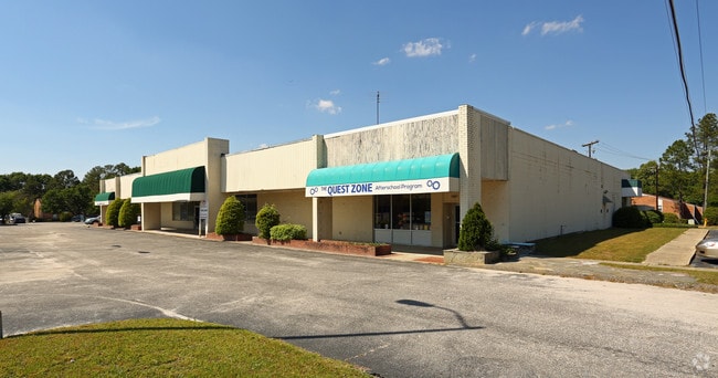
1923 2Nd Loop Rd, Florence, SC 29501


NEARBY LISTINGS FOR SALE OR LEASE
Property Detail
1923 2Nd Loop Rd
90029-01-014
Map Prepared For Atlantic Regional Llc
Commercialnec
2ND LOOP RD
X
Florence
45041C0141E
South Carolina
2024
3.38 AC
2024
Florence/Dillon
001300
Other Market Areas
18,100 SF
Florence, SC
DEMOGRAPHICS near 1923 2Nd Loop Rd
1 mile
3 mile
5 mile
2024 Total Population
6,706
41,556
76,240
2029 Population
6,614
41,212
75,852
Pop Growth 2024-2029
(1.37%)
(0.83%)
(0.51%)
Average Age
41
40
40
2024 Total Households
2,894
17,793
31,156
HH Growth 2024-2029
(1.38%)
(0.84%)
(0.51%)
Median Household Inc
$67,720
$55,140
$58,533
Avg Household Size
2.30
2.30
2.40
2024 Avg HH Vehicles
2.00
2.00
2.00
Median Home Value
$178,938
$185,007
$173,990
Median Year Built
1972
1981
1985
Nearby Places
Map Layers
Map Styles
 Street
 Aerial
Transit
 Traffic
 Biking
Places
Listings with unknown addresses are not visible on the map
- Restaurants
- Banks
- Shops
- Fitness
- Groceries
PUBLIC TRANSPORTATION
COMMUTER RAIL
Drive
Walk
Distance
12 min
5.3 mi
SALE & LEASE HISTORY
LISTING DATE
SALE/LEASE

Sep 25, 2016
For Lease
Sep 24, 2016
For Sale
Dec 21, 2023
For Sale
Nearby Properties
Address
Land Use
TOTAL SIZE
Lot Size
Zoning
Address
Land Use
TOTAL SIZE
Lot Size
Zoning
492,953 SF
68.41 AC
PDD
Address
Land Use
TOTAL SIZE
Lot Size
Zoning
218,850 SF
7.54 AC
B3
Address
Land Use
TOTAL SIZE
Lot Size
Zoning
194,083 SF
27.70 AC
B3
Address
Land Use
TOTAL SIZE
Lot Size
Zoning
2,418 SF
23.31 AC
Address
Land Use
TOTAL SIZE
Lot Size
Zoning
97,000 SF
50.87 AC
Address
Land Use
TOTAL SIZE
Lot Size
Zoning
8,416 SF
2.10 AC
B4
Address
Land Use
TOTAL SIZE
Lot Size
Zoning
1,347.68 AC
Address
Land Use
TOTAL SIZE
Lot Size
Zoning
119,211 SF
2.98 AC
Address
Land Use
TOTAL SIZE
Lot Size
Zoning
13,198 SF
12.29 AC
Address
Land Use
TOTAL SIZE
Lot Size
Zoning
218,026 SF
27.49 AC
Address
Land Use
TOTAL SIZE
Lot Size
Zoning
49,000 SF
9.20 AC
Address
Land Use
TOTAL SIZE
Lot Size
Zoning
587 SF
2.31 AC
Address
Land Use
TOTAL SIZE
Lot Size
Zoning
49,190 SF
5.40 AC
Address
Land Use
TOTAL SIZE
Lot Size
Zoning
66,715 SF
0.52 AC
Address
Land Use
TOTAL SIZE
Lot Size
Zoning
55,536 SF
0.02 AC
Address
Land Use
TOTAL SIZE
Lot Size
Zoning
55,536 SF
0.02 AC
Address
Land Use
TOTAL SIZE
Lot Size
Zoning
8,800 SF
15.25 AC
Address
Land Use
TOTAL SIZE
Lot Size
Zoning
108,700 SF
8.15 AC
R5
Address
Land Use
TOTAL SIZE
Lot Size
Zoning
16,600 SF
11.03 AC
Address
Land Use
TOTAL SIZE
Lot Size
Zoning
85,251 SF
2 AC
Address
Land Use
TOTAL SIZE
Lot Size
Zoning
99,628 SF
19.35 AC
Address
Land Use
TOTAL SIZE
Lot Size
Zoning
26.36 AC
B1
Address
Land Use
TOTAL SIZE
Lot Size
Zoning
79,263 SF
1.34 AC
B4
Address
Land Use
TOTAL SIZE
Lot Size
Zoning
1,920 SF
13.25 AC
R5
Address
Land Use
TOTAL SIZE
Lot Size
Zoning
31,860 SF
12.23 AC
PDD
Address
Land Use
TOTAL SIZE
Lot Size
Zoning
89,105 SF
6.24 AC
Address
Land Use
TOTAL SIZE
Lot Size
Zoning
4,000 SF
6.22 AC
Address
Land Use
TOTAL SIZE
Lot Size
Zoning
12,498 SF
10.56 AC
The World's #1 Commercial Real Estate Marketplace
Connect with us
© 2026 CoStar Group
The information above has been obtained from sources believed reliable. While we do not doubt its accuracy we have not verified it and make no guarantee, warranty or representation about it. It is your responsibility to independently confirm its accuracy and completeness. Any projections, opinions, assumptions, or estimates used are for example only and do not represent the current or future performance of the property. The value of this transaction to you depends on tax and other factors which should be evaluated by your tax, financial, and legal advisors. You and your advisors should conduct a careful, independent investigation of the property to determine to your satisfaction the suitability of the property for your needs.