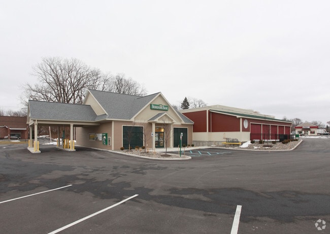
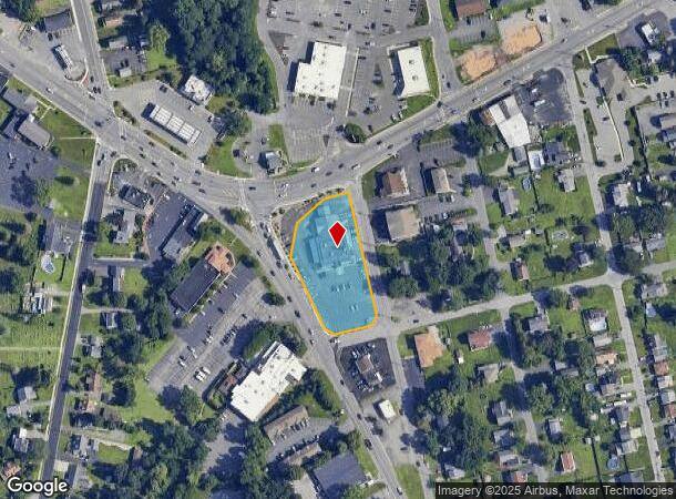
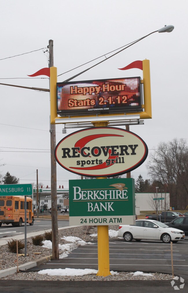
Property Record
1925 Curry Rd, Schenectady, NY 12303
NEARBY LISTINGS FOR SALE OR LEASE
Property Detail
1925 Curry Rd
059-009-0007-001-000-0000
Schenectady
Publichealthcarefacility
New York
X
1.000
36001C0039D
1.23 AC
2025
Outer Schenectady County
2024
Albany/Schenectady/Troy
032902
Albany-Schenectady-Troy, NY
8,874 SF
DEMOGRAPHICS near 1925 Curry Rd
1 Mile
3 Mile
5 Mile
2024 Total Population
12,144
86,337
146,908
2029 Population
12,816
90,472
153,648
Pop Growth 2024-2029
+ 5.53%
+ 4.79%
+ 4.59%
Average Age
41
39
40
2024 Total Households
5,215
35,724
60,710
HH Growth 2024-2029
+ 5.87%
+ 5.03%
+ 4.87%
Median Household Inc
$73,924
$61,561
$73,229
Avg Household Size
2.30
2.30
2.30
2024 Avg HH Vehicles
2.00
1.00
2.00
Median Home Value
$165,791
$162,842
$189,554
Median Year Built
1954
1950
1955
Nearby Places
Map Layers
Map Styles
 Street
 Aerial
- Restaurants
- Banks
- Shops
- Fitness
- Groceries
PUBLIC TRANSPORTATION
COMMUTER RAIL
DRIVE
WALK
Distance
8 min
3.1 mi
AIRPORT
Albany International
DRIVE
WALK
Distance
Albany International
21 min
10.8 mi
Freight Ports
Albany, NY Port
DRIVE
WALK
Distance
Albany, NY Port
27 min
17.2 mi
Nearby Properties
Address
Land Use
TOTAL SIZE
Lot Size
Zoning
Address
Land Use
TOTAL SIZE
Lot Size
Zoning
2,068,862 SF
204.52 AC
I-2
Address
Land Use
TOTAL SIZE
Lot Size
Zoning
6,733 SF
100 AC
03 - MULTI
Address
Land Use
TOTAL SIZE
Lot Size
Zoning
0.01 AC
06 - INDUS
Address
Land Use
TOTAL SIZE
Lot Size
Zoning
184,878 SF
15.58 AC
03 - MULTI
Address
Land Use
TOTAL SIZE
Lot Size
Zoning
1,003,413 SF
177.60 AC
B-1, I-1
Address
Land Use
TOTAL SIZE
Lot Size
Zoning
102,862 SF
32.45 AC
CS
Address
Land Use
TOTAL SIZE
Lot Size
Zoning
120,755 SF
33.88 AC
R1
Address
Land Use
TOTAL SIZE
Lot Size
Zoning
382,858 SF
70.33 AC
R-1
Address
Land Use
TOTAL SIZE
Lot Size
Zoning
59,240 SF
0.72 AC
05 - COMME
Address
Land Use
TOTAL SIZE
Lot Size
Zoning
284,171 SF
16.40 AC
03 - MULTI
Address
Land Use
TOTAL SIZE
Lot Size
Zoning
183,759 SF
1.40 AC
05 - COMME
Address
Land Use
TOTAL SIZE
Lot Size
Zoning
181,230 SF
1.02 AC
05 - COMME
Address
Land Use
TOTAL SIZE
Lot Size
Zoning
4,896 SF
12.80 AC
A-1
Address
Land Use
TOTAL SIZE
Lot Size
Zoning
128,744 SF
119 AC
A-1
Address
Land Use
TOTAL SIZE
Lot Size
Zoning
152,503 SF
8.21 AC
I-1
Address
Land Use
TOTAL SIZE
Lot Size
Zoning
136,722 SF
2.01 AC
05 - COMME
Address
Land Use
TOTAL SIZE
Lot Size
Zoning
21,791 SF
4.93 AC
B-1, B-2
Address
Land Use
TOTAL SIZE
Lot Size
Zoning
141,145 SF
1.11 AC
05 - COMME
Address
Land Use
TOTAL SIZE
Lot Size
Zoning
21,791 SF
4.86 AC
B-1, B-2
Address
Land Use
TOTAL SIZE
Lot Size
Zoning
Address
Land Use
TOTAL SIZE
Lot Size
Zoning
12,289 SF
17.08 AC
R-3
Address
Land Use
TOTAL SIZE
Lot Size
Zoning
86,049 SF
17.10 AC
RO30
Address
Land Use
TOTAL SIZE
Lot Size
Zoning
45,896 SF
10.20 AC
03 - MULTI
Address
Land Use
TOTAL SIZE
Lot Size
Zoning
113,670 SF
1.35 AC
05 - COMME
Address
Land Use
TOTAL SIZE
Lot Size
Zoning
202,050 SF
20.75 AC
B-2
Address
Land Use
TOTAL SIZE
Lot Size
Zoning
116,392 SF
1.84 AC
05 - COMME
Address
Land Use
TOTAL SIZE
Lot Size
Zoning
99.20 AC
Address
Land Use
TOTAL SIZE
Lot Size
Zoning
79,041 SF
13.20 AC
CN
Address
Land Use
TOTAL SIZE
Lot Size
Zoning
229,890 SF
85.08 AC
I-1
Address
Land Use
TOTAL SIZE
Lot Size
Zoning
7,216 SF
15.90 AC
03 - MULTI
The World's #1 Commercial Real Estate Marketplace
Connect with us
© 2026 CoStar Group
The information above has been obtained from sources believed reliable. While we do not doubt its accuracy we have not verified it and make no guarantee, warranty or representation about it. It is your responsibility to independently confirm its accuracy and completeness. Any projections, opinions, assumptions, or estimates used are for example only and do not represent the current or future performance of the property. The value of this transaction to you depends on tax and other factors which should be evaluated by your tax, financial, and legal advisors. You and your advisors should conduct a careful, independent investigation of the property to determine to your satisfaction the suitability of the property for your needs.