Property Record
1925 Dolores Way, Carbondale, CO 81623

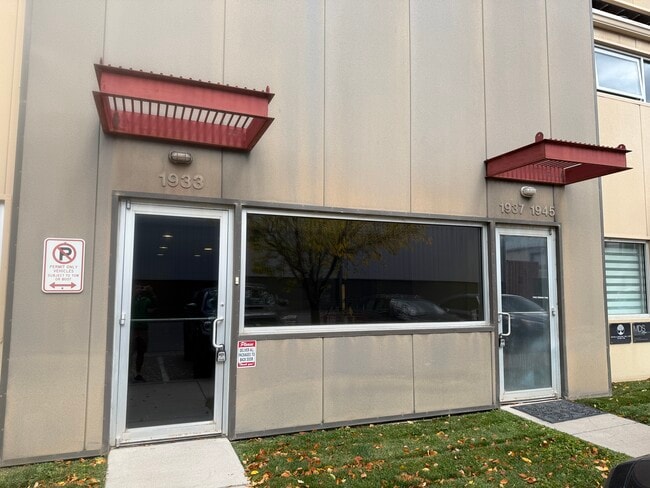
Property Detail
1925 Dolores Way
Rifle, CO
SECTION: 33 TOWNSHIP: 7 RANGE: 88 SUBDIVISION: CLEAVER AND CALEB CONDOMINIUMS UNIT: C4 A RESUB OF LOT 7B OF THE AMENDED KAY
R044447
Garfield
Commercialcondominium
Colorado
2025
7b
2024
0.03 AC
951804
Colorado Northwest Area
864 SF
Other Market Areas
NEARBY LISTINGS FOR SALE OR LEASE
DEMOGRAPHICS near 1925 Dolores Way
1 mile
3 mile
5 mile
2024 Total Population
3,977
8,940
12,462
2029 Population
4,123
9,308
12,981
Pop Growth 2024-2029
+ 3.67%
+ 4.12%
+ 4.16%
Average Age
39
40
40
2024 Total Households
1,398
3,297
4,591
HH Growth 2024-2029
+ 3.65%
+ 4.19%
+ 4.20%
Median Household Inc
$99,054
$95,431
$99,879
Avg Household Size
2.60
2.60
2.60
2024 Avg HH Vehicles
2.00
2.00
2.00
Median Home Value
$750,425
$813,411
$845,121
Median Year Built
1992
1994
1994
Nearby Places
Map Layers
Map Styles
 Street
 Aerial
Transit
 Traffic
 Biking
Places
Listings with unknown addresses are not visible on the map
- Restaurants
- Banks
- Shops
- Fitness
- Groceries
PUBLIC TRANSPORTATION
AIRPORT
Aspen-Pitkin County/Sardy Field
Drive
Walk
Distance
Aspen-Pitkin County/Sardy Field
49 min
28.8 mi
Eagle County Regional
Drive
Walk
Distance
Eagle County Regional
58 min
39.2 mi
Freight Ports
Tulsa Port Of Catoosa
Drive
Walk
Distance
Tulsa Port Of Catoosa
933 min
878.6 mi
SALE & LEASE HISTORY
LISTING DATE
SALE/LEASE

Oct 02, 2025
For Sale
Nearby Properties
Address
Land Use
TOTAL SIZE
Lot Size
Zoning
Address
Land Use
TOTAL SIZE
Lot Size
Zoning
60,565 SF
6.52 AC
Address
Land Use
TOTAL SIZE
Lot Size
Zoning
12,780 SF
4.19 AC
Address
Land Use
TOTAL SIZE
Lot Size
Zoning
4,020 SF
2.15 AC
Address
Land Use
TOTAL SIZE
Lot Size
Zoning
15,428 SF
92.42 AC
Address
Land Use
TOTAL SIZE
Lot Size
Zoning
34,434 SF
4.77 AC
Address
Land Use
TOTAL SIZE
Lot Size
Zoning
20,461 SF
203.65 AC
Address
Land Use
TOTAL SIZE
Lot Size
Zoning
12,457 SF
4.67 AC
RU
Address
Land Use
TOTAL SIZE
Lot Size
Zoning
3.86 AC
Address
Land Use
TOTAL SIZE
Lot Size
Zoning
37,780 SF
3.67 AC
CG
Address
Land Use
TOTAL SIZE
Lot Size
Zoning
32,390 SF
8.82 AC
R
Address
Land Use
TOTAL SIZE
Lot Size
Zoning
25,596 SF
0.96 AC
Address
Land Use
TOTAL SIZE
Lot Size
Zoning
16,060 SF
3 AC
Address
Land Use
TOTAL SIZE
Lot Size
Zoning
8.18 AC
ROW
Address
Land Use
TOTAL SIZE
Lot Size
Zoning
37,666 SF
2.03 AC
Address
Land Use
TOTAL SIZE
Lot Size
Zoning
192 SF
3.12 AC
Address
Land Use
TOTAL SIZE
Lot Size
Zoning
2.60 AC
CG
Address
Land Use
TOTAL SIZE
Lot Size
Zoning
4.41 AC
CG
Address
Land Use
TOTAL SIZE
Lot Size
Zoning
2,106 SF
7.55 AC
CG
Address
Land Use
TOTAL SIZE
Lot Size
Zoning
18.46 AC
R
Address
Land Use
TOTAL SIZE
Lot Size
Zoning
24,992 SF
7.98 AC
PUD
Address
Land Use
TOTAL SIZE
Lot Size
Zoning
42,026 SF
3.32 AC
Address
Land Use
TOTAL SIZE
Lot Size
Zoning
2,320 SF
0.45 AC
Address
Land Use
TOTAL SIZE
Lot Size
Zoning
18,000 SF
1.50 AC
Address
Land Use
TOTAL SIZE
Lot Size
Zoning
26,928 SF
0.45 AC
Address
Land Use
TOTAL SIZE
Lot Size
Zoning
904 SF
8.66 AC
Address
Land Use
TOTAL SIZE
Lot Size
Zoning
4,634 SF
0.82 AC
Address
Land Use
TOTAL SIZE
Lot Size
Zoning
4,329 SF
0.41 AC
Address
Land Use
TOTAL SIZE
Lot Size
Zoning
10,569 SF
1.25 AC
Address
Land Use
TOTAL SIZE
Lot Size
Zoning
1.44 AC
Address
Land Use
TOTAL SIZE
Lot Size
Zoning
5,818 SF
1.19 AC
The World's #1 Commercial Real Estate Marketplace
Connect with us
© 2026 CoStar Group
The information above has been obtained from sources believed reliable. While we do not doubt its accuracy we have not verified it and make no guarantee, warranty or representation about it. It is your responsibility to independently confirm its accuracy and completeness. Any projections, opinions, assumptions, or estimates used are for example only and do not represent the current or future performance of the property. The value of this transaction to you depends on tax and other factors which should be evaluated by your tax, financial, and legal advisors. You and your advisors should conduct a careful, independent investigation of the property to determine to your satisfaction the suitability of the property for your needs.