Property Record
1925 E Vernon Ave, Vernon, CA 90058
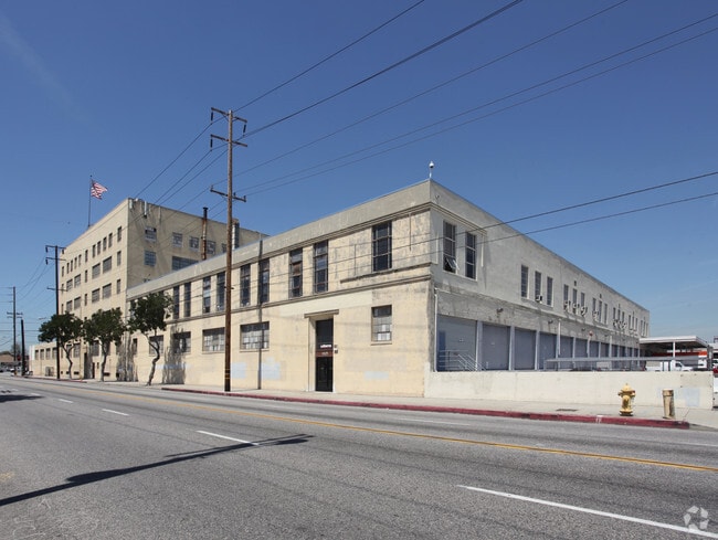


Property Detail
1925 E Vernon Ave
6302-017-052
POR OF SE 1/4 OF SEC 9 T2S R13W AND POR OF SW 1/4 OF SEC 10 T2S R13W
Warehouse
Los Angeles
VEM*
California
B and X Area of moderate flood hazard, usually the area between the limits of the 100-year and 500-year floods.
6 AC
2024
Vernon
2025
Los Angeles
980016
Los Angeles-Long Beach-Glendale, CA
386,865 SF
NEARBY LISTINGS FOR SALE OR LEASE
DEMOGRAPHICS near 1925 E Vernon Ave
1 mile
3 mile
5 mile
2025 Total Population
25,708
360,614
1,183,036
2030 Population
25,071
353,922
1,166,017
Pop Growth 2025-2030
(2.48%)
(1.86%)
(1.44%)
Average Age
34
36
37
2025 Total Households
5,893
98,493
349,234
HH Growth 2025-2030
(3.00%)
(1.91%)
(1.32%)
Median Household Inc
$54,469
$57,027
$58,368
Avg Household Size
4.00
3.30
3.20
2025 Avg HH Vehicles
2.00
2.00
2.00
Median Home Value
$627,843
$680,411
$702,726
Median Year Built
1950
1953
1954
Nearby Places
Map Layers
Map Styles
 Street
 Aerial
Transit
 Traffic
 Biking
Places
Listings with unknown addresses are not visible on the map
- Restaurants
- Banks
- Shops
- Fitness
- Groceries
PUBLIC TRANSPORTATION
TRANSIT/SUBWAY
Vernon Station (Blue Line - Los Angeles County Metropolitan Transportation Authority (Metro))
Drive
Walk
Distance
Vernon Station (Blue Line - Los Angeles County Metropolitan Transportation Authority (Metro))
1 min
7 min
0.4 mi
COMMUTER RAIL
Drive
Walk
Distance
8 min
3.7 mi
Union Station (91 Line - Southern California Regional Rail Authority (Metrolink), Antelope Valley Line - Southern California Regional Rail Authority (Metrolink), Orange County Line - Southern California Regional Rail Authority (Metrolink), Riverside Line - Southern California Regional Rail Authority (Metrolink), San Bernardino Line - Southern California Regional Rail Authority (Metrolink), Ventura County Line - Southern California Regional Rail Authority (Metrolink))
Drive
Walk
Distance
Union Station (91 Line - Southern California Regional Rail Authority (Metrolink), Antelope Valley Line - Southern California Regional Rail Authority (Metrolink), Orange County Line - Southern California Regional Rail Authority (Metrolink), Riverside Line - Southern California Regional Rail Authority (Metrolink), San Bernardino Line - Southern California Regional Rail Authority (Metrolink), Ventura County Line - Southern California Regional Rail Authority (Metrolink))
12 min
4.1 mi
AIRPORT
Los Angeles International
Drive
Walk
Distance
Los Angeles International
24 min
13.2 mi
Long Beach (Daugherty Field)
Drive
Walk
Distance
Long Beach (Daugherty Field)
28 min
15.8 mi
Bob Hope
Drive
Walk
Distance
Bob Hope
29 min
20.7 mi
Nearby Properties
Address
Land Use
TOTAL SIZE
Lot Size
Zoning
Address
Land Use
TOTAL SIZE
Lot Size
Zoning
1,178,786 SF
3.89 AC
LAC2
Address
Land Use
TOTAL SIZE
Lot Size
Zoning
764,804 SF
1.48 AC
Address
Land Use
TOTAL SIZE
Lot Size
Zoning
420,864 SF
63.07 AC
LAUSC-1A
Address
Land Use
TOTAL SIZE
Lot Size
Zoning
574,047 SF
1.70 AC
LAR5
Address
Land Use
TOTAL SIZE
Lot Size
Zoning
2,697,158 SF
20.18 AC
LAM2
Address
Land Use
TOTAL SIZE
Lot Size
Zoning
256,059 SF
Address
Land Use
TOTAL SIZE
Lot Size
Zoning
581,956 SF
0.89 AC
LAR5
Address
Land Use
TOTAL SIZE
Lot Size
Zoning
364,997 SF
1.24 AC
LAR5
Address
Land Use
TOTAL SIZE
Lot Size
Zoning
50,048 SF
1.16 AC
LAR5
Address
Land Use
TOTAL SIZE
Lot Size
Zoning
666,499 SF
10.63 AC
LAC2
Address
Land Use
TOTAL SIZE
Lot Size
Zoning
298,630 SF
4.64 AC
LAUSC-1B
Address
Land Use
TOTAL SIZE
Lot Size
Zoning
329,487 SF
0.94 AC
LAC2
Address
Land Use
TOTAL SIZE
Lot Size
Zoning
466,058 SF
2.54 AC
Address
Land Use
TOTAL SIZE
Lot Size
Zoning
320,925 SF
0.88 AC
LAC2
Address
Land Use
TOTAL SIZE
Lot Size
Zoning
444,139 SF
3.63 AC
LAM3
Address
Land Use
TOTAL SIZE
Lot Size
Zoning
448,914 SF
2.67 AC
LAC2
Address
Land Use
TOTAL SIZE
Lot Size
Zoning
274,675 SF
1.34 AC
LAR5
Address
Land Use
TOTAL SIZE
Lot Size
Zoning
479,272 SF
16.14 AC
LAM3
Address
Land Use
TOTAL SIZE
Lot Size
Zoning
1,027,870 SF
2.02 AC
LAC2
Address
Land Use
TOTAL SIZE
Lot Size
Zoning
1,088,170 SF
15.98 AC
LAM3
Address
Land Use
TOTAL SIZE
Lot Size
Zoning
267,773 SF
1.20 AC
LAR5
Address
Land Use
TOTAL SIZE
Lot Size
Zoning
535,949 SF
5.85 AC
LAM3
Address
Land Use
TOTAL SIZE
Lot Size
Zoning
1,810,830 SF
4.28 AC
LAM2
Address
Land Use
TOTAL SIZE
Lot Size
Zoning
327,061 SF
2.18 AC
LAM3
Address
Land Use
TOTAL SIZE
Lot Size
Zoning
322,080 SF
2.85 AC
LAC2
Address
Land Use
TOTAL SIZE
Lot Size
Zoning
182,700 SF
8.29 AC
LAM3
Address
Land Use
TOTAL SIZE
Lot Size
Zoning
481,489 SF
2.61 AC
LAR5
Address
Land Use
TOTAL SIZE
Lot Size
Zoning
279,351 SF
1.25 AC
LAC2
Address
Land Use
TOTAL SIZE
Lot Size
Zoning
277,250 SF
1.60 AC
LAC2
Address
Land Use
TOTAL SIZE
Lot Size
Zoning
306,816 SF
1.48 AC
LAR5
The World's #1 Commercial Real Estate Marketplace
Connect with us
© 2026 CoStar Group
The information above has been obtained from sources believed reliable. While we do not doubt its accuracy we have not verified it and make no guarantee, warranty or representation about it. It is your responsibility to independently confirm its accuracy and completeness. Any projections, opinions, assumptions, or estimates used are for example only and do not represent the current or future performance of the property. The value of this transaction to you depends on tax and other factors which should be evaluated by your tax, financial, and legal advisors. You and your advisors should conduct a careful, independent investigation of the property to determine to your satisfaction the suitability of the property for your needs.