Property Record
1925 Mclemore Dr, Montgomery, AL 36117


Property Detail
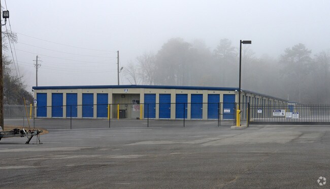
1925 Mclemore Dr
09-02-04-0-000-001.003
0902040000001003
Officebuilding
Montgomery
B-3
Alabama
AE The base floodplain where base flood elevations are provided. AE Zones are now used on new format FIRMs instead of A1-A30 Zones.
1
2025
9.52 AC
2025
North Montgomery
005414
Montgomery
4,281 SF
Montgomery, AL
NEARBY LISTINGS FOR SALE OR LEASE
-
-
View all Montgomery listings for sale on LoopNet.com
DEMOGRAPHICS near 1925 Mclemore Dr
1 mile
3 mile
5 mile
2025 Total Population
1,870
22,404
61,714
2030 Population
1,803
21,728
59,897
Pop Growth 2025-2030
(3.58%)
(3.02%)
(2.94%)
Average Age
40
38
40
2025 Total Households
763
9,648
26,145
HH Growth 2025-2030
(3.54%)
(2.90%)
(3.15%)
Median Household Inc
$96,008
$69,544
$74,376
Avg Household Size
2.40
2.30
2.20
2025 Avg HH Vehicles
2.00
2.00
2.00
Median Home Value
$215,460
$189,558
$217,336
Median Year Built
1997
1990
1990
Nearby Places
Map Layers
Map Styles
 Street
 Aerial
Transit
 Traffic
 Biking
Places
Listings with unknown addresses are not visible on the map
- Restaurants
- Banks
- Shops
- Fitness
- Groceries
PUBLIC TRANSPORTATION
AIRPORT
Montgomery Regional (Dannelly Field)
Drive
Walk
Distance
Montgomery Regional (Dannelly Field)
27 min
18.4 mi
Freight Ports
Port of Panama City
Drive
Walk
Distance
Port of Panama City
238 min
187.1 mi
Nearby Properties
Address
Land Use
TOTAL SIZE
Lot Size
Zoning
Address
Land Use
TOTAL SIZE
Lot Size
Zoning
117,161 SF
12.07 AC
INST
Address
Land Use
TOTAL SIZE
Lot Size
Zoning
5,118 SF
22.75 AC
R-65-M
Address
Land Use
TOTAL SIZE
Lot Size
Zoning
4,142 SF
25.96 AC
PUD
Address
Land Use
TOTAL SIZE
Lot Size
Zoning
1,996 SF
15.81 AC
PUD
Address
Land Use
TOTAL SIZE
Lot Size
Zoning
76,996 SF
15.51 AC
B-3
Address
Land Use
TOTAL SIZE
Lot Size
Zoning
385,644 SF
26.60 AC
B-2
Address
Land Use
TOTAL SIZE
Lot Size
Zoning
6,605 SF
6 AC
PUD
Address
Land Use
TOTAL SIZE
Lot Size
Zoning
180,684 SF
21.94 AC
PUD
Address
Land Use
TOTAL SIZE
Lot Size
Zoning
92,200 SF
9.74 AC
O-1
Address
Land Use
TOTAL SIZE
Lot Size
Zoning
7,040 SF
11.70 AC
R-65-M
Address
Land Use
TOTAL SIZE
Lot Size
Zoning
224,132 SF
26.57 AC
AGR-2
Address
Land Use
TOTAL SIZE
Lot Size
Zoning
223,000 SF
26 AC
O-1
Address
Land Use
TOTAL SIZE
Lot Size
Zoning
5,606 SF
21 AC
R-75-M
Address
Land Use
TOTAL SIZE
Lot Size
Zoning
125,121 SF
12.28 AC
PUD
Address
Land Use
TOTAL SIZE
Lot Size
Zoning
152,523 SF
13.96 AC
PUD
Address
Land Use
TOTAL SIZE
Lot Size
Zoning
82,638 SF
O-1
Address
Land Use
TOTAL SIZE
Lot Size
Zoning
71,844 SF
2.73 AC
PUD
Address
Land Use
TOTAL SIZE
Lot Size
Zoning
2,200 SF
11.06 AC
R-75-M
Address
Land Use
TOTAL SIZE
Lot Size
Zoning
30,077 SF
8.53 AC
PUD
Address
Land Use
TOTAL SIZE
Lot Size
Zoning
54,822 SF
6.45 AC
PUD
Address
Land Use
TOTAL SIZE
Lot Size
Zoning
6,024 SF
17.30 AC
R-75-M
Address
Land Use
TOTAL SIZE
Lot Size
Zoning
11,190 SF
13.75 AC
AGR-1
Address
Land Use
TOTAL SIZE
Lot Size
Zoning
88,034 SF
6.60 AC
M-1
Address
Land Use
TOTAL SIZE
Lot Size
Zoning
62,173 SF
2.50 AC
PUD
Address
Land Use
TOTAL SIZE
Lot Size
Zoning
8,014 SF
7.10 AC
R-75-M
Address
Land Use
TOTAL SIZE
Lot Size
Zoning
64,237 SF
11.30 AC
INST
Address
Land Use
TOTAL SIZE
Lot Size
Zoning
73,990 SF
8.49 AC
B-2
Address
Land Use
TOTAL SIZE
Lot Size
Zoning
36,514 SF
4.57 AC
R-65-M
Address
Land Use
TOTAL SIZE
Lot Size
Zoning
27,398 SF
10.61 AC
B-3
Address
Land Use
TOTAL SIZE
Lot Size
Zoning
34.70 AC
B-2
The World's #1 Commercial Real Estate Marketplace
Connect with us
© 2026 CoStar Group
The information above has been obtained from sources believed reliable. While we do not doubt its accuracy we have not verified it and make no guarantee, warranty or representation about it. It is your responsibility to independently confirm its accuracy and completeness. Any projections, opinions, assumptions, or estimates used are for example only and do not represent the current or future performance of the property. The value of this transaction to you depends on tax and other factors which should be evaluated by your tax, financial, and legal advisors. You and your advisors should conduct a careful, independent investigation of the property to determine to your satisfaction the suitability of the property for your needs.