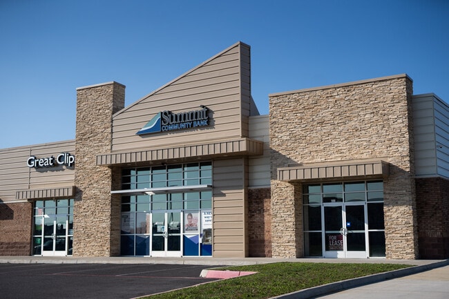
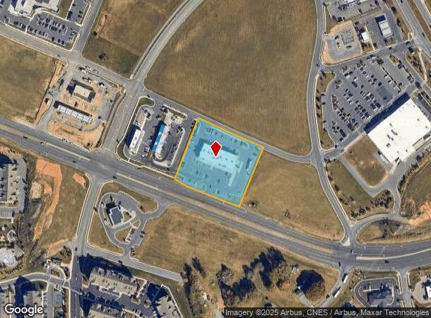
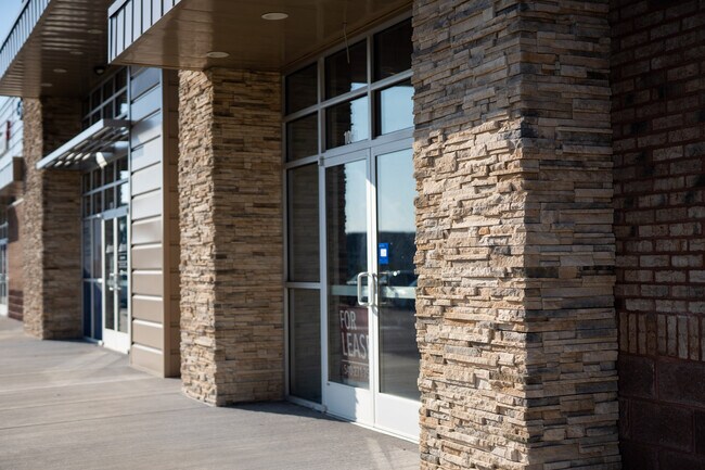
Property Record
1925 Stone Spring Rd, Harrisonburg, VA 22801
NEARBY LISTINGS FOR SALE OR LEASE
Property Detail
1925 Stone Spring Rd
125-27-L10
STONE PORT RETAIL PARK P4 L10
Commercialnec
Rockingham
X
Virginia
51165C0415D
2.01 AC
2025
Staunton & Harrisonburg
2025
Other Market Areas
011700
Harrisonburg, VA
10,868 SF
DEMOGRAPHICS near 1925 Stone Spring Rd
1 mile
3 mile
5 mile
2024 Total Population
5,600
45,790
72,506
2029 Population
5,827
46,141
72,774
Pop Growth 2024-2029
+ 4.05%
+ 0.77%
+ 0.37%
Average Age
36
33
35
2024 Total Households
2,299
15,093
25,215
HH Growth 2024-2029
+ 4.05%
+ 1.05%
+ 0.46%
Median Household Inc
$68,485
$62,860
$61,972
Avg Household Size
2.40
2.50
2.60
2024 Avg HH Vehicles
2.00
2.00
2.00
Median Home Value
$234,356
$302,370
$292,758
Median Year Built
2002
1996
1991
Nearby Places
Map Layers
Map Styles
 Street
 Aerial
Transit
 Traffic
 Biking
Places
Listings with unknown addresses are not visible on the map
- Restaurants
- Banks
- Shops
- Fitness
- Groceries
PUBLIC TRANSPORTATION
AIRPORT
Charlottesville-Albemarle
Drive
Walk
Distance
Charlottesville-Albemarle
66 min
45.6 mi
SALE & LEASE HISTORY
LISTING DATE
SALE/LEASE

Sep 01, 2017
For Lease
Nearby Properties
Address
Land Use
TOTAL SIZE
Lot Size
Zoning
Address
Land Use
TOTAL SIZE
Lot Size
Zoning
143.09 AC
MULTI DWEL
Address
Land Use
TOTAL SIZE
Lot Size
Zoning
68.88 AC
GENERAL IN
Address
Land Use
TOTAL SIZE
Lot Size
Zoning
114.53 AC
MULTI DWEL
Address
Land Use
TOTAL SIZE
Lot Size
Zoning
9.63 AC
MULTI DWEL
Address
Land Use
TOTAL SIZE
Lot Size
Zoning
122,976 SF
59.92 AC
Address
Land Use
TOTAL SIZE
Lot Size
Zoning
126,552 SF
49.87 AC
GENERAL BU
Address
Land Use
TOTAL SIZE
Lot Size
Zoning
100,172 SF
0.79 AC
MULTI DWEL
Address
Land Use
TOTAL SIZE
Lot Size
Zoning
10,560 SF
258 AC
MULTI DWEL
Address
Land Use
TOTAL SIZE
Lot Size
Zoning
36.81 AC
R5
Address
Land Use
TOTAL SIZE
Lot Size
Zoning
219,561 SF
55.38 AC
GENERAL IN
Address
Land Use
TOTAL SIZE
Lot Size
Zoning
11.56 AC
B1
Address
Land Use
TOTAL SIZE
Lot Size
Zoning
1,656 SF
36.28 AC
GENERAL IN
Address
Land Use
TOTAL SIZE
Lot Size
Zoning
11.07 AC
RESIDENTIA
Address
Land Use
TOTAL SIZE
Lot Size
Zoning
236,916 SF
3.72 AC
MULTI DWEL
Address
Land Use
TOTAL SIZE
Lot Size
Zoning
172,594 SF
0.65 AC
MULTI DWEL
Address
Land Use
TOTAL SIZE
Lot Size
Zoning
16,620 SF
192 AC
HIGH DENSI
Address
Land Use
TOTAL SIZE
Lot Size
Zoning
14,490 SF
190 AC
PLANNED UN
Address
Land Use
TOTAL SIZE
Lot Size
Zoning
17,472 SF
216 AC
HIGH DENSI
Address
Land Use
TOTAL SIZE
Lot Size
Zoning
11.11 AC
R3
Address
Land Use
TOTAL SIZE
Lot Size
Zoning
86,400 SF
37.26 AC
GENERAL BU
Address
Land Use
TOTAL SIZE
Lot Size
Zoning
14,856 SF
168 AC
MULTI DWEL
Address
Land Use
TOTAL SIZE
Lot Size
Zoning
87,636 SF
18.07 AC
GENERAL BU
Address
Land Use
TOTAL SIZE
Lot Size
Zoning
6.10 AC
PMF
Address
Land Use
TOTAL SIZE
Lot Size
Zoning
27,572 SF
MULTI DWEL
Address
Land Use
TOTAL SIZE
Lot Size
Zoning
32,592 SF
4.17 AC
COMMERCIAL
Address
Land Use
TOTAL SIZE
Lot Size
Zoning
12.17 AC
R5
Address
Land Use
TOTAL SIZE
Lot Size
Zoning
78,560 SF
3.41 AC
MULTI DWEL
Address
Land Use
TOTAL SIZE
Lot Size
Zoning
9,440 SF
17.31 AC
R3
Address
Land Use
TOTAL SIZE
Lot Size
Zoning
54,943 SF
19.68 AC
GENERAL BU
The World's #1 Commercial Real Estate Marketplace
Connect with us
© 2026 CoStar Group
The information above has been obtained from sources believed reliable. While we do not doubt its accuracy we have not verified it and make no guarantee, warranty or representation about it. It is your responsibility to independently confirm its accuracy and completeness. Any projections, opinions, assumptions, or estimates used are for example only and do not represent the current or future performance of the property. The value of this transaction to you depends on tax and other factors which should be evaluated by your tax, financial, and legal advisors. You and your advisors should conduct a careful, independent investigation of the property to determine to your satisfaction the suitability of the property for your needs.