Property Record
1925 Sw 96Th St, Stuart, FL 34997

Property Detail
1925 Sw 96Th St
07-39-41-000-014-00030-2
TROPICAL FRUIT FARMS THAT PORTION OF S 1/4 OF LOT 14 & S 1/4 LOT 15 W OF RD 76 LYING E OF A LINE DESC AS: BEG 1904.75 E/O & 50 N/O THE SW COR SEC 7 N02DEG47 00 E 280.86 TO N PROP LINE (LESS R/W)
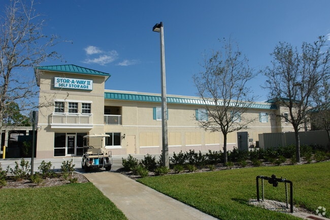
Warehouse
MARTIN
LC
Florida
B and X Area of moderate flood hazard, usually the area between the limits of the 100-year and 500-year floods.
14,15
2024
4.99 AC
2025
Martin Inland
001703
Port St Lucie/Fort Pierce
62,120 SF
Port St. Lucie, FL
NEARBY LISTINGS FOR SALE OR LEASE
-
-
View all Stuart listings for sale on LoopNet.com
DEMOGRAPHICS near 1925 Sw 96Th St
1 mile
3 mile
5 mile
2025 Total Population
3,423
10,014
25,709
2030 Population
3,498
10,257
26,296
Pop Growth 2025-2030
+ 2.19%
+ 2.43%
+ 2.28%
Average Age
48
48
48
2025 Total Households
1,383
4,037
10,510
HH Growth 2025-2030
+ 1.95%
+ 2.16%
+ 2.15%
Median Household Inc
$91,847
$94,908
$88,297
Avg Household Size
2.40
2.40
2.40
2025 Avg HH Vehicles
2.00
2.00
2.00
Median Home Value
$434,572
$481,986
$487,097
Median Year Built
1998
1997
1994
Nearby Places
Map Layers
Map Styles
 Street
 Aerial
Layers
 Traffic
 Biking
Places
Listings with unknown addresses are not visible on the map
- Restaurants
- Banks
- Shops
- Fitness
- Groceries
Nearby Properties
Address
Land Use
TOTAL SIZE
Lot Size
Zoning
Address
Land Use
TOTAL SIZE
Lot Size
Zoning
49.11 AC
Address
Land Use
TOTAL SIZE
Lot Size
Zoning
20.76 AC
Address
Land Use
TOTAL SIZE
Lot Size
Zoning
6,510 SF
1,216.20 AC
A2
Address
Land Use
TOTAL SIZE
Lot Size
Zoning
16.75 AC
Address
Land Use
TOTAL SIZE
Lot Size
Zoning
17.29 AC
Address
Land Use
TOTAL SIZE
Lot Size
Zoning
39,801 SF
8.50 AC
LI
Address
Land Use
TOTAL SIZE
Lot Size
Zoning
56,281 SF
28.86 AC
LI
Address
Land Use
TOTAL SIZE
Lot Size
Zoning
69,133 SF
6 AC
PUDC
Address
Land Use
TOTAL SIZE
Lot Size
Zoning
97,783 SF
6.34 AC
LI
Address
Land Use
TOTAL SIZE
Lot Size
Zoning
190,638 SF
147 AC
A1
Address
Land Use
TOTAL SIZE
Lot Size
Zoning
8,630 SF
17.77 AC
PUDC
Address
Land Use
TOTAL SIZE
Lot Size
Zoning
5.52 AC
LI
Address
Land Use
TOTAL SIZE
Lot Size
Zoning
44,712 SF
15.18 AC
PS2
Address
Land Use
TOTAL SIZE
Lot Size
Zoning
47,906 SF
21.36 AC
RE2A
Address
Land Use
TOTAL SIZE
Lot Size
Zoning
39,555 SF
2.47 AC
PUDC
Address
Land Use
TOTAL SIZE
Lot Size
Zoning
248.21 AC
A1
Address
Land Use
TOTAL SIZE
Lot Size
Zoning
51,969 SF
16.19 AC
GI
Address
Land Use
TOTAL SIZE
Lot Size
Zoning
2.99 AC
LI
Address
Land Use
TOTAL SIZE
Lot Size
Zoning
28,488 SF
181.84 AC
PR
Address
Land Use
TOTAL SIZE
Lot Size
Zoning
53,801 SF
7.30 AC
WGC
Address
Land Use
TOTAL SIZE
Lot Size
Zoning
80,989 SF
31.75 AC
A1
Address
Land Use
TOTAL SIZE
Lot Size
Zoning
52,800 SF
3.78 AC
LI
Address
Land Use
TOTAL SIZE
Lot Size
Zoning
18,017 SF
1.38 AC
WGC
Address
Land Use
TOTAL SIZE
Lot Size
Zoning
29,700 SF
2.01 AC
LI
Address
Land Use
TOTAL SIZE
Lot Size
Zoning
36,000 SF
2.79 AC
LI
Address
Land Use
TOTAL SIZE
Lot Size
Zoning
27,209 SF
5.68 AC
M2
Address
Land Use
TOTAL SIZE
Lot Size
Zoning
29.60 AC
Address
Land Use
TOTAL SIZE
Lot Size
Zoning
13,762 SF
1.94 AC
COR1
Address
Land Use
TOTAL SIZE
Lot Size
Zoning
18,220 SF
1.83 AC
The World's #1 Commercial Real Estate Marketplace
Connect with us
© 2026 CoStar Group
The information above has been obtained from sources believed reliable. While we do not doubt its accuracy we have not verified it and make no guarantee, warranty or representation about it. It is your responsibility to independently confirm its accuracy and completeness. Any projections, opinions, assumptions, or estimates used are for example only and do not represent the current or future performance of the property. The value of this transaction to you depends on tax and other factors which should be evaluated by your tax, financial, and legal advisors. You and your advisors should conduct a careful, independent investigation of the property to determine to your satisfaction the suitability of the property for your needs.