Property Record
1926 Hartford Dr, Gastonia, NC 28052


NEARBY LISTINGS FOR SALE OR LEASE
Property Detail
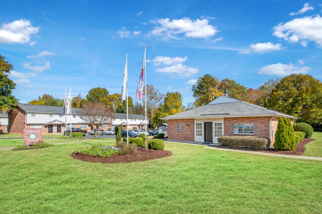
1926 Hartford Dr
114095
Linwood Park Apartments
Apartment
01 091 155 00 000
AE
Gaston
3710353400J
North Carolina
2025
14.02 AC
2025
Outlying Gaston County
033204
Charlotte
1,602 SF
Charlotte-Concord-Gastonia, NC-SC
DEMOGRAPHICS near 1926 Hartford Dr
1 Mile
3 Mile
5 Mile
2024 Total Population
6,171
43,002
83,849
2029 Population
6,586
46,067
89,592
Pop Growth 2024-2029
+ 6.73%
+ 7.13%
+ 6.85%
Average Age
37
39
40
2024 Total Households
2,274
17,091
33,505
HH Growth 2024-2029
+ 6.90%
+ 7.24%
+ 7.00%
Median Household Inc
$37,694
$39,487
$44,769
Avg Household Size
2.60
2.40
2.40
2024 Avg HH Vehicles
2.00
2.00
2.00
Median Home Value
$139,414
$146,877
$172,413
Median Year Built
1967
1970
1976
Nearby Places
Map Layers
Map Styles
 Street
 Aerial
- Restaurants
- Banks
- Shops
- Fitness
- Groceries
PUBLIC TRANSPORTATION
COMMUTER RAIL
Gastonia Amtrak Station (Crescent - Amtrak)
DRIVE
WALK
Distance
Gastonia Amtrak Station (Crescent - Amtrak)
10 min
5.2 mi
AIRPORT
Charlotte/Douglas International
DRIVE
WALK
Distance
Charlotte/Douglas International
36 min
20.8 mi
Freight Ports
North Charleston Terminal
DRIVE
WALK
Distance
North Charleston Terminal
244 min
204.5 mi
Nearby Properties
Address
Land Use
TOTAL SIZE
Lot Size
Zoning
Address
Land Use
TOTAL SIZE
Lot Size
Zoning
56,000 SF
23.22 AC
GOV01
Address
Land Use
TOTAL SIZE
Lot Size
Zoning
4,519 SF
2.10 AC
Address
Land Use
TOTAL SIZE
Lot Size
Zoning
159,263 SF
9.83 AC
GOV01
Address
Land Use
TOTAL SIZE
Lot Size
Zoning
17.37 AC
Address
Land Use
TOTAL SIZE
Lot Size
Zoning
2,066 SF
16.10 AC
Address
Land Use
TOTAL SIZE
Lot Size
Zoning
9,792 SF
14.31 AC
APT01
Address
Land Use
TOTAL SIZE
Lot Size
Zoning
192,978 SF
22.67 AC
RET05
Address
Land Use
TOTAL SIZE
Lot Size
Zoning
123,948 SF
6.94 AC
GOV05
Address
Land Use
TOTAL SIZE
Lot Size
Zoning
0.79 AC
RET01
Address
Land Use
TOTAL SIZE
Lot Size
Zoning
112,513 SF
13.09 AC
PUB01
Address
Land Use
TOTAL SIZE
Lot Size
Zoning
8,412 SF
39.83 AC
PUB01
Address
Land Use
TOTAL SIZE
Lot Size
Zoning
14.51 AC
Address
Land Use
TOTAL SIZE
Lot Size
Zoning
5,880 SF
10.17 AC
APT01
Address
Land Use
TOTAL SIZE
Lot Size
Zoning
1,760 SF
3.51 AC
Address
Land Use
TOTAL SIZE
Lot Size
Zoning
104,144 SF
13.69 AC
OFF04
Address
Land Use
TOTAL SIZE
Lot Size
Zoning
44,794 SF
46.96 AC
PUB01
Address
Land Use
TOTAL SIZE
Lot Size
Zoning
57,880 SF
5.99 AC
GOV05
Address
Land Use
TOTAL SIZE
Lot Size
Zoning
11,676 SF
7.31 AC
Address
Land Use
TOTAL SIZE
Lot Size
Zoning
1,200 SF
7.58 AC
APT02
Address
Land Use
TOTAL SIZE
Lot Size
Zoning
109,085 SF
1.69 AC
BANK1
Address
Land Use
TOTAL SIZE
Lot Size
Zoning
1,471 SF
8.96 AC
OFF01
Address
Land Use
TOTAL SIZE
Lot Size
Zoning
12.25 AC
Address
Land Use
TOTAL SIZE
Lot Size
Zoning
78,004 SF
5.72 AC
APT01
Address
Land Use
TOTAL SIZE
Lot Size
Zoning
514,404 SF
27.84 AC
INDS2
Address
Land Use
TOTAL SIZE
Lot Size
Zoning
5,432 SF
7.61 AC
APT02
Address
Land Use
TOTAL SIZE
Lot Size
Zoning
1,746 SF
15.31 AC
Address
Land Use
TOTAL SIZE
Lot Size
Zoning
33,134 SF
6.80 AC
Address
Land Use
TOTAL SIZE
Lot Size
Zoning
1,800 SF
11.08 AC
APT01
Address
Land Use
TOTAL SIZE
Lot Size
Zoning
780 SF
7.07 AC
APT01
The World's #1 Commercial Real Estate Marketplace
Connect with us
© 2025 CoStar Group
The information above has been obtained from sources believed reliable. While we do not doubt its accuracy we have not verified it and make no guarantee, warranty or representation about it. It is your responsibility to independently confirm its accuracy and completeness. Any projections, opinions, assumptions, or estimates used are for example only and do not represent the current or future performance of the property. The value of this transaction to you depends on tax and other factors which should be evaluated by your tax, financial, and legal advisors. You and your advisors should conduct a careful, independent investigation of the property to determine to your satisfaction the suitability of the property for your needs.