Property Record
1926 Smiths Xing, Ridgeland, SC 29936


NEARBY LISTINGS FOR SALE OR LEASE
Property Detail
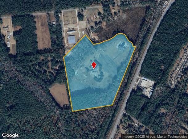
1926 Smiths Xing
063-20-01-001
COUNTY (DISTRICT 01)
Realpropertynec
Jasper
X
South Carolina
45053C0305D
35.96 AC
2025
I-95 Walterboro/Hardeeville
2025
Other Market Areas
950201
Hilton Head Island-Bluffton-Beaufort, SC
5,765 SF
DEMOGRAPHICS near 1926 Smiths Xing
1 Mile
3 Mile
5 Mile
2024 Total Population
1,330
7,072
10,140
2029 Population
1,709
8,953
12,915
Pop Growth 2024-2029
+ 28.50%
+ 26.60%
+ 27.37%
Average Age
36
40
40
2024 Total Households
475
2,282
3,377
HH Growth 2024-2029
+ 28.00%
+ 28.53%
+ 28.63%
Median Household Inc
$41,904
$40,311
$39,297
Avg Household Size
2.80
2.60
2.60
2024 Avg HH Vehicles
2.00
2.00
2.00
Median Home Value
$111,966
$145,849
$141,469
Median Year Built
1987
1989
1993
Nearby Places
Map Layers
Map Styles
 Street
 Aerial
- Restaurants
- Banks
- Shops
- Fitness
- Groceries
PUBLIC TRANSPORTATION
AIRPORT
Savannah/Hilton Head International
DRIVE
WALK
Distance
Savannah/Hilton Head International
44 min
32.5 mi
Hilton Head
DRIVE
WALK
Distance
Hilton Head
50 min
37.0 mi
Freight Ports
Georgia Ports - Savannah
DRIVE
WALK
Distance
Georgia Ports - Savannah
40 min
30.9 mi
SALE & LEASE HISTORY
LISTING DATE
SALE/LEASE

Jun 12, 2019
For Sale
Nearby Properties
Address
Land Use
TOTAL SIZE
Lot Size
Zoning
Address
Land Use
TOTAL SIZE
Lot Size
Zoning
2,400 SF
3,507.45 AC
Address
Land Use
TOTAL SIZE
Lot Size
Zoning
1,280 SF
5.56 AC
R20
Address
Land Use
TOTAL SIZE
Lot Size
Zoning
780 SF
23.33 AC
RA
Address
Land Use
TOTAL SIZE
Lot Size
Zoning
1,280 SF
11.75 AC
R20
Address
Land Use
TOTAL SIZE
Lot Size
Zoning
980 SF
2.62 AC
RA
Address
Land Use
TOTAL SIZE
Lot Size
Zoning
812 SF
2.23 AC
RA
Address
Land Use
TOTAL SIZE
Lot Size
Zoning
1,024 SF
3 AC
LI
Address
Land Use
TOTAL SIZE
Lot Size
Zoning
980 SF
4.40 AC
R20
Address
Land Use
TOTAL SIZE
Lot Size
Zoning
1,120 SF
6.20 AC
RA
Address
Land Use
TOTAL SIZE
Lot Size
Zoning
728 SF
6.20 AC
R1
Address
Land Use
TOTAL SIZE
Lot Size
Zoning
980 SF
196.62 AC
LI
Address
Land Use
TOTAL SIZE
Lot Size
Zoning
720 SF
1.02 AC
RA
Address
Land Use
TOTAL SIZE
Lot Size
Zoning
2,176 SF
200 AC
RA
Address
Land Use
TOTAL SIZE
Lot Size
Zoning
840 SF
2 AC
R1
Address
Land Use
TOTAL SIZE
Lot Size
Zoning
840 SF
70.80 AC
LI
Address
Land Use
TOTAL SIZE
Lot Size
Zoning
720 SF
14.18 AC
R1
Address
Land Use
TOTAL SIZE
Lot Size
Zoning
980 SF
2.70 AC
GC
Address
Land Use
TOTAL SIZE
Lot Size
Zoning
93.69 AC
Address
Land Use
TOTAL SIZE
Lot Size
Zoning
720 SF
2.10 AC
RA
Address
Land Use
TOTAL SIZE
Lot Size
Zoning
2,304 SF
2.20 AC
R1
Address
Land Use
TOTAL SIZE
Lot Size
Zoning
1,984 SF
3.40 AC
R1
Address
Land Use
TOTAL SIZE
Lot Size
Zoning
924 SF
2.44 AC
RA
Address
Land Use
TOTAL SIZE
Lot Size
Zoning
720 SF
16.44 AC
R1
Address
Land Use
TOTAL SIZE
Lot Size
Zoning
1,120 SF
1.10 AC
RA
Address
Land Use
TOTAL SIZE
Lot Size
Zoning
980 SF
2.86 AC
GC
Address
Land Use
TOTAL SIZE
Lot Size
Zoning
960 SF
0.39 AC
RA
Address
Land Use
TOTAL SIZE
Lot Size
Zoning
720 SF
0.97 AC
RA
Address
Land Use
TOTAL SIZE
Lot Size
Zoning
2,432 SF
0.35 AC
RA
Address
Land Use
TOTAL SIZE
Lot Size
Zoning
1,568 SF
0.11 AC
RA
Address
Land Use
TOTAL SIZE
Lot Size
Zoning
720 SF
1.80 AC
RA
The World's #1 Commercial Real Estate Marketplace
Connect with us
© 2025 CoStar Group
The information above has been obtained from sources believed reliable. While we do not doubt its accuracy we have not verified it and make no guarantee, warranty or representation about it. It is your responsibility to independently confirm its accuracy and completeness. Any projections, opinions, assumptions, or estimates used are for example only and do not represent the current or future performance of the property. The value of this transaction to you depends on tax and other factors which should be evaluated by your tax, financial, and legal advisors. You and your advisors should conduct a careful, independent investigation of the property to determine to your satisfaction the suitability of the property for your needs.