Property Record
1927 Taraval St, San Francisco, CA 94116
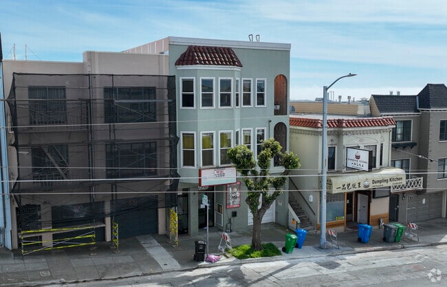

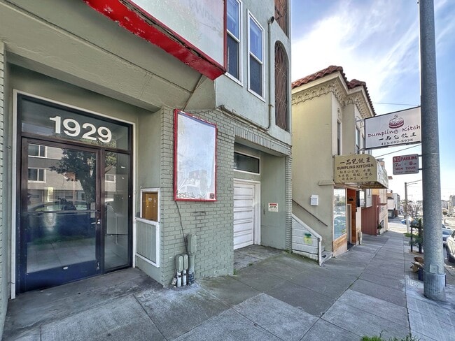

This Property Is For Sale
Current Lease Availabilities
NEARBY LISTINGS FOR SALE OR LEASE
Property Detail
1927 Taraval St
San Francisco
Outside Land Bl #1168
San Francisco-Redwood City-South San Francisco, CA
BLK 1168
2396-039
San Francisco
Retailwithmorethanonenonretailuse
California
2024
39
2025
0.06 AC
033001
Central Sunset
4,812 SF
DEMOGRAPHICS near 1927 Taraval St
1 Mile
3 Mile
5 Mile
2024 Total Population
41,213
277,512
699,965
2029 Population
37,363
255,573
647,660
Pop Growth 2024-2029
(9.34%)
(7.91%)
(7.47%)
Average Age
45
43
43
2024 Total Households
14,130
105,602
276,869
HH Growth 2024-2029
(9.94%)
(8.30%)
(7.86%)
Median Household Inc
$133,256
$131,159
$125,894
Avg Household Size
2.80
2.50
2.40
2024 Avg HH Vehicles
2.00
1.00
1.00
Median Home Value
$1,121,987
$1,111,943
$1,094,625
Median Year Built
1946
1948
1948
Nearby Places
Map Layers
Map Styles
 Street
 Aerial
- Restaurants
- Banks
- Shops
- Fitness
- Groceries
PUBLIC TRANSPORTATION
COMMUTER RAIL
DRIVE
WALK
Distance
15 min
6.9 mi
DRIVE
WALK
Distance
15 min
7.9 mi
AIRPORT
San Francisco International
DRIVE
WALK
Distance
San Francisco International
23 min
13.3 mi
Metro Oakland International
DRIVE
WALK
Distance
Metro Oakland International
44 min
25.7 mi
Norman Y Mineta San Jose International
DRIVE
WALK
Distance
Norman Y Mineta San Jose International
59 min
44.9 mi
Nearby Properties
Address
Land Use
TOTAL SIZE
Lot Size
Zoning
Address
Land Use
TOTAL SIZE
Lot Size
Zoning
411,904 SF
21.74 AC
C2
Address
Land Use
TOTAL SIZE
Lot Size
Zoning
718 SF
18.55 AC
RH2
Address
Land Use
TOTAL SIZE
Lot Size
Zoning
4.41 AC
RH-3/RM-2
Address
Land Use
TOTAL SIZE
Lot Size
Zoning
2.03 AC
C2
Address
Land Use
TOTAL SIZE
Lot Size
Zoning
88,900 SF
5.37 AC
NCS
Address
Land Use
TOTAL SIZE
Lot Size
Zoning
11.31 AC
RM2
Address
Land Use
TOTAL SIZE
Lot Size
Zoning
160,983 SF
1.84 AC
NC2
Address
Land Use
TOTAL SIZE
Lot Size
Zoning
90,539 SF
2.28 AC
RH2
Address
Land Use
TOTAL SIZE
Lot Size
Zoning
Address
Land Use
TOTAL SIZE
Lot Size
Zoning
73,491 SF
4.48 AC
C2
Address
Land Use
TOTAL SIZE
Lot Size
Zoning
12,555 SF
0.74 AC
NCS
Address
Land Use
TOTAL SIZE
Lot Size
Zoning
146,036 SF
0.49 AC
RH3
Address
Land Use
TOTAL SIZE
Lot Size
Zoning
176,000 SF
1.64 AC
C2
Address
Land Use
TOTAL SIZE
Lot Size
Zoning
54,131 SF
1.75 AC
C2
Address
Land Use
TOTAL SIZE
Lot Size
Zoning
76,000 SF
1.48 AC
RM4
Address
Land Use
TOTAL SIZE
Lot Size
Zoning
194,477 SF
11.37 AC
RH1
Address
Land Use
TOTAL SIZE
Lot Size
Zoning
87,525 SF
1.65 AC
RM1
Address
Land Use
TOTAL SIZE
Lot Size
Zoning
205,770 SF
3.37 AC
RM4
Address
Land Use
TOTAL SIZE
Lot Size
Zoning
6.80 AC
RM1
Address
Land Use
TOTAL SIZE
Lot Size
Zoning
81,756 SF
5.39 AC
RH1D
Address
Land Use
TOTAL SIZE
Lot Size
Zoning
257,754 SF
1.37 AC
Address
Land Use
TOTAL SIZE
Lot Size
Zoning
63,943 SF
0.77 AC
Address
Land Use
TOTAL SIZE
Lot Size
Zoning
66,986 SF
4.91 AC
NCS
Address
Land Use
TOTAL SIZE
Lot Size
Zoning
2.01 AC
RM1
Address
Land Use
TOTAL SIZE
Lot Size
Zoning
136,892 SF
0.96 AC
Address
Land Use
TOTAL SIZE
Lot Size
Zoning
6.18 AC
RM1
Address
Land Use
TOTAL SIZE
Lot Size
Zoning
100,740 SF
2.57 AC
Address
Land Use
TOTAL SIZE
Lot Size
Zoning
132,880 SF
1.07 AC
Address
Land Use
TOTAL SIZE
Lot Size
Zoning
108,970 SF
7 AC
NCS
Address
Land Use
TOTAL SIZE
Lot Size
Zoning
116,946 SF
0.91 AC
The World's #1 Commercial Real Estate Marketplace
Connect with us
© 2026 CoStar Group
The information above has been obtained from sources believed reliable. While we do not doubt its accuracy we have not verified it and make no guarantee, warranty or representation about it. It is your responsibility to independently confirm its accuracy and completeness. Any projections, opinions, assumptions, or estimates used are for example only and do not represent the current or future performance of the property. The value of this transaction to you depends on tax and other factors which should be evaluated by your tax, financial, and legal advisors. You and your advisors should conduct a careful, independent investigation of the property to determine to your satisfaction the suitability of the property for your needs.