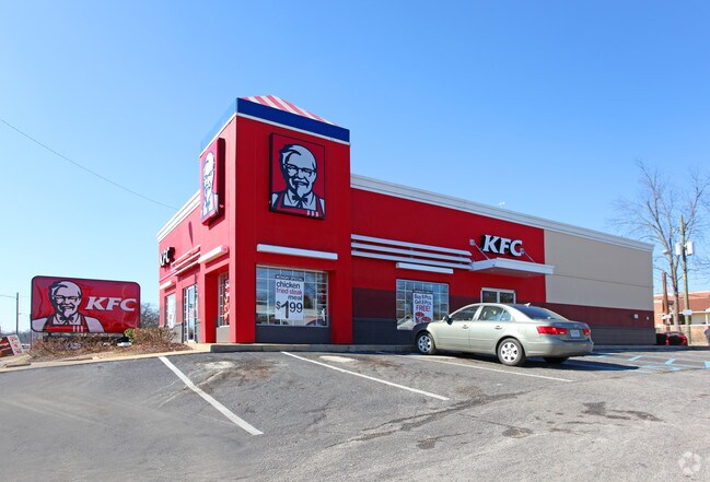
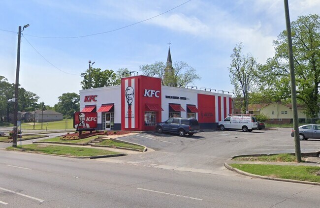
Property Record
1928 Bessemer Rd, Birmingham, AL 35208


NEARBY LISTINGS FOR SALE OR LEASE
Property Detail
1928 Bessemer Rd
Birmingham-Hoover, AL
Central Pk Hgld Re 29-7-1
29-00-07-1-001-010.000
LOT 1-A OF A RESURVEY OF LOTS 1 & 2 & 3 OF BLK 2 CENTRAL PK HIGHLANDS 160/75
Restaurantbuilding
Jefferson
X
Alabama
01073C0532G
1-a
2023
0.50 AC
2024
Bessemer
003700
Birmingham
2,497 SF
DEMOGRAPHICS near 1928 Bessemer Rd
1 Mile
3 Mile
5 Mile
2024 Total Population
12,170
69,820
147,921
2029 Population
12,095
70,411
148,120
Pop Growth 2024-2029
(0.62%)
+ 0.85%
+ 0.13%
Average Age
42
41
39
2024 Total Households
5,230
29,416
63,719
HH Growth 2024-2029
(0.69%)
+ 0.89%
+ 0.21%
Median Household Inc
$36,683
$34,100
$39,496
Avg Household Size
2.20
2.20
2.10
2024 Avg HH Vehicles
2.00
1.00
2.00
Median Home Value
$65,656
$72,749
$97,821
Median Year Built
1955
1958
1966
Nearby Places
Map Layers
Map Styles
 Street
 Aerial
- Restaurants
- Banks
- Shops
- Fitness
- Groceries
PUBLIC TRANSPORTATION
COMMUTER RAIL
Birmingham (Crescent - Amtrak)
DRIVE
WALK
Distance
Birmingham (Crescent - Amtrak)
8 min
5.1 mi
AIRPORT
Birmingham-Shuttlesworth International
DRIVE
WALK
Distance
Birmingham-Shuttlesworth International
17 min
10.2 mi
Freight Ports
Port of Mobile
DRIVE
WALK
Distance
Port of Mobile
284 min
259.3 mi
SALE & LEASE HISTORY
LISTING DATE
SALE/LEASE

Jul 15, 2020
For Sale
Nearby Properties
Address
Land Use
TOTAL SIZE
Lot Size
Zoning
Address
Land Use
TOTAL SIZE
Lot Size
Zoning
203,878 SF
12.58 AC
B6
Address
Land Use
TOTAL SIZE
Lot Size
Zoning
344,150 SF
42 AC
R5
Address
Land Use
TOTAL SIZE
Lot Size
Zoning
416,477 SF
80 AC
R5
Address
Land Use
TOTAL SIZE
Lot Size
Zoning
180,412 SF
14.89 AC
R6
Address
Land Use
TOTAL SIZE
Lot Size
Zoning
146,358 SF
13.70 AC
R6
Address
Land Use
TOTAL SIZE
Lot Size
Zoning
127,240 SF
3.50 AC
R4
Address
Land Use
TOTAL SIZE
Lot Size
Zoning
200,650 SF
19.48 AC
R4
Address
Land Use
TOTAL SIZE
Lot Size
Zoning
116,442 SF
2.67 AC
B6
Address
Land Use
TOTAL SIZE
Lot Size
Zoning
106,366 SF
8.70 AC
R3
Address
Land Use
TOTAL SIZE
Lot Size
Zoning
68,046 SF
6 AC
B6
Address
Land Use
TOTAL SIZE
Lot Size
Zoning
250,918 SF
10 AC
B-2
Address
Land Use
TOTAL SIZE
Lot Size
Zoning
65,299 SF
2 AC
B2
Address
Land Use
TOTAL SIZE
Lot Size
Zoning
46,155 SF
0.77 AC
R4
Address
Land Use
TOTAL SIZE
Lot Size
Zoning
93,081 SF
1.06 AC
B2
Address
Land Use
TOTAL SIZE
Lot Size
Zoning
1.83 AC
B6
Address
Land Use
TOTAL SIZE
Lot Size
Zoning
225,942 SF
7.30 AC
M1
Address
Land Use
TOTAL SIZE
Lot Size
Zoning
41,695 SF
5.40 AC
R4
Address
Land Use
TOTAL SIZE
Lot Size
Zoning
101,671 SF
14.73 AC
B2
Address
Land Use
TOTAL SIZE
Lot Size
Zoning
74,509 SF
9 AC
B6
Address
Land Use
TOTAL SIZE
Lot Size
Zoning
211,517 SF
9.50 AC
M1
Address
Land Use
TOTAL SIZE
Lot Size
Zoning
140,764 SF
7.21 AC
R6
Address
Land Use
TOTAL SIZE
Lot Size
Zoning
37,619 SF
9.36 AC
R3
Address
Land Use
TOTAL SIZE
Lot Size
Zoning
8,324 SF
158 AC
R3
Address
Land Use
TOTAL SIZE
Lot Size
Zoning
65,260 SF
5.29 AC
B2
Address
Land Use
TOTAL SIZE
Lot Size
Zoning
43,142 SF
4.20 AC
QB2
Address
Land Use
TOTAL SIZE
Lot Size
Zoning
128,484 SF
8.70 AC
QB1
Address
Land Use
TOTAL SIZE
Lot Size
Zoning
147,113 SF
18.31 AC
M2
Address
Land Use
TOTAL SIZE
Lot Size
Zoning
92,678 SF
2.07 AC
R4
Address
Land Use
TOTAL SIZE
Lot Size
Zoning
157,183 SF
6.50 AC
B2
Address
Land Use
TOTAL SIZE
Lot Size
Zoning
86,177 SF
11.80 AC
QB2
The World's #1 Commercial Real Estate Marketplace
Connect with us
© 2026 CoStar Group
The information above has been obtained from sources believed reliable. While we do not doubt its accuracy we have not verified it and make no guarantee, warranty or representation about it. It is your responsibility to independently confirm its accuracy and completeness. Any projections, opinions, assumptions, or estimates used are for example only and do not represent the current or future performance of the property. The value of this transaction to you depends on tax and other factors which should be evaluated by your tax, financial, and legal advisors. You and your advisors should conduct a careful, independent investigation of the property to determine to your satisfaction the suitability of the property for your needs.