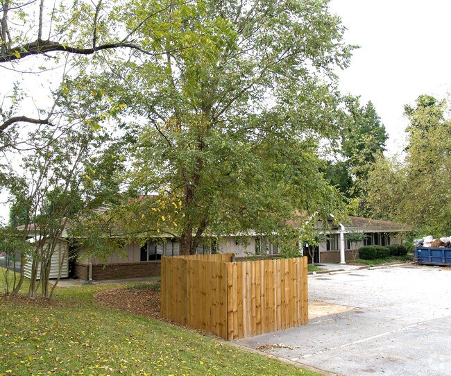
Property Record
1928 Old Norcross Rd, Lawrenceville, GA 30044


NEARBY LISTINGS FOR SALE OR LEASE
Property Detail
1928 Old Norcross Rd
Atlanta-Sandy Springs-Roswell, GA
Old Norcross Rd
7-036-019
OLD NORCROSS RD
Commercialnec
Gwinnett
X
Georgia
13135C0086F
36
2025
1.56 AC
2025
Gwinnett Mall/Duluth
050558
Atlanta
6,460 SF
DEMOGRAPHICS near 1928 Old Norcross Rd
1 Mile
3 Mile
5 Mile
2024 Total Population
10,218
99,584
244,078
2029 Population
10,585
103,985
254,275
Pop Growth 2024-2029
+ 3.59%
+ 4.42%
+ 4.18%
Average Age
36
36
37
2024 Total Households
3,299
33,217
82,936
HH Growth 2024-2029
+ 3.70%
+ 4.55%
+ 4.26%
Median Household Inc
$81,974
$65,581
$66,774
Avg Household Size
3.00
2.90
2.90
2024 Avg HH Vehicles
2.00
2.00
2.00
Median Home Value
$233,294
$264,732
$288,574
Median Year Built
1992
1994
1993
Nearby Places
Map Layers
Map Styles
 Street
 Aerial
- Restaurants
- Banks
- Shops
- Fitness
- Groceries
PUBLIC TRANSPORTATION
AIRPORT
Hartsfield - Jackson Atlanta International
DRIVE
WALK
Distance
Hartsfield - Jackson Atlanta International
50 min
37.1 mi
Nearby Properties
Address
Land Use
TOTAL SIZE
Lot Size
Zoning
Address
Land Use
TOTAL SIZE
Lot Size
Zoning
1,276,197 SF
91.78 AC
OI
Address
Land Use
TOTAL SIZE
Lot Size
Zoning
850,292 SF
70.76 AC
HM
Address
Land Use
TOTAL SIZE
Lot Size
Zoning
594,977 SF
47.90 AC
RM13
Address
Land Use
TOTAL SIZE
Lot Size
Zoning
563,525 SF
47.80 AC
RM13
Address
Land Use
TOTAL SIZE
Lot Size
Zoning
628,779 SF
97.15 AC
M1
Address
Land Use
TOTAL SIZE
Lot Size
Zoning
1,588,972 SF
112.95 AC
C2
Address
Land Use
TOTAL SIZE
Lot Size
Zoning
522,601 SF
42.40 AC
RM
Address
Land Use
TOTAL SIZE
Lot Size
Zoning
441,836 SF
35.71 AC
RM13
Address
Land Use
TOTAL SIZE
Lot Size
Zoning
486,908 SF
38.98 AC
RM13
Address
Land Use
TOTAL SIZE
Lot Size
Zoning
684,224 SF
77.07 AC
OI
Address
Land Use
TOTAL SIZE
Lot Size
Zoning
365,821 SF
17.08 AC
RM24
Address
Land Use
TOTAL SIZE
Lot Size
Zoning
444,605 SF
37.43 AC
RM
Address
Land Use
TOTAL SIZE
Lot Size
Zoning
348,681 SF
35.52 AC
RM10
Address
Land Use
TOTAL SIZE
Lot Size
Zoning
440,998 SF
35.04 AC
RM
Address
Land Use
TOTAL SIZE
Lot Size
Zoning
584,576 SF
38.60 AC
RM13
Address
Land Use
TOTAL SIZE
Lot Size
Zoning
340,573 SF
22.12 AC
RM13
Address
Land Use
TOTAL SIZE
Lot Size
Zoning
314,338 SF
28.83 AC
RM13
Address
Land Use
TOTAL SIZE
Lot Size
Zoning
316,443 SF
30.15 AC
RM13
Address
Land Use
TOTAL SIZE
Lot Size
Zoning
315,806 SF
13.03 AC
MUR
Address
Land Use
TOTAL SIZE
Lot Size
Zoning
303,275 SF
19.80 AC
RM13
Address
Land Use
TOTAL SIZE
Lot Size
Zoning
262,476 SF
20.51 AC
RM13
Address
Land Use
TOTAL SIZE
Lot Size
Zoning
409,542 SF
35.94 AC
RM13
Address
Land Use
TOTAL SIZE
Lot Size
Zoning
331,159 SF
35.49 AC
RM8
Address
Land Use
TOTAL SIZE
Lot Size
Zoning
261,174 SF
8.11 AC
MUO
Address
Land Use
TOTAL SIZE
Lot Size
Zoning
373,242 SF
6.41 AC
RM24
Address
Land Use
TOTAL SIZE
Lot Size
Zoning
712,123 SF
22.18 AC
RM24
Address
Land Use
TOTAL SIZE
Lot Size
Zoning
325,459 SF
21.18 AC
HM
Address
Land Use
TOTAL SIZE
Lot Size
Zoning
420,759 SF
33.62 AC
RM13
Address
Land Use
TOTAL SIZE
Lot Size
Zoning
282,713 SF
25.95 AC
RM13
Address
Land Use
TOTAL SIZE
Lot Size
Zoning
206,297 SF
25.06 AC
RA200
The World's #1 Commercial Real Estate Marketplace
Connect with us
© 2026 CoStar Group
The information above has been obtained from sources believed reliable. While we do not doubt its accuracy we have not verified it and make no guarantee, warranty or representation about it. It is your responsibility to independently confirm its accuracy and completeness. Any projections, opinions, assumptions, or estimates used are for example only and do not represent the current or future performance of the property. The value of this transaction to you depends on tax and other factors which should be evaluated by your tax, financial, and legal advisors. You and your advisors should conduct a careful, independent investigation of the property to determine to your satisfaction the suitability of the property for your needs.