Property Record
1929 Jefferson Ave Sw, Birmingham, AL 35211

NEARBY LISTINGS FOR SALE OR LEASE
Property Detail
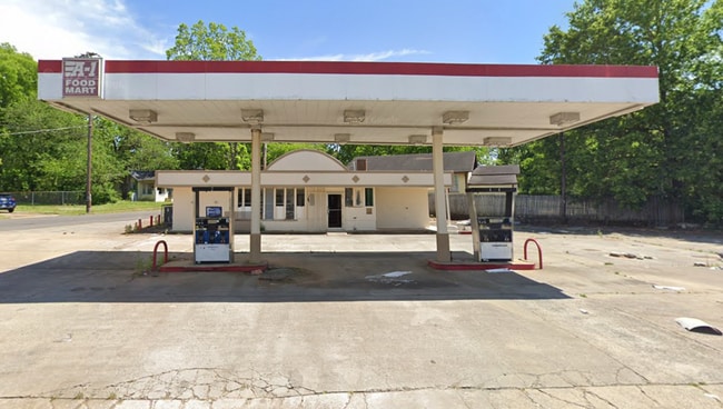
1929 Jefferson Ave Sw
Birmingham-Hoover, AL
Rosmoor Re B 15 R 29-17-1
29-00-17-1-008-001.000
LOT 4-A BLK 15 A RESUR OF PT OF BLK 15 ROSMOOR LAND CO
Storebuilding
Jefferson
X
Alabama
01073C0551G
4-a
2023
0.28 AC
2024
Bessemer
005702
Birmingham
1,156 SF
DEMOGRAPHICS near 1929 Jefferson Ave Sw
1 Mile
3 Mile
5 Mile
2024 Total Population
10,945
74,337
166,288
2029 Population
11,209
75,923
168,190
Pop Growth 2024-2029
+ 2.41%
+ 2.13%
+ 1.14%
Average Age
43
41
39
2024 Total Households
4,660
32,365
71,313
HH Growth 2024-2029
+ 2.42%
+ 2.14%
+ 1.27%
Median Household Inc
$36,084
$34,322
$42,065
Avg Household Size
2.20
2.10
2.10
2024 Avg HH Vehicles
2.00
1.00
2.00
Median Home Value
$66,294
$77,383
$136,537
Median Year Built
1961
1962
1967
Nearby Places
Map Layers
Map Styles
 Street
 Aerial
- Restaurants
- Banks
- Shops
- Fitness
- Groceries
PUBLIC TRANSPORTATION
COMMUTER RAIL
DRIVE
WALK
Distance
11 min
4.8 mi
AIRPORT
Birmingham-Shuttlesworth International
DRIVE
WALK
Distance
Birmingham-Shuttlesworth International
20 min
9.9 mi
SALE & LEASE HISTORY
LISTING DATE
SALE/LEASE

Jul 16, 2024
For Sale
Nearby Properties
Address
Land Use
TOTAL SIZE
Lot Size
Zoning
Address
Land Use
TOTAL SIZE
Lot Size
Zoning
203,878 SF
12.58 AC
B6
Address
Land Use
TOTAL SIZE
Lot Size
Zoning
242,746 SF
20.96 AC
MXDE
Address
Land Use
TOTAL SIZE
Lot Size
Zoning
344,150 SF
42 AC
R5
Address
Land Use
TOTAL SIZE
Lot Size
Zoning
209,765 SF
19.20 AC
I-3
Address
Land Use
TOTAL SIZE
Lot Size
Zoning
416,477 SF
80 AC
R5
Address
Land Use
TOTAL SIZE
Lot Size
Zoning
311,982 SF
30 AC
R6
Address
Land Use
TOTAL SIZE
Lot Size
Zoning
92,332 SF
8.40 AC
Address
Land Use
TOTAL SIZE
Lot Size
Zoning
180,412 SF
14.89 AC
R6
Address
Land Use
TOTAL SIZE
Lot Size
Zoning
267,289 SF
18.40 AC
L1
Address
Land Use
TOTAL SIZE
Lot Size
Zoning
517,500 SF
29 AC
I1
Address
Land Use
TOTAL SIZE
Lot Size
Zoning
222,131 SF
31 AC
I3
Address
Land Use
TOTAL SIZE
Lot Size
Zoning
136,184 SF
21 AC
B2-B
Address
Land Use
TOTAL SIZE
Lot Size
Zoning
146,358 SF
13.70 AC
R6
Address
Land Use
TOTAL SIZE
Lot Size
Zoning
127,240 SF
3.50 AC
R4
Address
Land Use
TOTAL SIZE
Lot Size
Zoning
98,217 SF
13.20 AC
Address
Land Use
TOTAL SIZE
Lot Size
Zoning
200,650 SF
19.48 AC
R4
Address
Land Use
TOTAL SIZE
Lot Size
Zoning
116,442 SF
2.67 AC
B6
Address
Land Use
TOTAL SIZE
Lot Size
Zoning
72,468 SF
8.70 AC
I3
Address
Land Use
TOTAL SIZE
Lot Size
Zoning
198,732 SF
11.60 AC
L1
Address
Land Use
TOTAL SIZE
Lot Size
Zoning
35,826 SF
3.77 AC
I-3
Address
Land Use
TOTAL SIZE
Lot Size
Zoning
336,653 SF
22.50 AC
CM1
Address
Land Use
TOTAL SIZE
Lot Size
Zoning
191,910 SF
13.88 AC
I3
Address
Land Use
TOTAL SIZE
Lot Size
Zoning
106,366 SF
8.70 AC
R3
Address
Land Use
TOTAL SIZE
Lot Size
Zoning
134,032 SF
4.13 AC
B5
Address
Land Use
TOTAL SIZE
Lot Size
Zoning
189,046 SF
14 AC
B1
Address
Land Use
TOTAL SIZE
Lot Size
Zoning
144,613 SF
11 AC
B5
Address
Land Use
TOTAL SIZE
Lot Size
Zoning
79,035 SF
8.43 AC
R5
Address
Land Use
TOTAL SIZE
Lot Size
Zoning
67,628 SF
5.46 AC
B5
The World's #1 Commercial Real Estate Marketplace
Connect with us
© 2026 CoStar Group
The information above has been obtained from sources believed reliable. While we do not doubt its accuracy we have not verified it and make no guarantee, warranty or representation about it. It is your responsibility to independently confirm its accuracy and completeness. Any projections, opinions, assumptions, or estimates used are for example only and do not represent the current or future performance of the property. The value of this transaction to you depends on tax and other factors which should be evaluated by your tax, financial, and legal advisors. You and your advisors should conduct a careful, independent investigation of the property to determine to your satisfaction the suitability of the property for your needs.