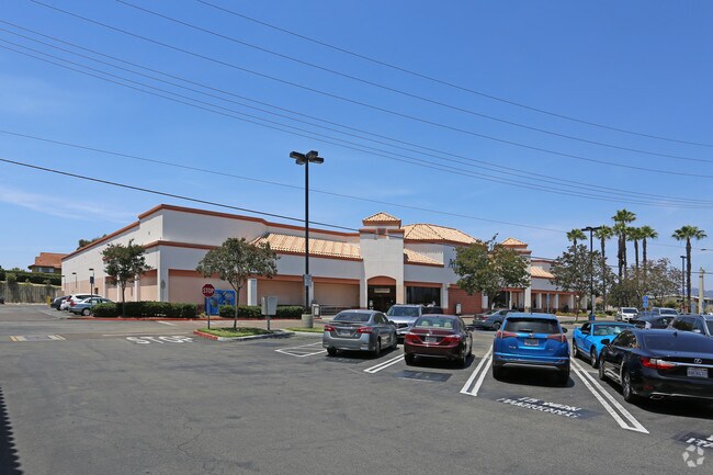
Property Record
1929 W San Marcos Blvd, San Marcos, CA 92078


NEARBY LISTINGS FOR SALE OR LEASE
Property Detail
1929 W San Marcos Blvd
221-024-14
City/San Marcos
Supermarket
PAR A TR PM16614
X
San Diego
06073C0789H
California
2024
4.44 AC
2025
San Marcos
020019
San Diego
43,964 SF
San Diego-Carlsbad, CA
DEMOGRAPHICS near 1929 W San Marcos Blvd
1 Mile
3 Mile
5 Mile
2024 Total Population
14,095
104,520
208,301
2029 Population
14,063
103,664
206,546
Pop Growth 2024-2029
(0.23%)
(0.82%)
(0.84%)
Average Age
49
39
40
2024 Total Households
5,616
35,282
72,436
HH Growth 2024-2029
(0.20%)
(0.93%)
(1.00%)
Median Household Inc
$78,856
$102,331
$110,219
Avg Household Size
2.30
2.90
2.80
2024 Avg HH Vehicles
2.00
2.00
2.00
Median Home Value
$617,293
$805,899
$817,770
Median Year Built
1982
1993
1989
Nearby Places
Map Layers
Map Styles
 Street
 Aerial
- Restaurants
- Banks
- Shops
- Fitness
- Groceries
PUBLIC TRANSPORTATION
COMMUTER RAIL
Carlsbad Poinsettia (Coaster - San Diego North County Transit District (Coaster/Sprinter/Breeze))
DRIVE
WALK
Distance
Carlsbad Poinsettia (Coaster - San Diego North County Transit District (Coaster/Sprinter/Breeze))
15 min
8.5 mi
Encinitas (Coaster - San Diego North County Transit District (Coaster/Sprinter/Breeze))
DRIVE
WALK
Distance
Encinitas (Coaster - San Diego North County Transit District (Coaster/Sprinter/Breeze))
17 min
9.8 mi
AIRPORT
San Diego International
DRIVE
WALK
Distance
San Diego International
44 min
31.9 mi
Freight Ports
Port of San Diego
DRIVE
WALK
Distance
Port of San Diego
50 min
36.4 mi
SALE & LEASE HISTORY
LISTING DATE
SALE/LEASE

Oct 26, 2017
For Lease
Nearby Properties
Address
Land Use
TOTAL SIZE
Lot Size
Zoning
Address
Land Use
TOTAL SIZE
Lot Size
Zoning
27.98 AC
SPA
Address
Land Use
TOTAL SIZE
Lot Size
Zoning
13.92 AC
P-M
Address
Land Use
TOTAL SIZE
Lot Size
Zoning
18.90 AC
R-M
Address
Land Use
TOTAL SIZE
Lot Size
Zoning
14.32 AC
P-M
Address
Land Use
TOTAL SIZE
Lot Size
Zoning
15.37 AC
SPA
Address
Land Use
TOTAL SIZE
Lot Size
Zoning
5.25 AC
SPA
Address
Land Use
TOTAL SIZE
Lot Size
Zoning
12.49 AC
P-C
Address
Land Use
TOTAL SIZE
Lot Size
Zoning
5.37 AC
SPA
Address
Land Use
TOTAL SIZE
Lot Size
Zoning
10.82 AC
SPA
Address
Land Use
TOTAL SIZE
Lot Size
Zoning
28.45 AC
O-S
Address
Land Use
TOTAL SIZE
Lot Size
Zoning
11.87 AC
R-M
Address
Land Use
TOTAL SIZE
Lot Size
Zoning
9.41 AC
SPI
Address
Land Use
TOTAL SIZE
Lot Size
Zoning
69,200 SF
4.52 AC
P-M
Address
Land Use
TOTAL SIZE
Lot Size
Zoning
16.91 AC
C
Address
Land Use
TOTAL SIZE
Lot Size
Zoning
11.08 AC
SPI
Address
Land Use
TOTAL SIZE
Lot Size
Zoning
SPECIFIC P
Address
Land Use
TOTAL SIZE
Lot Size
Zoning
11.49 AC
P-M
Address
Land Use
TOTAL SIZE
Lot Size
Zoning
14.91 AC
SPI
Address
Land Use
TOTAL SIZE
Lot Size
Zoning
4.76 AC
C34
Address
Land Use
TOTAL SIZE
Lot Size
Zoning
10.94 AC
P-M
Address
Land Use
TOTAL SIZE
Lot Size
Zoning
13.20 AC
P-M
Address
Land Use
TOTAL SIZE
Lot Size
Zoning
9.80 AC
I
Address
Land Use
TOTAL SIZE
Lot Size
Zoning
7.91 AC
SPI
Address
Land Use
TOTAL SIZE
Lot Size
Zoning
19.35 AC
P-M
Address
Land Use
TOTAL SIZE
Lot Size
Zoning
27.30 AC
SPI
Address
Land Use
TOTAL SIZE
Lot Size
Zoning
10.44 AC
P-M
Address
Land Use
TOTAL SIZE
Lot Size
Zoning
6.38 AC
P-M
Address
Land Use
TOTAL SIZE
Lot Size
Zoning
19.68 AC
SPI
Address
Land Use
TOTAL SIZE
Lot Size
Zoning
10.80 AC
SPA
Address
Land Use
TOTAL SIZE
Lot Size
Zoning
1.94 AC
C
The World's #1 Commercial Real Estate Marketplace
Connect with us
© 2026 CoStar Group
The information above has been obtained from sources believed reliable. While we do not doubt its accuracy we have not verified it and make no guarantee, warranty or representation about it. It is your responsibility to independently confirm its accuracy and completeness. Any projections, opinions, assumptions, or estimates used are for example only and do not represent the current or future performance of the property. The value of this transaction to you depends on tax and other factors which should be evaluated by your tax, financial, and legal advisors. You and your advisors should conduct a careful, independent investigation of the property to determine to your satisfaction the suitability of the property for your needs.