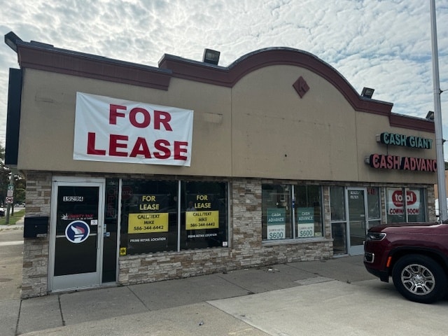
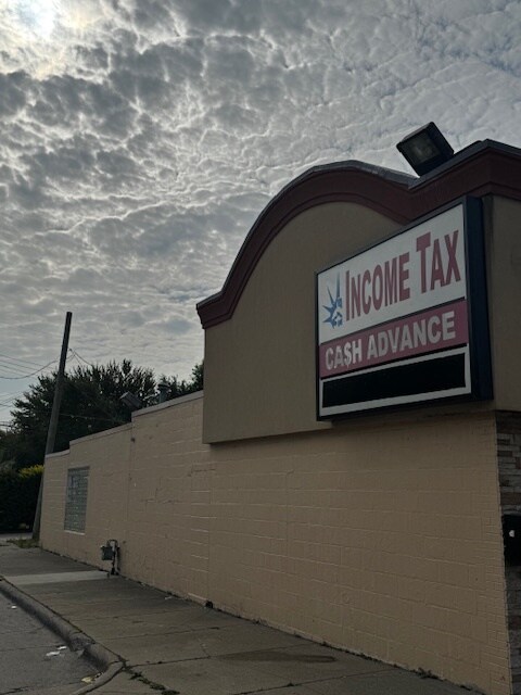
Property Record
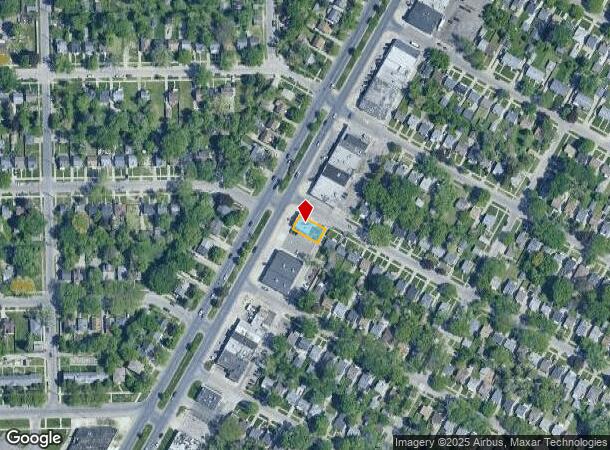
19294 Kelly Rd, Harper Woods, MI 48225
NEARBY LISTINGS FOR SALE OR LEASE
Property Detail
19294 Kelly Rd
Detroit-Warren-Dearborn, MI
East Park Manor No 1
42-001-01-0689-000
617A689 690 LOT 689 AND 690 EAST PARK MANOR NO.1 PCS 123,617 L55 P75 WCR
Officebuilding
Wayne
X
Michigan
26163C0140F
689-690
2024
0.08 AC
2025
The Pointes/Harper Woods
551600
Detroit
2,448 SF
DEMOGRAPHICS near 19294 Kelly Rd
1 Mile
3 Mile
5 Mile
2024 Total Population
22,467
174,550
346,365
2029 Population
22,296
174,118
344,548
Pop Growth 2024-2029
(0.76%)
(0.25%)
(0.52%)
Average Age
34
37
39
2024 Total Households
7,641
64,435
134,504
HH Growth 2024-2029
(0.86%)
(0.42%)
(0.63%)
Median Household Inc
$45,022
$46,068
$49,984
Avg Household Size
2.90
2.60
2.50
2024 Avg HH Vehicles
1.00
1.00
2.00
Median Home Value
$73,444
$96,318
$129,258
Median Year Built
1951
1952
1953
Nearby Places
- Restaurants
- Banks
- Shops
- Fitness
- Groceries
PUBLIC TRANSPORTATION
AIRPORT
Windsor International
DRIVE
WALK
Distance
Windsor International
45 min
21.8 mi
Detroit Metro Wayne County
DRIVE
WALK
Distance
Detroit Metro Wayne County
47 min
31.4 mi
SALE & LEASE HISTORY
LISTING DATE
SALE/LEASE

Sep 19, 2025
For Lease
Nearby Properties
Address
Land Use
TOTAL SIZE
Lot Size
Zoning
Address
Land Use
TOTAL SIZE
Lot Size
Zoning
1,034,990 SF
28.60 AC
Address
Land Use
TOTAL SIZE
Lot Size
Zoning
211,065 SF
8.84 AC
C.F
Address
Land Use
TOTAL SIZE
Lot Size
Zoning
575,081 SF
8.53 AC
R6
Address
Land Use
TOTAL SIZE
Lot Size
Zoning
182,866 SF
5.08 AC
PD
Address
Land Use
TOTAL SIZE
Lot Size
Zoning
101,733 SF
1.10 AC
C-2
Address
Land Use
TOTAL SIZE
Lot Size
Zoning
166,064 SF
6.33 AC
M-3
Address
Land Use
TOTAL SIZE
Lot Size
Zoning
103,069 SF
11.41 AC
B-3
Address
Land Use
TOTAL SIZE
Lot Size
Zoning
105,354 SF
2.33 AC
B-3
Address
Land Use
TOTAL SIZE
Lot Size
Zoning
75,284 SF
0.87 AC
C
Address
Land Use
TOTAL SIZE
Lot Size
Zoning
136,270 SF
3.42 AC
LI
Address
Land Use
TOTAL SIZE
Lot Size
Zoning
156,352 SF
2.72 AC
B-3
Address
Land Use
TOTAL SIZE
Lot Size
Zoning
26,068 SF
5.57 AC
B-2
Address
Land Use
TOTAL SIZE
Lot Size
Zoning
30,919 SF
0.86 AC
C
Address
Land Use
TOTAL SIZE
Lot Size
Zoning
36,417 SF
0.68 AC
B4
Address
Land Use
TOTAL SIZE
Lot Size
Zoning
141,023 SF
7.96 AC
MZ
Address
Land Use
TOTAL SIZE
Lot Size
Zoning
130,276 SF
6.24 AC
M-2
Address
Land Use
TOTAL SIZE
Lot Size
Zoning
92,903 SF
1.70 AC
LI
Address
Land Use
TOTAL SIZE
Lot Size
Zoning
80,320 SF
4.73 AC
RM-1
Address
Land Use
TOTAL SIZE
Lot Size
Zoning
147,581 SF
9.21 AC
MZ
Address
Land Use
TOTAL SIZE
Lot Size
Zoning
233,876 SF
8.20 AC
Address
Land Use
TOTAL SIZE
Lot Size
Zoning
36,191 SF
3.87 AC
B-2
Address
Land Use
TOTAL SIZE
Lot Size
Zoning
89,120 SF
10.75 AC
M-3
Address
Land Use
TOTAL SIZE
Lot Size
Zoning
87,897 SF
4.50 AC
RM-1
Address
Land Use
TOTAL SIZE
Lot Size
Zoning
49,807 SF
0.84 AC
PD
Address
Land Use
TOTAL SIZE
Lot Size
Zoning
122,548 SF
6.15 AC
M-2
Address
Land Use
TOTAL SIZE
Lot Size
Zoning
10,908 SF
2.78 AC
B-3
Address
Land Use
TOTAL SIZE
Lot Size
Zoning
27,860 SF
3.79 AC
LI
Address
Land Use
TOTAL SIZE
Lot Size
Zoning
109,016 SF
7.96 AC
MZ
Address
Land Use
TOTAL SIZE
Lot Size
Zoning
92,610 SF
1.76 AC
B-3
Address
Land Use
TOTAL SIZE
Lot Size
Zoning
36,086 SF
2.05 AC
B2
The World's #1 Commercial Real Estate Marketplace
Connect with us
© 2025 CoStar Group
The information above has been obtained from sources believed reliable. While we do not doubt its accuracy we have not verified it and make no guarantee, warranty or representation about it. It is your responsibility to independently confirm its accuracy and completeness. Any projections, opinions, assumptions, or estimates used are for example only and do not represent the current or future performance of the property. The value of this transaction to you depends on tax and other factors which should be evaluated by your tax, financial, and legal advisors. You and your advisors should conduct a careful, independent investigation of the property to determine to your satisfaction the suitability of the property for your needs.