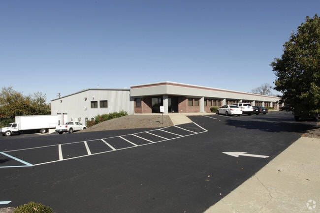
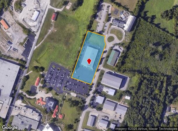
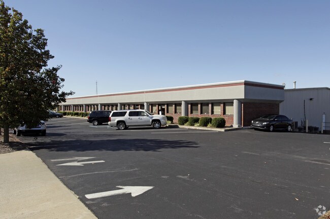
Property Record
193 Computrex Dr, Nicholasville, KY 40356
NEARBY LISTINGS FOR SALE OR LEASE
Property Detail
193 Computrex Dr
067-00-00-180.05
Minor Consolidation Plat
Multipleuses
TRACT 1-A
X
Jessamine
21113C0070D
Kentucky
2025
3 AC
2025
Jessamine County
060600
Lexington/Fayette
24,000 SF
Lexington-Fayette, KY
DEMOGRAPHICS near 193 Computrex Dr
1 Mile
3 Mile
5 Mile
2024 Total Population
329
20,108
113,074
2029 Population
350
20,472
114,444
Pop Growth 2024-2029
+ 6.38%
+ 1.81%
+ 1.21%
Average Age
44
39
39
2024 Total Households
123
7,691
46,576
HH Growth 2024-2029
+ 6.50%
+ 1.86%
+ 1.04%
Median Household Inc
$99,999
$79,615
$67,842
Avg Household Size
2.60
2.60
2.40
2024 Avg HH Vehicles
2.00
2.00
2.00
Median Home Value
$410,714
$262,285
$248,376
Median Year Built
1988
1996
1987
Nearby Places
Map Layers
Map Styles
 Street
 Aerial
- Restaurants
- Banks
- Shops
- Fitness
- Groceries
PUBLIC TRANSPORTATION
AIRPORT
Blue Grass
DRIVE
WALK
Distance
Blue Grass
23 min
13.4 mi
Freight Ports
Port of Toledo
DRIVE
WALK
Distance
Port of Toledo
349 min
296.6 mi
SALE & LEASE HISTORY
LISTING DATE
SALE/LEASE

Sep 25, 2016
For Lease
May 07, 2018
For Lease
Nearby Properties
Address
Land Use
TOTAL SIZE
Lot Size
Zoning
Address
Land Use
TOTAL SIZE
Lot Size
Zoning
41,132 SF
19 AC
Address
Land Use
TOTAL SIZE
Lot Size
Zoning
4,992 SF
32.12 AC
Address
Land Use
TOTAL SIZE
Lot Size
Zoning
444,063 SF
26.02 AC
Address
Land Use
TOTAL SIZE
Lot Size
Zoning
41,467 SF
56 AC
Address
Land Use
TOTAL SIZE
Lot Size
Zoning
Address
Land Use
TOTAL SIZE
Lot Size
Zoning
4,142 SF
19.94 AC
Address
Land Use
TOTAL SIZE
Lot Size
Zoning
44,298 SF
11 AC
Address
Land Use
TOTAL SIZE
Lot Size
Zoning
39,277 SF
15 AC
Address
Land Use
TOTAL SIZE
Lot Size
Zoning
13,686 SF
2 AC
Address
Land Use
TOTAL SIZE
Lot Size
Zoning
60,990 SF
4.29 AC
Address
Land Use
TOTAL SIZE
Lot Size
Zoning
1,920 SF
99.41 AC
A-U
Address
Land Use
TOTAL SIZE
Lot Size
Zoning
29,690 SF
255 AC
Address
Land Use
TOTAL SIZE
Lot Size
Zoning
52,480 SF
9 AC
Address
Land Use
TOTAL SIZE
Lot Size
Zoning
200,857 SF
22.84 AC
Address
Land Use
TOTAL SIZE
Lot Size
Zoning
11,725 SF
10 AC
Address
Land Use
TOTAL SIZE
Lot Size
Zoning
136 SF
13 AC
Address
Land Use
TOTAL SIZE
Lot Size
Zoning
87,453 SF
9 AC
Address
Land Use
TOTAL SIZE
Lot Size
Zoning
43,220 SF
19 AC
Address
Land Use
TOTAL SIZE
Lot Size
Zoning
23,154 SF
4.56 AC
R-3
Address
Land Use
TOTAL SIZE
Lot Size
Zoning
2,094 SF
7 AC
R-3
Address
Land Use
TOTAL SIZE
Lot Size
Zoning
Address
Land Use
TOTAL SIZE
Lot Size
Zoning
11,200 SF
6.23 AC
R-3
Address
Land Use
TOTAL SIZE
Lot Size
Zoning
24,678 SF
2.47 AC
R-3
Address
Land Use
TOTAL SIZE
Lot Size
Zoning
5,022 SF
30.06 AC
Address
Land Use
TOTAL SIZE
Lot Size
Zoning
Address
Land Use
TOTAL SIZE
Lot Size
Zoning
20,865 SF
4 AC
Address
Land Use
TOTAL SIZE
Lot Size
Zoning
Address
Land Use
TOTAL SIZE
Lot Size
Zoning
18,274 SF
6 AC
Address
Land Use
TOTAL SIZE
Lot Size
Zoning
56,900 SF
7 AC
The World's #1 Commercial Real Estate Marketplace
Connect with us
© 2026 CoStar Group
The information above has been obtained from sources believed reliable. While we do not doubt its accuracy we have not verified it and make no guarantee, warranty or representation about it. It is your responsibility to independently confirm its accuracy and completeness. Any projections, opinions, assumptions, or estimates used are for example only and do not represent the current or future performance of the property. The value of this transaction to you depends on tax and other factors which should be evaluated by your tax, financial, and legal advisors. You and your advisors should conduct a careful, independent investigation of the property to determine to your satisfaction the suitability of the property for your needs.