Property Record
193 Lake St, Bristol, NH 03222


NEARBY LISTINGS FOR SALE OR LEASE
-
-
View all Bristol listings for sale on LoopNet.com
Property Detail
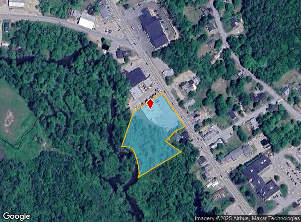
193 Lake St
000112000001000001
Grafton
Commercialbuilding
New Hampshire
AE
1
33009C1176F
2.28 AC
2024
Concord/New Hampshire North Area
2024
Other Market Areas
961201
Claremont-Lebanon, NH-VT
7,843 SF
DEMOGRAPHICS near 193 Lake St
1 Mile
3 Mile
5 Mile
2024 Total Population
1,861
4,795
7,683
2029 Population
1,994
5,167
8,263
Pop Growth 2024-2029
+ 7.15%
+ 7.76%
+ 7.55%
Average Age
44
47
47
2024 Total Households
801
2,112
3,348
HH Growth 2024-2029
+ 6.74%
+ 7.53%
+ 7.32%
Median Household Inc
$72,307
$70,685
$72,751
Avg Household Size
2.20
2.20
2.20
2024 Avg HH Vehicles
2.00
2.00
2.00
Median Home Value
$196,900
$242,405
$259,938
Median Year Built
1980
1983
1983
Nearby Places
Map Layers
Map Styles
 Street
 Aerial
- Restaurants
- Banks
- Shops
- Fitness
- Groceries
SALE & LEASE HISTORY
LISTING DATE
SALE/LEASE

Sep 24, 2016
For Sale
Sep 24, 2016
For Sale
Sep 23, 2016
For Sale
Nearby Properties
Address
Land Use
TOTAL SIZE
Lot Size
Zoning
Address
Land Use
TOTAL SIZE
Lot Size
Zoning
Address
Land Use
TOTAL SIZE
Lot Size
Zoning
3,709 SF
26 AC
I
Address
Land Use
TOTAL SIZE
Lot Size
Zoning
256,046 SF
41.02 AC
I
Address
Land Use
TOTAL SIZE
Lot Size
Zoning
7,682 SF
35 AC
L
Address
Land Use
TOTAL SIZE
Lot Size
Zoning
44,456 SF
5.10 AC
VC
Address
Land Use
TOTAL SIZE
Lot Size
Zoning
8.38 AC
C1
Address
Land Use
TOTAL SIZE
Lot Size
Zoning
0.52 AC
L
Address
Land Use
TOTAL SIZE
Lot Size
Zoning
2,173 SF
13.85 AC
I
Address
Land Use
TOTAL SIZE
Lot Size
Zoning
1.30 AC
VC
Address
Land Use
TOTAL SIZE
Lot Size
Zoning
32,347 SF
2.60 AC
VC
Address
Land Use
TOTAL SIZE
Lot Size
Zoning
19,724 SF
2.01 AC
VC
Address
Land Use
TOTAL SIZE
Lot Size
Zoning
11,312 SF
2 AC
I
Address
Land Use
TOTAL SIZE
Lot Size
Zoning
21,648 SF
1.80 AC
VC
Address
Land Use
TOTAL SIZE
Lot Size
Zoning
2,136 SF
2 AC
L
Address
Land Use
TOTAL SIZE
Lot Size
Zoning
1.47 AC
L
Address
Land Use
TOTAL SIZE
Lot Size
Zoning
15,913 SF
3.87 AC
VR
Address
Land Use
TOTAL SIZE
Lot Size
Zoning
0.44 AC
GR
Address
Land Use
TOTAL SIZE
Lot Size
Zoning
Address
Land Use
TOTAL SIZE
Lot Size
Zoning
22,984 SF
4.79 AC
I
Address
Land Use
TOTAL SIZE
Lot Size
Zoning
3,367 SF
0.49 AC
L
Address
Land Use
TOTAL SIZE
Lot Size
Zoning
2,212 SF
0.50 AC
L
Address
Land Use
TOTAL SIZE
Lot Size
Zoning
15,048 SF
9.60 AC
I
Address
Land Use
TOTAL SIZE
Lot Size
Zoning
2,812 SF
0.37 AC
L
Address
Land Use
TOTAL SIZE
Lot Size
Zoning
4,066 SF
14.79 AC
TOWNWI
Address
Land Use
TOTAL SIZE
Lot Size
Zoning
1,416 SF
0.39 AC
L
Address
Land Use
TOTAL SIZE
Lot Size
Zoning
5,714 SF
0.73 AC
DC
Address
Land Use
TOTAL SIZE
Lot Size
Zoning
1.88 AC
L
Address
Land Use
TOTAL SIZE
Lot Size
Zoning
6 AC
RURAL
Address
Land Use
TOTAL SIZE
Lot Size
Zoning
11,844 SF
5.01 AC
VC
Address
Land Use
TOTAL SIZE
Lot Size
Zoning
6,000 SF
1.30 AC
L
The World's #1 Commercial Real Estate Marketplace
Connect with us
© 2025 CoStar Group
The information above has been obtained from sources believed reliable. While we do not doubt its accuracy we have not verified it and make no guarantee, warranty or representation about it. It is your responsibility to independently confirm its accuracy and completeness. Any projections, opinions, assumptions, or estimates used are for example only and do not represent the current or future performance of the property. The value of this transaction to you depends on tax and other factors which should be evaluated by your tax, financial, and legal advisors. You and your advisors should conduct a careful, independent investigation of the property to determine to your satisfaction the suitability of the property for your needs.