Property Record
193 E Osteen Rd E, Pembroke, GA 31321
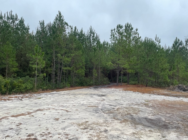
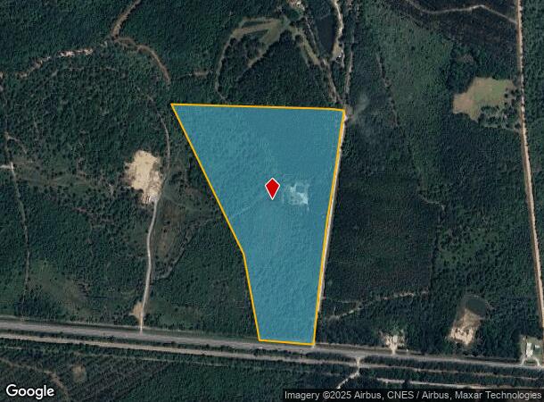
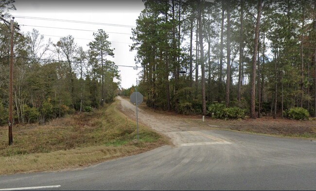
This Property Is For Sale
NEARBY LISTINGS FOR SALE OR LEASE
Property Detail
193 E Osteen Rd E
Savannah
Bryan
Savannah, GA
Georgia
016-13-002-001
31.21 AC
Ruralagriculturalresidence
Bryan County
1,410 SF
DEMOGRAPHICS near 193 E Osteen Rd E
1 Mile
3 Mile
5 Mile
2024 Total Population
139
2,027
7,268
2029 Population
162
2,406
8,602
Pop Growth 2024-2029
+ 16.55%
+ 18.70%
+ 18.35%
Average Age
39
39
39
2024 Total Households
51
739
2,673
HH Growth 2024-2029
+ 17.65%
+ 18.81%
+ 18.37%
Median Household Inc
$64,218
$63,398
$59,111
Avg Household Size
2.60
2.70
2.70
2024 Avg HH Vehicles
2.00
2.00
2.00
Median Home Value
$220,000
$183,659
$166,375
Median Year Built
1993
1992
1993
Nearby Places
Map Layers
Map Styles
 Street
 Aerial
- Restaurants
- Banks
- Shops
- Fitness
- Groceries
PUBLIC TRANSPORTATION
AIRPORT
Savannah/Hilton Head International
DRIVE
WALK
Distance
Savannah/Hilton Head International
42 min
30.0 mi
Freight Ports
Georgia Ports - Savannah
DRIVE
WALK
Distance
Georgia Ports - Savannah
44 min
32.7 mi
Nearby Properties
Address
Land Use
TOTAL SIZE
Lot Size
Zoning
Address
Land Use
TOTAL SIZE
Lot Size
Zoning
81,504 SF
46.29 AC
B-2
Address
Land Use
TOTAL SIZE
Lot Size
Zoning
123,462 SF
36.82 AC
B-2
Address
Land Use
TOTAL SIZE
Lot Size
Zoning
69,775 SF
3.62 AC
R-3
Address
Land Use
TOTAL SIZE
Lot Size
Zoning
67,986 SF
48.25 AC
RR-1
Address
Land Use
TOTAL SIZE
Lot Size
Zoning
149.91 AC
PUD
Address
Land Use
TOTAL SIZE
Lot Size
Zoning
75 AC
PUD
Address
Land Use
TOTAL SIZE
Lot Size
Zoning
286.75 AC
R-15
Address
Land Use
TOTAL SIZE
Lot Size
Zoning
20,674 SF
3.73 AC
R-1
Address
Land Use
TOTAL SIZE
Lot Size
Zoning
17,664 SF
5.76 AC
R-3
Address
Land Use
TOTAL SIZE
Lot Size
Zoning
15,262 SF
1.69 AC
B-2
Address
Land Use
TOTAL SIZE
Lot Size
Zoning
8,820 SF
0.97 AC
B-2
Address
Land Use
TOTAL SIZE
Lot Size
Zoning
25,104 SF
1.73 AC
R-3
Address
Land Use
TOTAL SIZE
Lot Size
Zoning
1,280 SF
4.51 AC
I-1
Address
Land Use
TOTAL SIZE
Lot Size
Zoning
11,826 SF
4.10 AC
A-5
Address
Land Use
TOTAL SIZE
Lot Size
Zoning
154.03 AC
A-5
Address
Land Use
TOTAL SIZE
Lot Size
Zoning
646.69 AC
A-5
Address
Land Use
TOTAL SIZE
Lot Size
Zoning
15,768 SF
2.23 AC
R-3
Address
Land Use
TOTAL SIZE
Lot Size
Zoning
627.89 AC
A-5
Address
Land Use
TOTAL SIZE
Lot Size
Zoning
14,496 SF
10.97 AC
RR-1
Address
Land Use
TOTAL SIZE
Lot Size
Zoning
640 AC
A-5
Address
Land Use
TOTAL SIZE
Lot Size
Zoning
30.89 AC
R-3
Address
Land Use
TOTAL SIZE
Lot Size
Zoning
262 AC
A-5
Address
Land Use
TOTAL SIZE
Lot Size
Zoning
4,644 SF
0.72 AC
B-3
Address
Land Use
TOTAL SIZE
Lot Size
Zoning
5,455 SF
0.56 AC
B-3
Address
Land Use
TOTAL SIZE
Lot Size
Zoning
5,400 SF
1.50 AC
B-2
Address
Land Use
TOTAL SIZE
Lot Size
Zoning
1,344 SF
9.36 AC
B-2
Address
Land Use
TOTAL SIZE
Lot Size
Zoning
5,472 SF
1.22 AC
B-2
Address
Land Use
TOTAL SIZE
Lot Size
Zoning
230.62 AC
A-5
Address
Land Use
TOTAL SIZE
Lot Size
Zoning
450.13 AC
A-5
Address
Land Use
TOTAL SIZE
Lot Size
Zoning
939.96 AC
A-5
The World's #1 Commercial Real Estate Marketplace
Connect with us
© 2026 CoStar Group
The information above has been obtained from sources believed reliable. While we do not doubt its accuracy we have not verified it and make no guarantee, warranty or representation about it. It is your responsibility to independently confirm its accuracy and completeness. Any projections, opinions, assumptions, or estimates used are for example only and do not represent the current or future performance of the property. The value of this transaction to you depends on tax and other factors which should be evaluated by your tax, financial, and legal advisors. You and your advisors should conduct a careful, independent investigation of the property to determine to your satisfaction the suitability of the property for your needs.