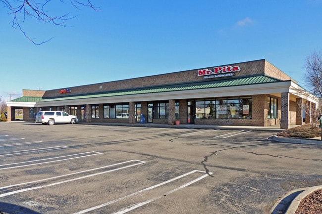
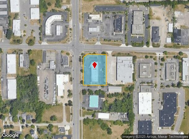
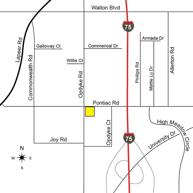
Property Record
1930 N Opdyke Rd, Auburn Hills, MI 48326
Current Lease Availabilities
NEARBY LISTINGS FOR SALE OR LEASE
Property Detail
1930 N Opdyke Rd
Detroit-Warren-Dearborn, MI
Supervisors Plat #3
14-14-326-001
T3N, R10E, SEC 14 SUPERVISOR'S PLAT NO 3 LOTS 1 & 2 EXC W 17 FT OF SD LOT 1 IN M-24 HWY, ALSO EXC BEG AT NE COR OF SD LOT 2,
Regionalshoppingcenterormallwithanchorstore
Oakland
X
Michigan
26125C0386F
1-2
2024
1.41 AC
2024
Auburn Hills
140101
Detroit
12,166 SF
DEMOGRAPHICS near 1930 N Opdyke Rd
1 Mile
3 Mile
5 Mile
2024 Total Population
5,112
56,105
156,424
2029 Population
5,027
56,003
156,013
Pop Growth 2024-2029
(1.66%)
(0.18%)
(0.26%)
Average Age
37
37
40
2024 Total Households
2,347
21,712
61,645
HH Growth 2024-2029
(2.00%)
(0.22%)
(0.29%)
Median Household Inc
$52,056
$54,558
$69,852
Avg Household Size
2.00
2.30
2.40
2024 Avg HH Vehicles
1.00
2.00
2.00
Median Home Value
$149,305
$169,465
$279,397
Median Year Built
1973
1975
1975
Nearby Places
- Restaurants
- Banks
- Shops
- Fitness
- Groceries
PUBLIC TRANSPORTATION
COMMUTER RAIL
Pontiac Amtrak Station (Wolverine - Amtrak)
DRIVE
WALK
Distance
Pontiac Amtrak Station (Wolverine - Amtrak)
9 min
4.2 mi
Freight Ports
Port of Toledo
DRIVE
WALK
Distance
Port of Toledo
108 min
89.9 mi
Nearby Properties
Address
Land Use
TOTAL SIZE
Lot Size
Zoning
Address
Land Use
TOTAL SIZE
Lot Size
Zoning
7,879,586 SF
457.68 AC
TR
Address
Land Use
TOTAL SIZE
Lot Size
Zoning
2,734,739 SF
80.39 AC
Address
Land Use
TOTAL SIZE
Lot Size
Zoning
803,597 SF
67 AC
SP
Address
Land Use
TOTAL SIZE
Lot Size
Zoning
23.38 AC
BI
Address
Land Use
TOTAL SIZE
Lot Size
Zoning
238,755 SF
Address
Land Use
TOTAL SIZE
Lot Size
Zoning
453,700 SF
Address
Land Use
TOTAL SIZE
Lot Size
Zoning
404,427 SF
28.15 AC
TR
Address
Land Use
TOTAL SIZE
Lot Size
Zoning
527,000 SF
36.03 AC
Address
Land Use
TOTAL SIZE
Lot Size
Zoning
316,358 SF
20.89 AC
P
Address
Land Use
TOTAL SIZE
Lot Size
Zoning
337,992 SF
18.96 AC
TR
Address
Land Use
TOTAL SIZE
Lot Size
Zoning
104,434 SF
8.64 AC
Address
Land Use
TOTAL SIZE
Lot Size
Zoning
1,771,589 SF
96.73 AC
Address
Land Use
TOTAL SIZE
Lot Size
Zoning
430,338 SF
46.09 AC
Address
Land Use
TOTAL SIZE
Lot Size
Zoning
238,755 SF
18.12 AC
Address
Land Use
TOTAL SIZE
Lot Size
Zoning
246,150 SF
26.64 AC
TR
Address
Land Use
TOTAL SIZE
Lot Size
Zoning
247,500 SF
Address
Land Use
TOTAL SIZE
Lot Size
Zoning
487,797 SF
34.74 AC
TR
Address
Land Use
TOTAL SIZE
Lot Size
Zoning
278,387 SF
43.37 AC
Address
Land Use
TOTAL SIZE
Lot Size
Zoning
210,000 SF
14.46 AC
TR
Address
Land Use
TOTAL SIZE
Lot Size
Zoning
337,992 SF
Address
Land Use
TOTAL SIZE
Lot Size
Zoning
430,338 SF
43.22 AC
Address
Land Use
TOTAL SIZE
Lot Size
Zoning
214,772 SF
Address
Land Use
TOTAL SIZE
Lot Size
Zoning
213,112 SF
12.17 AC
I1
Address
Land Use
TOTAL SIZE
Lot Size
Zoning
101,568 SF
8.06 AC
Address
Land Use
TOTAL SIZE
Lot Size
Zoning
321,936 SF
29.11 AC
RM1
Address
Land Use
TOTAL SIZE
Lot Size
Zoning
278,387 SF
Address
Land Use
TOTAL SIZE
Lot Size
Zoning
64,217 SF
39.13 AC
Address
Land Use
TOTAL SIZE
Lot Size
Zoning
455,045 SF
23.47 AC
I1
Address
Land Use
TOTAL SIZE
Lot Size
Zoning
135,230 SF
Address
Land Use
TOTAL SIZE
Lot Size
Zoning
25,747 SF
2.95 AC
470
The World's #1 Commercial Real Estate Marketplace
Connect with us
© 2025 CoStar Group
The information above has been obtained from sources believed reliable. While we do not doubt its accuracy we have not verified it and make no guarantee, warranty or representation about it. It is your responsibility to independently confirm its accuracy and completeness. Any projections, opinions, assumptions, or estimates used are for example only and do not represent the current or future performance of the property. The value of this transaction to you depends on tax and other factors which should be evaluated by your tax, financial, and legal advisors. You and your advisors should conduct a careful, independent investigation of the property to determine to your satisfaction the suitability of the property for your needs.