Property Record
1930 Division Hwy, Ephrata, PA 17522

NEARBY LISTINGS FOR SALE OR LEASE
-
-
View all Ephrata listings for sale on LoopNet.com
Property Detail
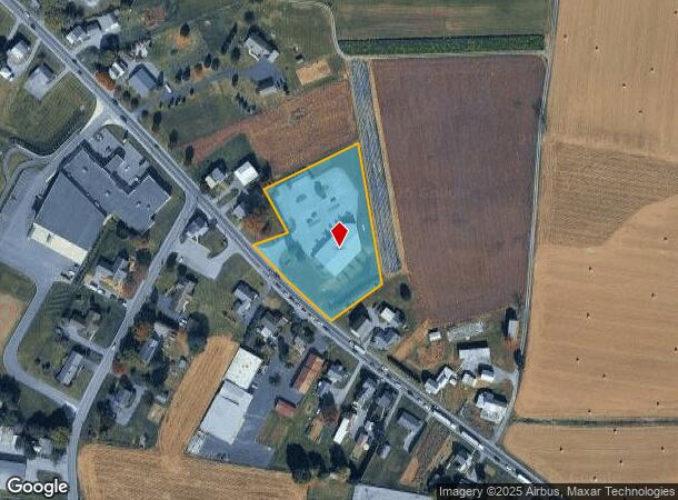
1930 Division Hwy
Lancaster, PA
Fairs Store
190-05194-0-0000
1930 DIVISION HWY
Storebuilding
Lancaster
X
Pennsylvania
42071C0213F
7
2024
2.40 AC
2025
Lancaster County
012900
Philadelphia
8,090 SF
DEMOGRAPHICS near 1930 Division Hwy
1 Mile
3 Mile
5 Mile
2024 Total Population
651
6,583
55,081
2029 Population
653
6,558
55,286
Pop Growth 2024-2029
+ 0.31%
(0.38%)
+ 0.37%
Average Age
37
39
40
2024 Total Households
201
2,096
20,650
HH Growth 2024-2029
+ 0.50%
(0.38%)
+ 0.47%
Median Household Inc
$69,677
$70,222
$69,037
Avg Household Size
3.10
2.90
2.60
2024 Avg HH Vehicles
2.00
2.00
2.00
Median Home Value
$307,895
$305,970
$235,419
Median Year Built
1967
1968
1975
Nearby Places
Map Layers
Map Styles
 Street
 Aerial
- Restaurants
- Banks
- Shops
- Fitness
- Groceries
Nearby Properties
Address
Land Use
TOTAL SIZE
Lot Size
Zoning
Address
Land Use
TOTAL SIZE
Lot Size
Zoning
198,400 SF
36.90 AC
C-2
Address
Land Use
TOTAL SIZE
Lot Size
Zoning
154,041 SF
12.78 AC
Address
Land Use
TOTAL SIZE
Lot Size
Zoning
335,767 SF
22.20 AC
I
Address
Land Use
TOTAL SIZE
Lot Size
Zoning
87,464 SF
7.30 AC
R-2
Address
Land Use
TOTAL SIZE
Lot Size
Zoning
85,104 SF
24.20 AC
Address
Land Use
TOTAL SIZE
Lot Size
Zoning
55,896 SF
3.49 AC
Address
Land Use
TOTAL SIZE
Lot Size
Zoning
36,322 SF
7.70 AC
C-2
Address
Land Use
TOTAL SIZE
Lot Size
Zoning
27,534 SF
25.40 AC
A
Address
Land Use
TOTAL SIZE
Lot Size
Zoning
44,663 SF
10.40 AC
AG
Address
Land Use
TOTAL SIZE
Lot Size
Zoning
42,438 SF
6.47 AC
I
Address
Land Use
TOTAL SIZE
Lot Size
Zoning
123,436 SF
8.90 AC
I
Address
Land Use
TOTAL SIZE
Lot Size
Zoning
58,063 SF
7.35 AC
Address
Land Use
TOTAL SIZE
Lot Size
Zoning
26,072 SF
6.35 AC
C-2
Address
Land Use
TOTAL SIZE
Lot Size
Zoning
81,950 SF
7.70 AC
I
Address
Land Use
TOTAL SIZE
Lot Size
Zoning
66,735 SF
3.50 AC
C-2
Address
Land Use
TOTAL SIZE
Lot Size
Zoning
68,412 SF
8.04 AC
C-2
Address
Land Use
TOTAL SIZE
Lot Size
Zoning
19,940 SF
2.44 AC
C2
Address
Land Use
TOTAL SIZE
Lot Size
Zoning
9,115 SF
96.60 AC
AG
Address
Land Use
TOTAL SIZE
Lot Size
Zoning
19,080 SF
12.40 AC
Address
Land Use
TOTAL SIZE
Lot Size
Zoning
55,188 SF
9.50 AC
C2
Address
Land Use
TOTAL SIZE
Lot Size
Zoning
16,063 SF
2.70 AC
C-2
Address
Land Use
TOTAL SIZE
Lot Size
Zoning
67,836 SF
5.10 AC
I
Address
Land Use
TOTAL SIZE
Lot Size
Zoning
23,005 SF
14.56 AC
A
Address
Land Use
TOTAL SIZE
Lot Size
Zoning
43,914 SF
3.40 AC
C-2
Address
Land Use
TOTAL SIZE
Lot Size
Zoning
43,866 SF
17.30 AC
A
Address
Land Use
TOTAL SIZE
Lot Size
Zoning
14,468 SF
10 AC
AG
Address
Land Use
TOTAL SIZE
Lot Size
Zoning
17,488 SF
4.70 AC
AG
Address
Land Use
TOTAL SIZE
Lot Size
Zoning
12,234 SF
14.18 AC
Address
Land Use
TOTAL SIZE
Lot Size
Zoning
11,065 SF
82.90 AC
A
Address
Land Use
TOTAL SIZE
Lot Size
Zoning
17,151 SF
16.54 AC
A
The World's #1 Commercial Real Estate Marketplace
Connect with us
© 2025 CoStar Group
The information above has been obtained from sources believed reliable. While we do not doubt its accuracy we have not verified it and make no guarantee, warranty or representation about it. It is your responsibility to independently confirm its accuracy and completeness. Any projections, opinions, assumptions, or estimates used are for example only and do not represent the current or future performance of the property. The value of this transaction to you depends on tax and other factors which should be evaluated by your tax, financial, and legal advisors. You and your advisors should conduct a careful, independent investigation of the property to determine to your satisfaction the suitability of the property for your needs.