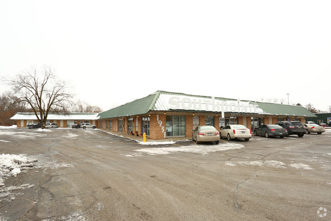
Property Record
1931 Horton Rd, Jackson, MI 49203


NEARBY LISTINGS FOR SALE OR LEASE
Property Detail
1931 Horton Rd
Jackson, MI
Ridgeway Subdivision
000-13-21-130-050-01
PARCEL 1: COMMENCING AT THE WEST 1/4 POST OF SECTION 21, TOWN 3 SOUTH, RANGE 1 WEST, THENCE NORTH 680.03 FEET ALONG THE WEST
Stripcommercialcenter
Jackson
X
Michigan
26075C0308D
8
2024
2.38 AC
2025
Jackson County
005201
West Michigan
12,726 SF
DEMOGRAPHICS near 1931 Horton Rd
1 Mile
3 Mile
5 Mile
2024 Total Population
2,641
27,708
63,010
2029 Population
2,595
27,452
62,756
Pop Growth 2024-2029
(1.74%)
(0.92%)
(0.40%)
Average Age
44
42
40
2024 Total Households
1,045
11,224
25,813
HH Growth 2024-2029
(1.82%)
(1.03%)
(0.40%)
Median Household Inc
$84,490
$59,552
$49,975
Avg Household Size
2.40
2.30
2.30
2024 Avg HH Vehicles
2.00
2.00
2.00
Median Home Value
$205,179
$157,352
$131,799
Median Year Built
1961
1956
1954
Nearby Places
Map Layers
Map Styles
 Street
 Aerial
- Restaurants
- Banks
- Shops
- Fitness
- Groceries
PUBLIC TRANSPORTATION
COMMUTER RAIL
DRIVE
WALK
Distance
10 min
5.2 mi
Freight Ports
DRIVE
WALK
Distance
104 min
76.7 mi
SALE & LEASE HISTORY
LISTING DATE
SALE/LEASE

Jan 16, 2018
For Sale
Dec 27, 2016
For Lease
Nearby Properties
Address
Land Use
TOTAL SIZE
Lot Size
Zoning
Address
Land Use
TOTAL SIZE
Lot Size
Zoning
110,011 SF
12.50 AC
Address
Land Use
TOTAL SIZE
Lot Size
Zoning
136,221 SF
8.04 AC
R-3
Address
Land Use
TOTAL SIZE
Lot Size
Zoning
136,221 SF
6.78 AC
R-3
Address
Land Use
TOTAL SIZE
Lot Size
Zoning
54,672 SF
5.93 AC
C-2
Address
Land Use
TOTAL SIZE
Lot Size
Zoning
23 AC
O-1
Address
Land Use
TOTAL SIZE
Lot Size
Zoning
45,510 SF
4.68 AC
PR1
Address
Land Use
TOTAL SIZE
Lot Size
Zoning
39,379 SF
7.34 AC
PR1
Address
Land Use
TOTAL SIZE
Lot Size
Zoning
6.60 AC
Address
Land Use
TOTAL SIZE
Lot Size
Zoning
25,852 SF
289 AC
AG1
Address
Land Use
TOTAL SIZE
Lot Size
Zoning
52,264 SF
3.53 AC
R-3
Address
Land Use
TOTAL SIZE
Lot Size
Zoning
122,698 SF
4.63 AC
I-2
Address
Land Use
TOTAL SIZE
Lot Size
Zoning
9.17 AC
RS2
Address
Land Use
TOTAL SIZE
Lot Size
Zoning
29,137 SF
1.87 AC
C-2
Address
Land Use
TOTAL SIZE
Lot Size
Zoning
34,968 SF
3.85 AC
C-1
Address
Land Use
TOTAL SIZE
Lot Size
Zoning
56,982 SF
4.55 AC
RM1
Address
Land Use
TOTAL SIZE
Lot Size
Zoning
40,170 SF
4.76 AC
C-2
Address
Land Use
TOTAL SIZE
Lot Size
Zoning
62,500 SF
10.85 AC
C-1
Address
Land Use
TOTAL SIZE
Lot Size
Zoning
24,754 SF
2.23 AC
O-1
Address
Land Use
TOTAL SIZE
Lot Size
Zoning
22,169 SF
4.97 AC
C-1
Address
Land Use
TOTAL SIZE
Lot Size
Zoning
22,135 SF
5.40 AC
PR1
Address
Land Use
TOTAL SIZE
Lot Size
Zoning
48,011 SF
5.37 AC
I-1
Address
Land Use
TOTAL SIZE
Lot Size
Zoning
3,426 SF
4.38 AC
C-2
Address
Land Use
TOTAL SIZE
Lot Size
Zoning
12,208 SF
2.75 AC
O-1
Address
Land Use
TOTAL SIZE
Lot Size
Zoning
60,188 SF
10 AC
I-1
Address
Land Use
TOTAL SIZE
Lot Size
Zoning
54,850 SF
9.10 AC
C-2
Address
Land Use
TOTAL SIZE
Lot Size
Zoning
18,890 SF
2.12 AC
O-1
Address
Land Use
TOTAL SIZE
Lot Size
Zoning
6,164 SF
2.50 AC
O-1
Address
Land Use
TOTAL SIZE
Lot Size
Zoning
10,489 SF
1.69 AC
Address
Land Use
TOTAL SIZE
Lot Size
Zoning
47,500 SF
2.29 AC
I-2
Address
Land Use
TOTAL SIZE
Lot Size
Zoning
4,900 SF
6.57 AC
O-1
The World's #1 Commercial Real Estate Marketplace
Connect with us
© 2025 CoStar Group
The information above has been obtained from sources believed reliable. While we do not doubt its accuracy we have not verified it and make no guarantee, warranty or representation about it. It is your responsibility to independently confirm its accuracy and completeness. Any projections, opinions, assumptions, or estimates used are for example only and do not represent the current or future performance of the property. The value of this transaction to you depends on tax and other factors which should be evaluated by your tax, financial, and legal advisors. You and your advisors should conduct a careful, independent investigation of the property to determine to your satisfaction the suitability of the property for your needs.