Property Record
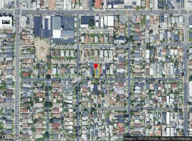
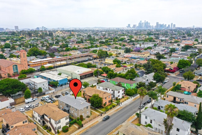
1931 W 35Th Pl, Los Angeles, CA 90018

This Property Is For Sale
NEARBY LISTINGS FOR SALE OR LEASE
Property Detail
1931 W 35Th Pl
Los Angeles-Long Beach-Glendale, CA
3110
5042-030-035
Los Angeles
Sfr
California
X
0.12 AC
06037C1614G
Leimert Park
1,794 SF
Los Angeles
DEMOGRAPHICS near 1931 W 35Th Pl
1 Mile
3 Mile
5 Mile
2024 Total Population
50,600
488,534
1,252,555
2029 Population
48,867
475,946
1,221,318
Pop Growth 2024-2029
(3.42%)
(2.58%)
(2.49%)
Average Age
40
39
39
2024 Total Households
16,141
166,911
460,843
HH Growth 2024-2029
(3.78%)
(2.83%)
(2.63%)
Median Household Inc
$65,201
$57,689
$65,930
Avg Household Size
3.00
2.70
2.60
2024 Avg HH Vehicles
2.00
1.00
1.00
Median Home Value
$855,889
$890,277
$903,462
Median Year Built
1947
1951
1957
Nearby Places
- Restaurants
- Banks
- Shops
- Fitness
- Groceries
PUBLIC TRANSPORTATION
TRANSIT/SUBWAY
Expo/Western (Expo Line - Los Angeles County Metropolitan Transportation Authority (Metro))
DRIVE
WALK
Distance
Expo/Western (Expo Line - Los Angeles County Metropolitan Transportation Authority (Metro))
2 min
15 min
0.8 mi
COMMUTER RAIL
Los Angeles (Coast Starlight - Amtrak, Pacific Surfliner - Amtrak, Southwest Chief - Amtrak, Texas Eagle - Amtrak)
DRIVE
WALK
Distance
Los Angeles (Coast Starlight - Amtrak, Pacific Surfliner - Amtrak, Southwest Chief - Amtrak, Texas Eagle - Amtrak)
12 min
6.4 mi
Union Station (91 Line - Southern California Regional Rail Authority (Metrolink), Antelope Valley Line - Southern California Regional Rail Authority (Metrolink), Orange County Line - Southern California Regional Rail Authority (Metrolink), Riverside Line - Southern California Regional Rail Authority (Metrolink), San Bernardino Line - Southern California Regional Rail Authority (Metrolink), Ventura County Line - Southern California Regional Rail Authority (Metrolink))
DRIVE
WALK
Distance
Union Station (91 Line - Southern California Regional Rail Authority (Metrolink), Antelope Valley Line - Southern California Regional Rail Authority (Metrolink), Orange County Line - Southern California Regional Rail Authority (Metrolink), Riverside Line - Southern California Regional Rail Authority (Metrolink), San Bernardino Line - Southern California Regional Rail Authority (Metrolink), Ventura County Line - Southern California Regional Rail Authority (Metrolink))
14 min
6.7 mi
AIRPORT
Los Angeles International
DRIVE
WALK
Distance
Los Angeles International
19 min
9.7 mi
Bob Hope
DRIVE
WALK
Distance
Bob Hope
27 min
15.0 mi
Long Beach (Daugherty Field)
DRIVE
WALK
Distance
Long Beach (Daugherty Field)
31 min
22.5 mi
Freight Ports
Port of Long Beach
DRIVE
WALK
Distance
Port of Long Beach
34 min
24.3 mi
Nearby Properties
Address
Land Use
TOTAL SIZE
Lot Size
Zoning
Address
Land Use
TOTAL SIZE
Lot Size
Zoning
969,516 SF
14.75 AC
Address
Land Use
TOTAL SIZE
Lot Size
Zoning
1,178,786 SF
3.89 AC
LAC2
Address
Land Use
TOTAL SIZE
Lot Size
Zoning
420,864 SF
63.07 AC
LAUSC-1A
Address
Land Use
TOTAL SIZE
Lot Size
Zoning
256,059 SF
Address
Land Use
TOTAL SIZE
Lot Size
Zoning
200,689 SF
5.79 AC
LAUSC-1A
Address
Land Use
TOTAL SIZE
Lot Size
Zoning
520,825 SF
2.13 AC
LAC2
Address
Land Use
TOTAL SIZE
Lot Size
Zoning
337,025 SF
14.59 AC
LAUSC-1A
Address
Land Use
TOTAL SIZE
Lot Size
Zoning
666,499 SF
10.63 AC
LAC2
Address
Land Use
TOTAL SIZE
Lot Size
Zoning
298,630 SF
4.64 AC
LAUSC-1B
Address
Land Use
TOTAL SIZE
Lot Size
Zoning
786,423 SF
11.74 AC
LAC2
Address
Land Use
TOTAL SIZE
Lot Size
Zoning
448,914 SF
2.67 AC
LAC2
Address
Land Use
TOTAL SIZE
Lot Size
Zoning
311,717 SF
1.45 AC
LAR5
Address
Land Use
TOTAL SIZE
Lot Size
Zoning
216,433 SF
1.38 AC
LAR5
Address
Land Use
TOTAL SIZE
Lot Size
Zoning
310,063 SF
2.22 AC
LAC2
Address
Land Use
TOTAL SIZE
Lot Size
Zoning
93,785 SF
3.95 AC
LAR5
Address
Land Use
TOTAL SIZE
Lot Size
Zoning
377,946 SF
5.03 AC
LAUSC-1A
Address
Land Use
TOTAL SIZE
Lot Size
Zoning
429,607 SF
0.79 AC
LAC2
Address
Land Use
TOTAL SIZE
Lot Size
Zoning
190,164 SF
1.18 AC
LAR4
Address
Land Use
TOTAL SIZE
Lot Size
Zoning
73,918 SF
3.86 AC
LAM1
Address
Land Use
TOTAL SIZE
Lot Size
Zoning
152,000 SF
1.04 AC
LAC2
Address
Land Use
TOTAL SIZE
Lot Size
Zoning
690,514 SF
LACM
Address
Land Use
TOTAL SIZE
Lot Size
Zoning
303,775 SF
2.27 AC
Address
Land Use
TOTAL SIZE
Lot Size
Zoning
102,877 SF
8.69 AC
LAC2
Address
Land Use
TOTAL SIZE
Lot Size
Zoning
1.05 AC
LAC4
Address
Land Use
TOTAL SIZE
Lot Size
Zoning
112,636 SF
24.20 AC
LAUSC-1A
Address
Land Use
TOTAL SIZE
Lot Size
Zoning
343,879 SF
4.26 AC
LAC2
Address
Land Use
TOTAL SIZE
Lot Size
Zoning
284,335 SF
2.01 AC
LAM1
Address
Land Use
TOTAL SIZE
Lot Size
Zoning
144,530 SF
1.36 AC
LAC4
Address
Land Use
TOTAL SIZE
Lot Size
Zoning
216,569 SF
1.08 AC
LAC2
The World's #1 Commercial Real Estate Marketplace
Connect with us
© 2025 CoStar Group
The information above has been obtained from sources believed reliable. While we do not doubt its accuracy we have not verified it and make no guarantee, warranty or representation about it. It is your responsibility to independently confirm its accuracy and completeness. Any projections, opinions, assumptions, or estimates used are for example only and do not represent the current or future performance of the property. The value of this transaction to you depends on tax and other factors which should be evaluated by your tax, financial, and legal advisors. You and your advisors should conduct a careful, independent investigation of the property to determine to your satisfaction the suitability of the property for your needs.