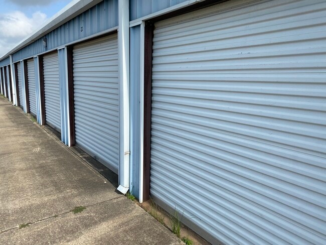
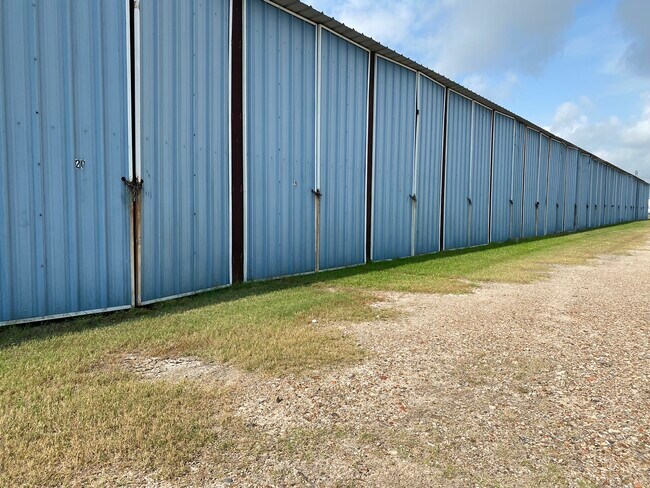
Property Record
1932 Fm 523 Rd, Freeport, TX 77541

Property Detail
1932 Fm 523 Rd
2110-0058-000
B C I C DIV 10, LOT 43-44-44A, ACRES 8.170, A0051 F J CALVIT, OYSTER CREEK
Commercialnec
BRAZORIA
0555
Texas
B and X Area of moderate flood hazard, usually the area between the limits of the 100-year and 500-year floods.
43
2024
8.17 AC
2025
South Hwy 35
664200
Houston
58,256 SF
Houston-Pasadena-The Woodlands, TX
NEARBY LISTINGS FOR SALE OR LEASE
-
-
View all Freeport listings for sale on LoopNet.com
DEMOGRAPHICS near 1932 Fm 523 Rd
1 mile
3 mile
5 mile
2025 Total Population
1,363
8,671
24,487
2030 Population
1,569
9,771
27,875
Pop Growth 2025-2030
+ 15.11%
+ 12.69%
+ 13.84%
Average Age
42
38
38
2025 Total Households
571
3,151
9,205
HH Growth 2025-2030
+ 15.41%
+ 13.17%
+ 14.68%
Median Household Inc
$44,799
$49,307
$51,970
Avg Household Size
2.40
2.70
2.60
2025 Avg HH Vehicles
2.00
2.00
2.00
Median Home Value
$208,224
$179,752
$179,960
Median Year Built
1994
1980
1978
Nearby Places
Map Layers
Map Styles
 Street
 Aerial
Layers
 Traffic
 Biking
Places
Listings with unknown addresses are not visible on the map
- Restaurants
- Banks
- Shops
- Fitness
- Groceries
SALE & LEASE HISTORY
LISTING DATE
SALE/LEASE

Jun 16, 2022
For Sale
Nearby Properties
Address
Land Use
TOTAL SIZE
Lot Size
Zoning
Address
Land Use
TOTAL SIZE
Lot Size
Zoning
Address
Land Use
TOTAL SIZE
Lot Size
Zoning
Address
Land Use
TOTAL SIZE
Lot Size
Zoning
Address
Land Use
TOTAL SIZE
Lot Size
Zoning
Address
Land Use
TOTAL SIZE
Lot Size
Zoning
Address
Land Use
TOTAL SIZE
Lot Size
Zoning
Address
Land Use
TOTAL SIZE
Lot Size
Zoning
Address
Land Use
TOTAL SIZE
Lot Size
Zoning
33.09 AC
0050
Address
Land Use
TOTAL SIZE
Lot Size
Zoning
61.70 AC
Address
Land Use
TOTAL SIZE
Lot Size
Zoning
Address
Land Use
TOTAL SIZE
Lot Size
Zoning
Address
Land Use
TOTAL SIZE
Lot Size
Zoning
Address
Land Use
TOTAL SIZE
Lot Size
Zoning
Address
Land Use
TOTAL SIZE
Lot Size
Zoning
242.03 AC
0275
Address
Land Use
TOTAL SIZE
Lot Size
Zoning
Address
Land Use
TOTAL SIZE
Lot Size
Zoning
4.27 AC
0170
Address
Land Use
TOTAL SIZE
Lot Size
Zoning
188,497 SF
14.79 AC
1135
Address
Land Use
TOTAL SIZE
Lot Size
Zoning
Address
Land Use
TOTAL SIZE
Lot Size
Zoning
75.99 AC
0410
Address
Land Use
TOTAL SIZE
Lot Size
Zoning
Address
Land Use
TOTAL SIZE
Lot Size
Zoning
Address
Land Use
TOTAL SIZE
Lot Size
Zoning
24.81 AC
0031
Address
Land Use
TOTAL SIZE
Lot Size
Zoning
48,773 SF
Address
Land Use
TOTAL SIZE
Lot Size
Zoning
1.75 AC
Address
Land Use
TOTAL SIZE
Lot Size
Zoning
Address
Land Use
TOTAL SIZE
Lot Size
Zoning
Address
Land Use
TOTAL SIZE
Lot Size
Zoning
15.78 AC
0130
Address
Land Use
TOTAL SIZE
Lot Size
Zoning
Address
Land Use
TOTAL SIZE
Lot Size
Zoning
56,600 SF
5 AC
0010
Address
Land Use
TOTAL SIZE
Lot Size
Zoning
129,934 SF
10.96 AC
0006
The World's #1 Commercial Real Estate Marketplace
Connect with us
© 2026 CoStar Group
The information above has been obtained from sources believed reliable. While we do not doubt its accuracy we have not verified it and make no guarantee, warranty or representation about it. It is your responsibility to independently confirm its accuracy and completeness. Any projections, opinions, assumptions, or estimates used are for example only and do not represent the current or future performance of the property. The value of this transaction to you depends on tax and other factors which should be evaluated by your tax, financial, and legal advisors. You and your advisors should conduct a careful, independent investigation of the property to determine to your satisfaction the suitability of the property for your needs.