Property Record
1933 Riverside Dr, Dayton, OH 45405
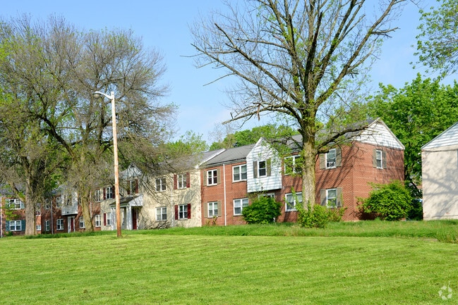

Property Detail
1933 Riverside Dr
Dayton, OH
City/Dayton Rev
R72-06111-0020
23842, 23843, 23844 & VAC ALLEY 61-11-14, 15
Apartment
Montgomery
X
Ohio
39113C0162E
13
2024
0.50 AC
2025
North Riverdale
001100
Cincinnati/Dayton
42,072 SF
NEARBY LISTINGS FOR SALE OR LEASE
DEMOGRAPHICS near 1933 Riverside Dr
1 mile
3 mile
5 mile
2024 Total Population
17,196
93,127
201,871
2029 Population
17,924
95,287
204,162
Pop Growth 2024-2029
+ 4.23%
+ 2.32%
+ 1.13%
Average Age
36
39
38
2024 Total Households
6,961
41,348
85,819
HH Growth 2024-2029
+ 4.11%
+ 2.22%
+ 1.10%
Median Household Inc
$35,548
$36,226
$39,640
Avg Household Size
2.30
2.10
2.20
2024 Avg HH Vehicles
1.00
1.00
1.00
Median Home Value
$68,436
$76,131
$86,237
Median Year Built
1947
1951
1954
Nearby Places
Map Layers
Map Styles
 Street
 Aerial
Transit
 Traffic
 Biking
Places
Listings with unknown addresses are not visible on the map
- Restaurants
- Banks
- Shops
- Fitness
- Groceries
PUBLIC TRANSPORTATION
AIRPORT
James M Cox Dayton International
Drive
Walk
Distance
James M Cox Dayton International
20 min
10.4 mi
Freight Ports
Port of Toledo
Drive
Walk
Distance
Port of Toledo
176 min
152.2 mi
SALE & LEASE HISTORY
LISTING DATE
SALE/LEASE

Aug 15, 2017
For Sale
Nearby Properties
Address
Land Use
TOTAL SIZE
Lot Size
Zoning
Address
Land Use
TOTAL SIZE
Lot Size
Zoning
1,570,433 SF
13.34 AC
Address
Land Use
TOTAL SIZE
Lot Size
Zoning
154,360 SF
19.35 AC
Address
Land Use
TOTAL SIZE
Lot Size
Zoning
127,232 SF
7.96 AC
Address
Land Use
TOTAL SIZE
Lot Size
Zoning
11.64 AC
Address
Land Use
TOTAL SIZE
Lot Size
Zoning
29,760 SF
5.13 AC
Address
Land Use
TOTAL SIZE
Lot Size
Zoning
767,771 SF
1.32 AC
Address
Land Use
TOTAL SIZE
Lot Size
Zoning
188,584 SF
2.83 AC
Address
Land Use
TOTAL SIZE
Lot Size
Zoning
1.95 AC
Address
Land Use
TOTAL SIZE
Lot Size
Zoning
5.42 AC
Address
Land Use
TOTAL SIZE
Lot Size
Zoning
22,133 SF
47.58 AC
Address
Land Use
TOTAL SIZE
Lot Size
Zoning
761,679 SF
5.09 AC
Address
Land Use
TOTAL SIZE
Lot Size
Zoning
5.92 AC
Address
Land Use
TOTAL SIZE
Lot Size
Zoning
222,197 SF
1.80 AC
Address
Land Use
TOTAL SIZE
Lot Size
Zoning
11.83 AC
Address
Land Use
TOTAL SIZE
Lot Size
Zoning
200,150 SF
1.81 AC
Address
Land Use
TOTAL SIZE
Lot Size
Zoning
3.76 AC
Address
Land Use
TOTAL SIZE
Lot Size
Zoning
255,494 SF
4.64 AC
Address
Land Use
TOTAL SIZE
Lot Size
Zoning
144,340 SF
91.38 AC
Address
Land Use
TOTAL SIZE
Lot Size
Zoning
158,144 SF
4.16 AC
Address
Land Use
TOTAL SIZE
Lot Size
Zoning
296,568 SF
3.60 AC
Address
Land Use
TOTAL SIZE
Lot Size
Zoning
268,166 SF
2.12 AC
Address
Land Use
TOTAL SIZE
Lot Size
Zoning
0.74 AC
Address
Land Use
TOTAL SIZE
Lot Size
Zoning
357,800 SF
1.22 AC
Address
Land Use
TOTAL SIZE
Lot Size
Zoning
2.67 AC
Address
Land Use
TOTAL SIZE
Lot Size
Zoning
168,648 SF
0.87 AC
Address
Land Use
TOTAL SIZE
Lot Size
Zoning
317,279 SF
0.84 AC
Address
Land Use
TOTAL SIZE
Lot Size
Zoning
170,977 SF
8.65 AC
Address
Land Use
TOTAL SIZE
Lot Size
Zoning
1.61 AC
Address
Land Use
TOTAL SIZE
Lot Size
Zoning
123,690 SF
1.57 AC
Address
Land Use
TOTAL SIZE
Lot Size
Zoning
128,246 SF
3.82 AC
The World's #1 Commercial Real Estate Marketplace
Connect with us
© 2026 CoStar Group
The information above has been obtained from sources believed reliable. While we do not doubt its accuracy we have not verified it and make no guarantee, warranty or representation about it. It is your responsibility to independently confirm its accuracy and completeness. Any projections, opinions, assumptions, or estimates used are for example only and do not represent the current or future performance of the property. The value of this transaction to you depends on tax and other factors which should be evaluated by your tax, financial, and legal advisors. You and your advisors should conduct a careful, independent investigation of the property to determine to your satisfaction the suitability of the property for your needs.