Property Record
19337 Mcdonald St, Lytle, TX 78052
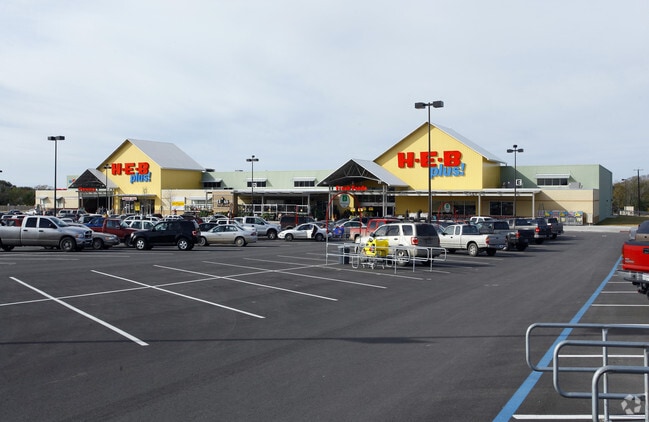

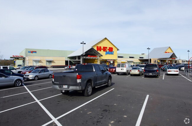
Property Detail
19337 Mcdonald St
San Antonio-New Braunfels, TX
HEB MCDONALD STREET S/D BLK 1 LOT PT OF 2 25.205
R164089
ATASCOSA
Commercialnec
Texas
AE The base floodplain where base flood elevations are provided. AE Zones are now used on new format FIRMs instead of A1-A30 Zones.
2
2025
25.21 AC
2025
Atascosa County
960203
San Antonio
112,135 SF
NEARBY LISTINGS FOR SALE OR LEASE
DEMOGRAPHICS near 19337 Mcdonald St
1 mile
3 mile
5 mile
2025 Total Population
1,585
6,056
15,055
2030 Population
1,701
6,293
15,633
Pop Growth 2025-2030
+ 7.32%
+ 3.91%
+ 3.84%
Average Age
40
39
39
2025 Total Households
564
1,977
4,826
HH Growth 2025-2030
+ 7.62%
+ 4.25%
+ 4.12%
Median Household Inc
$45,128
$62,063
$65,855
Avg Household Size
2.80
3.00
3.10
2025 Avg HH Vehicles
2.00
2.00
2.00
Median Home Value
$162,874
$191,899
$196,855
Median Year Built
1986
1988
1991
Nearby Places
Map Layers
Map Styles
 Street
 Aerial
Transit
 Traffic
 Biking
Places
Listings with unknown addresses are not visible on the map
- Restaurants
- Banks
- Shops
- Fitness
- Groceries
PUBLIC TRANSPORTATION
AIRPORT
San Antonio International
Drive
Walk
Distance
San Antonio International
40 min
31.9 mi
Freight Ports
Port of Corpus Christi
Drive
Walk
Distance
Port of Corpus Christi
164 min
153.7 mi
SALE & LEASE HISTORY
LISTING DATE
SALE/LEASE

Mar 24, 2022
For Lease
Nearby Properties
Address
Land Use
TOTAL SIZE
Lot Size
Zoning
Address
Land Use
TOTAL SIZE
Lot Size
Zoning
21,136 SF
7.58 AC
Address
Land Use
TOTAL SIZE
Lot Size
Zoning
40,658 SF
1.76 AC
Address
Land Use
TOTAL SIZE
Lot Size
Zoning
32,030 SF
4.09 AC
Address
Land Use
TOTAL SIZE
Lot Size
Zoning
868 SF
236.83 AC
Address
Land Use
TOTAL SIZE
Lot Size
Zoning
21,734 SF
2.49 AC
Address
Land Use
TOTAL SIZE
Lot Size
Zoning
38,975 SF
5.71 AC
Address
Land Use
TOTAL SIZE
Lot Size
Zoning
10,224 SF
1.42 AC
Address
Land Use
TOTAL SIZE
Lot Size
Zoning
13,418 SF
3.50 AC
Address
Land Use
TOTAL SIZE
Lot Size
Zoning
20,231 SF
1.40 AC
Address
Land Use
TOTAL SIZE
Lot Size
Zoning
28,953 SF
4.53 AC
Address
Land Use
TOTAL SIZE
Lot Size
Zoning
8,375 SF
0.72 AC
Address
Land Use
TOTAL SIZE
Lot Size
Zoning
6,783 SF
1.27 AC
Address
Land Use
TOTAL SIZE
Lot Size
Zoning
31,000 SF
7.97 AC
Address
Land Use
TOTAL SIZE
Lot Size
Zoning
4,757 SF
4.80 AC
Address
Land Use
TOTAL SIZE
Lot Size
Zoning
19,800 SF
3.12 AC
Address
Land Use
TOTAL SIZE
Lot Size
Zoning
16,250 SF
1.99 AC
Address
Land Use
TOTAL SIZE
Lot Size
Zoning
10,590 SF
2.48 AC
Address
Land Use
TOTAL SIZE
Lot Size
Zoning
2,420 SF
40.57 AC
Address
Land Use
TOTAL SIZE
Lot Size
Zoning
21,588 SF
1.10 AC
Address
Land Use
TOTAL SIZE
Lot Size
Zoning
16,491 SF
0.97 AC
Address
Land Use
TOTAL SIZE
Lot Size
Zoning
11,324 SF
3 AC
Address
Land Use
TOTAL SIZE
Lot Size
Zoning
9,970 SF
11.08 AC
Address
Land Use
TOTAL SIZE
Lot Size
Zoning
8,246 SF
1.59 AC
Address
Land Use
TOTAL SIZE
Lot Size
Zoning
56,686 SF
11.20 AC
Address
Land Use
TOTAL SIZE
Lot Size
Zoning
104.81 AC
Address
Land Use
TOTAL SIZE
Lot Size
Zoning
11,380 SF
0.52 AC
Address
Land Use
TOTAL SIZE
Lot Size
Zoning
27.64 AC
The World's #1 Commercial Real Estate Marketplace
Connect with us
© 2026 CoStar Group
The information above has been obtained from sources believed reliable. While we do not doubt its accuracy we have not verified it and make no guarantee, warranty or representation about it. It is your responsibility to independently confirm its accuracy and completeness. Any projections, opinions, assumptions, or estimates used are for example only and do not represent the current or future performance of the property. The value of this transaction to you depends on tax and other factors which should be evaluated by your tax, financial, and legal advisors. You and your advisors should conduct a careful, independent investigation of the property to determine to your satisfaction the suitability of the property for your needs.