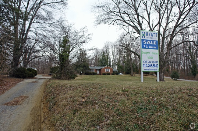
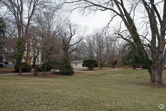
Property Record
1935 Generals Hwy, Annapolis, MD 21401


Save to a Folder
{{folder.Name}}
{{folder.ListingIds.length}} Properties
{{folder.ListingIds.length}} Property
Create a New Folder
Property Detail
1935 Generals Hwy
02-000-10672200
6.688 ACS--MERGE HOCKLEY STATION
Retirementnursinghomecombined
Anne Arundel
R1
Maryland
B and X Area of moderate flood hazard, usually the area between the limits of the 100-year and 500-year floods.
6.69 AC
2024
Annapolis
2025
Baltimore
702702
Baltimore-Columbia-Towson, MD
194,155 SF
NEARBY LISTINGS FOR SALE OR LEASE
DEMOGRAPHICS near 1935 Generals Hwy
1 mile
3 mile
5 mile
2025 Total Population
3,377
41,108
113,837
2030 Population
3,424
41,899
115,857
Pop Growth 2025-2030
+ 1.39%
+ 1.92%
+ 1.77%
Average Age
45
45
43
2025 Total Households
1,491
17,631
45,759
HH Growth 2025-2030
+ 1.01%
+ 1.83%
+ 1.79%
Median Household Inc
$115,154
$120,576
$121,186
Avg Household Size
2.10
2.20
2.40
2025 Avg HH Vehicles
2.00
2.00
2.00
Median Home Value
$735,229
$612,986
$606,581
Median Year Built
1991
1987
1981
Nearby Places
Map Layers
Map Styles
 Street
 Aerial
Layers
 Traffic
 Biking
Places
Listings with unknown addresses are not visible on the map
- Restaurants
- Banks
- Shops
- Fitness
- Groceries
PUBLIC TRANSPORTATION
AIRPORT
Baltimore/Washington International Thurgood Marshall
Drive
Walk
Distance
Baltimore/Washington International Thurgood Marshall
30 min
19.5 mi
Ronald Reagan Washington Ntl
Drive
Walk
Distance
Ronald Reagan Washington Ntl
46 min
33.9 mi
Freight Ports
Port of Baltimore
Drive
Walk
Distance
Port of Baltimore
36 min
24.7 mi
SALE & LEASE HISTORY
LISTING DATE
SALE/LEASE

Sep 24, 2016
For Sale
Nearby Properties
Address
Land Use
TOTAL SIZE
Lot Size
Zoning
Address
Land Use
TOTAL SIZE
Lot Size
Zoning
2,568,175 SF
55.32 AC
TC
Address
Land Use
TOTAL SIZE
Lot Size
Zoning
717,491 SF
26.28 AC
C2
Address
Land Use
TOTAL SIZE
Lot Size
Zoning
406,976 SF
18.98 AC
R2
Address
Land Use
TOTAL SIZE
Lot Size
Zoning
58.99 AC
R2
Address
Land Use
TOTAL SIZE
Lot Size
Zoning
296,790 SF
27.74 AC
TC
Address
Land Use
TOTAL SIZE
Lot Size
Zoning
313,440 SF
23.43 AC
TC
Address
Land Use
TOTAL SIZE
Lot Size
Zoning
441,482 SF
3.85 AC
W1
Address
Land Use
TOTAL SIZE
Lot Size
Zoning
577,560 SF
3.71 AC
C2
Address
Land Use
TOTAL SIZE
Lot Size
Zoning
346,335 SF
16.42 AC
R22
Address
Land Use
TOTAL SIZE
Lot Size
Zoning
419,712 SF
9.48 AC
R2
Address
Land Use
TOTAL SIZE
Lot Size
Zoning
389,081 SF
4.79 AC
TC
Address
Land Use
TOTAL SIZE
Lot Size
Zoning
591,962 SF
6.43 AC
BCE
Address
Land Use
TOTAL SIZE
Lot Size
Zoning
271,003 SF
1 AC
TC
Address
Land Use
TOTAL SIZE
Lot Size
Zoning
365,268 SF
4.85 AC
W1
Address
Land Use
TOTAL SIZE
Lot Size
Zoning
198,795 SF
36 AC
R2
Address
Land Use
TOTAL SIZE
Lot Size
Zoning
97,888 SF
59.42 AC
C2
Address
Land Use
TOTAL SIZE
Lot Size
Zoning
429.57 AC
OS
Address
Land Use
TOTAL SIZE
Lot Size
Zoning
341,468 SF
1.82 AC
TC
Address
Land Use
TOTAL SIZE
Lot Size
Zoning
435,081 SF
2.62 AC
TC
Address
Land Use
TOTAL SIZE
Lot Size
Zoning
315,260 SF
22.82 AC
C2
Address
Land Use
TOTAL SIZE
Lot Size
Zoning
309,756 SF
0.01 AC
R-22
Address
Land Use
TOTAL SIZE
Lot Size
Zoning
285,174 SF
24 AC
R2
Address
Land Use
TOTAL SIZE
Lot Size
Zoning
254,969 SF
13.73 AC
W1A
Address
Land Use
TOTAL SIZE
Lot Size
Zoning
73.33 AC
R2
Address
Land Use
TOTAL SIZE
Lot Size
Zoning
104,950 SF
2.93 AC
TC
Address
Land Use
TOTAL SIZE
Lot Size
Zoning
389,242 SF
11.56 AC
C2
Address
Land Use
TOTAL SIZE
Lot Size
Zoning
117,577 SF
6.92 AC
R2
Address
Land Use
TOTAL SIZE
Lot Size
Zoning
175,294 SF
13.82 AC
W1
Address
Land Use
TOTAL SIZE
Lot Size
Zoning
25,990 SF
32.06 AC
C2
The World's #1 Commercial Real Estate Marketplace
Connect with us
© 2026 CoStar Group
The information above has been obtained from sources believed reliable. While we do not doubt its accuracy we have not verified it and make no guarantee, warranty or representation about it. It is your responsibility to independently confirm its accuracy and completeness. Any projections, opinions, assumptions, or estimates used are for example only and do not represent the current or future performance of the property. The value of this transaction to you depends on tax and other factors which should be evaluated by your tax, financial, and legal advisors. You and your advisors should conduct a careful, independent investigation of the property to determine to your satisfaction the suitability of the property for your needs.