Property Record
1935 Lakeview Ave, Dracut, MA 01826

Save to a Folder
{{folder.Name}}
{{folder.ListingIds.length}} Properties
{{folder.ListingIds.length}} Property
Create a New Folder
Property Detail
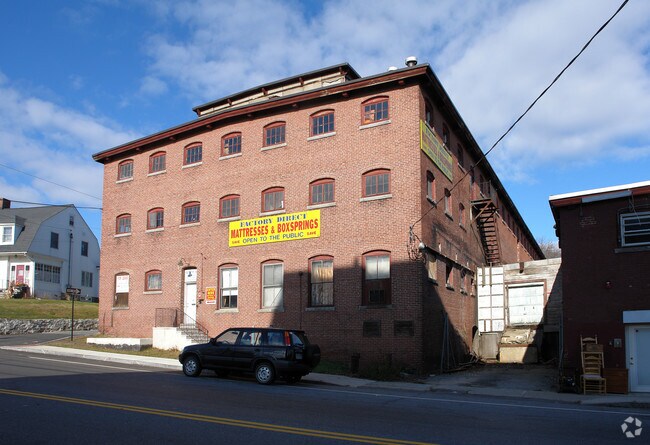
1935 Lakeview Ave
DRAC-000025-000000-000196
Middlesex
Manufacturinglight
Massachusetts
I1
194
AE The base floodplain where base flood elevations are provided. AE Zones are now used on new format FIRMs instead of A1-A30 Zones.
0.38 AC
2025
Groton/Townsend
2025
Boston
314102
Boston-Cambridge-Newton, MA-NH
9,139 SF
NEARBY LISTINGS FOR SALE OR LEASE
-
-
View all Dracut listings for sale on LoopNet.com
DEMOGRAPHICS near 1935 Lakeview Ave
1 mile
3 mile
5 mile
2025 Total Population
8,795
66,331
180,163
2030 Population
9,104
68,327
185,800
Pop Growth 2025-2030
+ 3.51%
+ 3.01%
+ 3.13%
Average Age
42
40
40
2025 Total Households
3,219
23,522
65,456
HH Growth 2025-2030
+ 3.67%
+ 3.12%
+ 3.31%
Median Household Inc
$107,710
$92,073
$93,662
Avg Household Size
2.70
2.60
2.60
2025 Avg HH Vehicles
2.00
2.00
2.00
Median Home Value
$450,554
$460,569
$477,751
Median Year Built
1978
1970
1965
Nearby Places
Map Layers
Map Styles
 Street
 Aerial
Layers
 Traffic
 Biking
Places
Listings with unknown addresses are not visible on the map
- Restaurants
- Banks
- Shops
- Fitness
- Groceries
PUBLIC TRANSPORTATION
COMMUTER RAIL
Lowell (Lowell Line - Massachusetts Bay Transportation Authority Commuter Rail (Purple Line))
Drive
Walk
Distance
Lowell (Lowell Line - Massachusetts Bay Transportation Authority Commuter Rail (Purple Line))
9 min
4.4 mi
North Billerica (Lowell Line - Massachusetts Bay Transportation Authority Commuter Rail (Purple Line))
Drive
Walk
Distance
North Billerica (Lowell Line - Massachusetts Bay Transportation Authority Commuter Rail (Purple Line))
18 min
8.7 mi
AIRPORT
Manchester Boston Regional
Drive
Walk
Distance
Manchester Boston Regional
40 min
25.1 mi
General Edward Lawrence Logan International
Drive
Walk
Distance
General Edward Lawrence Logan International
53 min
34.1 mi
Freight Ports
Port of Boston
Drive
Walk
Distance
Port of Boston
54 min
33.9 mi
Nearby Properties
Address
Land Use
TOTAL SIZE
Lot Size
Zoning
Address
Land Use
TOTAL SIZE
Lot Size
Zoning
9.73 AC
INST
Address
Land Use
TOTAL SIZE
Lot Size
Zoning
70.20 AC
R3
Address
Land Use
TOTAL SIZE
Lot Size
Zoning
30,744 SF
31.28 AC
INST
Address
Land Use
TOTAL SIZE
Lot Size
Zoning
23,251 SF
18.20 AC
SMF
Address
Land Use
TOTAL SIZE
Lot Size
Zoning
803 SF
3.29 AC
R1
Address
Land Use
TOTAL SIZE
Lot Size
Zoning
2.15 AC
INST
Address
Land Use
TOTAL SIZE
Lot Size
Zoning
59.09 AC
SSF
Address
Land Use
TOTAL SIZE
Lot Size
Zoning
68.15 AC
R1
Address
Land Use
TOTAL SIZE
Lot Size
Zoning
10.48 AC
INST
Address
Land Use
TOTAL SIZE
Lot Size
Zoning
2.62 AC
INST
Address
Land Use
TOTAL SIZE
Lot Size
Zoning
7.25 AC
INST
Address
Land Use
TOTAL SIZE
Lot Size
Zoning
167,201 SF
6.31 AC
DMU
Address
Land Use
TOTAL SIZE
Lot Size
Zoning
20.88 AC
TSF
Address
Land Use
TOTAL SIZE
Lot Size
Zoning
33.01 AC
R3
Address
Land Use
TOTAL SIZE
Lot Size
Zoning
8,528 SF
4.59 AC
UMF
Address
Land Use
TOTAL SIZE
Lot Size
Zoning
119,372 SF
1.74 AC
INST
Address
Land Use
TOTAL SIZE
Lot Size
Zoning
3.59 AC
UMF
Address
Land Use
TOTAL SIZE
Lot Size
Zoning
73,965 SF
1.33 AC
TTF
Address
Land Use
TOTAL SIZE
Lot Size
Zoning
3,822 SF
1.88 AC
INST
Address
Land Use
TOTAL SIZE
Lot Size
Zoning
70,004 SF
9.32 AC
UMF
Address
Land Use
TOTAL SIZE
Lot Size
Zoning
142,490 SF
0.80 AC
INST
Address
Land Use
TOTAL SIZE
Lot Size
Zoning
110,384 SF
0.96 AC
UMU
Address
Land Use
TOTAL SIZE
Lot Size
Zoning
73,034 SF
2.30 AC
TMF
Address
Land Use
TOTAL SIZE
Lot Size
Zoning
134,300 SF
5.58 AC
INST
Address
Land Use
TOTAL SIZE
Lot Size
Zoning
106,077 SF
1.80 AC
TSF
Address
Land Use
TOTAL SIZE
Lot Size
Zoning
76 AC
R
Address
Land Use
TOTAL SIZE
Lot Size
Zoning
8.45 AC
RR
Address
Land Use
TOTAL SIZE
Lot Size
Zoning
83,300 SF
2.31 AC
UMF
Address
Land Use
TOTAL SIZE
Lot Size
Zoning
53,811 SF
4.51 AC
TMUOTHR
Address
Land Use
TOTAL SIZE
Lot Size
Zoning
91,202 SF
12.65 AC
SMU
The World's #1 Commercial Real Estate Marketplace
Connect with us
© 2026 CoStar Group
The information above has been obtained from sources believed reliable. While we do not doubt its accuracy we have not verified it and make no guarantee, warranty or representation about it. It is your responsibility to independently confirm its accuracy and completeness. Any projections, opinions, assumptions, or estimates used are for example only and do not represent the current or future performance of the property. The value of this transaction to you depends on tax and other factors which should be evaluated by your tax, financial, and legal advisors. You and your advisors should conduct a careful, independent investigation of the property to determine to your satisfaction the suitability of the property for your needs.