Property Record
1935 N Pontiac Trl, Walled Lake, MI 48390


NEARBY LISTINGS FOR SALE OR LEASE
Property Detail
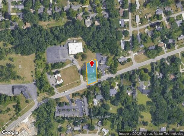
1935 N Pontiac Trl
17-26-251-018
T2N, R8E, SEC 26 PART OF SW 1/4 OF NE 1/4 BEG AT PT DIST N 01-05-12 E 372 FT & S 88-24-30 E 570 FT & S 01-05-30 W 2.29 FT & N 69-11-06 E 228.91 FT & N 73-12-20 E 277 FT FROM CENTER OF SEC, TH N 73-12-20 E 100.74 FT, TH S 00-27-50 W 209.43 FT, TH S 73
Dentalbldg
Oakland
X
Michigan
26125C0487F
0.47 AC
2024
Central I-96 Corridor
2024
Detroit
134700
Detroit-Warren-Dearborn, MI
2,768 SF
DEMOGRAPHICS near 1935 N Pontiac Trl
1 Mile
3 Mile
5 Mile
2024 Total Population
6,496
63,980
143,492
2029 Population
6,408
63,541
141,877
Pop Growth 2024-2029
(1.35%)
(0.69%)
(1.13%)
Average Age
45
44
43
2024 Total Households
2,921
27,833
59,329
HH Growth 2024-2029
(1.37%)
(0.64%)
(1.19%)
Median Household Inc
$72,479
$84,367
$93,564
Avg Household Size
2.20
2.30
2.40
2024 Avg HH Vehicles
2.00
2.00
2.00
Median Home Value
$260,295
$316,662
$337,272
Median Year Built
1982
1990
1987
Nearby Places
Map Layers
Map Styles
 Street
 Aerial
- Restaurants
- Banks
- Shops
- Fitness
- Groceries
PUBLIC TRANSPORTATION
AIRPORT
Detroit Metro Wayne County
DRIVE
WALK
Distance
Detroit Metro Wayne County
43 min
32.0 mi
Bishop International
DRIVE
WALK
Distance
Bishop International
65 min
41.0 mi
Windsor International
DRIVE
WALK
Distance
Windsor International
65 min
42.2 mi
SALE & LEASE HISTORY
LISTING DATE
SALE/LEASE

May 17, 2017
For Sale
Nearby Properties
Address
Land Use
TOTAL SIZE
Lot Size
Zoning
Address
Land Use
TOTAL SIZE
Lot Size
Zoning
162,600 SF
102.81 AC
RM-1
Address
Land Use
TOTAL SIZE
Lot Size
Zoning
614,079 SF
57.44 AC
Address
Land Use
TOTAL SIZE
Lot Size
Zoning
72.63 AC
RM-1
Address
Land Use
TOTAL SIZE
Lot Size
Zoning
659,897 SF
53.96 AC
AI
Address
Land Use
TOTAL SIZE
Lot Size
Zoning
400,505 SF
26.50 AC
Address
Land Use
TOTAL SIZE
Lot Size
Zoning
59.71 AC
RM-1
Address
Land Use
TOTAL SIZE
Lot Size
Zoning
17,277 SF
17.73 AC
R-A
Address
Land Use
TOTAL SIZE
Lot Size
Zoning
427,062 SF
31.20 AC
AI
Address
Land Use
TOTAL SIZE
Lot Size
Zoning
274,645 SF
39.27 AC
AI
Address
Land Use
TOTAL SIZE
Lot Size
Zoning
Address
Land Use
TOTAL SIZE
Lot Size
Zoning
367,354 SF
62.73 AC
AI
Address
Land Use
TOTAL SIZE
Lot Size
Zoning
188,643 SF
12.81 AC
IV
Address
Land Use
TOTAL SIZE
Lot Size
Zoning
269,975 SF
23.88 AC
AI
Address
Land Use
TOTAL SIZE
Lot Size
Zoning
287,023 SF
22.20 AC
Address
Land Use
TOTAL SIZE
Lot Size
Zoning
249,084 SF
19.65 AC
AI
Address
Land Use
TOTAL SIZE
Lot Size
Zoning
115,400 SF
9.38 AC
BI
Address
Land Use
TOTAL SIZE
Lot Size
Zoning
19.26 AC
R-A
Address
Land Use
TOTAL SIZE
Lot Size
Zoning
2,073 SF
116.28 AC
MH
Address
Land Use
TOTAL SIZE
Lot Size
Zoning
260,330 SF
21.04 AC
AI
Address
Land Use
TOTAL SIZE
Lot Size
Zoning
7,646 SF
24.55 AC
RM1
Address
Land Use
TOTAL SIZE
Lot Size
Zoning
244,500 SF
7.80 AC
AI
Address
Land Use
TOTAL SIZE
Lot Size
Zoning
222,664 SF
21.10 AC
BI
Address
Land Use
TOTAL SIZE
Lot Size
Zoning
Address
Land Use
TOTAL SIZE
Lot Size
Zoning
147,714 SF
13.54 AC
OST
Address
Land Use
TOTAL SIZE
Lot Size
Zoning
196,222 SF
Address
Land Use
TOTAL SIZE
Lot Size
Zoning
227,946 SF
20.96 AC
AI
Address
Land Use
TOTAL SIZE
Lot Size
Zoning
22.93 AC
RM-1
Address
Land Use
TOTAL SIZE
Lot Size
Zoning
26.54 AC
RM-1
Address
Land Use
TOTAL SIZE
Lot Size
Zoning
Address
Land Use
TOTAL SIZE
Lot Size
Zoning
164,969 SF
21.37 AC
AI
The World's #1 Commercial Real Estate Marketplace
Connect with us
© 2025 CoStar Group
The information above has been obtained from sources believed reliable. While we do not doubt its accuracy we have not verified it and make no guarantee, warranty or representation about it. It is your responsibility to independently confirm its accuracy and completeness. Any projections, opinions, assumptions, or estimates used are for example only and do not represent the current or future performance of the property. The value of this transaction to you depends on tax and other factors which should be evaluated by your tax, financial, and legal advisors. You and your advisors should conduct a careful, independent investigation of the property to determine to your satisfaction the suitability of the property for your needs.