Property Record
1935 W Baseline Rd, Phoenix, AZ 85041

Property Detail
1935 W Baseline Rd
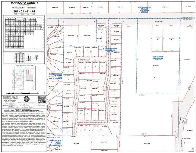
300-17-773A
1919 BASELINE MCR 1313-50
Publicstorage
MARICOPA
C2
Arizona
C and X Area of minimal flood hazard, usually depicted on FIRMs as above the 500-year flood level.
1
2025
6.45 AC
2025
Southwest Phoenix
116617
Phoenix
120,685 SF
Phoenix-Mesa-Chandler, AZ
NEARBY LISTINGS FOR SALE OR LEASE
DEMOGRAPHICS near 1935 W Baseline Rd
1 mile
3 mile
5 mile
2025 Total Population
11,637
100,497
193,166
2030 Population
12,081
105,331
202,569
Pop Growth 2025-2030
+ 3.82%
+ 4.81%
+ 4.87%
Average Age
35
35
35
2025 Total Households
3,404
29,029
57,165
HH Growth 2025-2030
+ 3.88%
+ 4.89%
+ 4.89%
Median Household Inc
$80,440
$75,945
$76,992
Avg Household Size
3.30
3.30
3.20
2025 Avg HH Vehicles
2.00
2.00
2.00
Median Home Value
$406,212
$392,639
$408,122
Median Year Built
2004
2001
2001
Nearby Places
Map Layers
Map Styles
 Street
 Aerial
Layers
 Traffic
 Biking
Places
Listings with unknown addresses are not visible on the map
- Restaurants
- Banks
- Shops
- Fitness
- Groceries
PUBLIC TRANSPORTATION
AIRPORT
Phoenix Sky Harbor International
Drive
Walk
Distance
Phoenix Sky Harbor International
20 min
10.4 mi
Phoenix-Mesa Gateway
Drive
Walk
Distance
Phoenix-Mesa Gateway
47 min
31.1 mi
Freight Ports
Port of San Diego
Drive
Walk
Distance
Port of San Diego
403 min
359.1 mi
Nearby Properties
Address
Land Use
TOTAL SIZE
Lot Size
Zoning
Address
Land Use
TOTAL SIZE
Lot Size
Zoning
47,597 SF
22.74 AC
R-43
Address
Land Use
TOTAL SIZE
Lot Size
Zoning
367,953 SF
38.18 AC
R-43AG
Address
Land Use
TOTAL SIZE
Lot Size
Zoning
10 SF
644.14 AC
R-35
Address
Land Use
TOTAL SIZE
Lot Size
Zoning
369,723 SF
19.41 AC
R3
Address
Land Use
TOTAL SIZE
Lot Size
Zoning
398,815 SF
12.72 AC
C2
Address
Land Use
TOTAL SIZE
Lot Size
Zoning
6.55 AC
C-G
Address
Land Use
TOTAL SIZE
Lot Size
Zoning
70,951 SF
336.40 AC
R-43AG
Address
Land Use
TOTAL SIZE
Lot Size
Zoning
205,550 SF
27.37 AC
R-6
Address
Land Use
TOTAL SIZE
Lot Size
Zoning
70,152 SF
180.34 AC
RE35
Address
Land Use
TOTAL SIZE
Lot Size
Zoning
91,949 SF
19.14 AC
R-43
Address
Land Use
TOTAL SIZE
Lot Size
Zoning
416,645 SF
18.80 AC
M-H
Address
Land Use
TOTAL SIZE
Lot Size
Zoning
219,555 SF
21.25 AC
C2
Address
Land Use
TOTAL SIZE
Lot Size
Zoning
91,063 SF
12 AC
R-43AG
Address
Land Use
TOTAL SIZE
Lot Size
Zoning
186,437 SF
17.85 AC
PAD-HD
Address
Land Use
TOTAL SIZE
Lot Size
Zoning
103,111 SF
12.13 AC
R-43
Address
Land Use
TOTAL SIZE
Lot Size
Zoning
139,410 SF
14.41 AC
C-C
Address
Land Use
TOTAL SIZE
Lot Size
Zoning
118,842 SF
5.10 AC
R3
Address
Land Use
TOTAL SIZE
Lot Size
Zoning
92,917 SF
14.54 AC
Address
Land Use
TOTAL SIZE
Lot Size
Zoning
8,880 SF
1.99 AC
I-2
Address
Land Use
TOTAL SIZE
Lot Size
Zoning
58,603 SF
12.15 AC
R-43AG
Address
Land Use
TOTAL SIZE
Lot Size
Zoning
64,031 SF
14.68 AC
R-43AG
Address
Land Use
TOTAL SIZE
Lot Size
Zoning
63,002 SF
11.61 AC
R-6
Address
Land Use
TOTAL SIZE
Lot Size
Zoning
78,576 SF
8.69 AC
R-10
Address
Land Use
TOTAL SIZE
Lot Size
Zoning
8,029 SF
2.19 AC
R-4
Address
Land Use
TOTAL SIZE
Lot Size
Zoning
55,493 SF
8.01 AC
R-6
Address
Land Use
TOTAL SIZE
Lot Size
Zoning
75,877 SF
7.91 AC
R-43AG
Address
Land Use
TOTAL SIZE
Lot Size
Zoning
75,757 SF
5.28 AC
R-10
Address
Land Use
TOTAL SIZE
Lot Size
Zoning
52,948 SF
7.98 AC
R-43AG
Address
Land Use
TOTAL SIZE
Lot Size
Zoning
76,254 SF
8.71 AC
C-C
Address
Land Use
TOTAL SIZE
Lot Size
Zoning
71,722 SF
8.77 AC
C-N
The World's #1 Commercial Real Estate Marketplace
Connect with us
© 2026 CoStar Group
The information above has been obtained from sources believed reliable. While we do not doubt its accuracy we have not verified it and make no guarantee, warranty or representation about it. It is your responsibility to independently confirm its accuracy and completeness. Any projections, opinions, assumptions, or estimates used are for example only and do not represent the current or future performance of the property. The value of this transaction to you depends on tax and other factors which should be evaluated by your tax, financial, and legal advisors. You and your advisors should conduct a careful, independent investigation of the property to determine to your satisfaction the suitability of the property for your needs.