Property Record
1935 Wright St, Sacramento, CA 95825
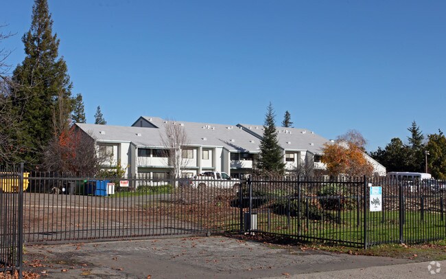
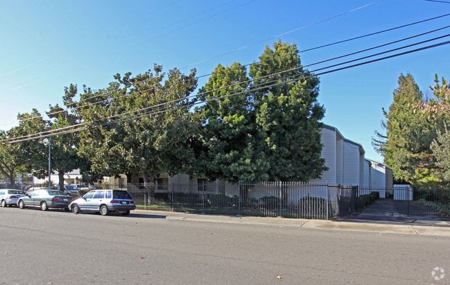

Property Detail
1935 Wright St
Sacramento-Roseville-Folsom, CA
PARCEL MAP, LOT A
278-0202-020
Sacramento
Apartment
California
RD-40
a
2024
2.29 AC
2025
Outer Arden-Arcade
005505
Sacramento
78,145 SF
NEARBY LISTINGS FOR SALE OR LEASE
DEMOGRAPHICS near 1935 Wright St
1 mile
3 mile
5 mile
2025 Total Population
24,413
146,206
391,884
2030 Population
24,773
148,108
397,561
Pop Growth 2025-2030
+ 1.47%
+ 1.30%
+ 1.45%
Average Age
36
39
39
2025 Total Households
9,453
58,560
154,196
HH Growth 2025-2030
+ 1.49%
+ 1.32%
+ 1.58%
Median Household Inc
$64,366
$74,082
$78,045
Avg Household Size
2.50
2.40
2.40
2025 Avg HH Vehicles
2.00
2.00
2.00
Median Home Value
$434,931
$557,012
$513,460
Median Year Built
1969
1964
1969
Nearby Places
Map Layers
Map Styles
 Street
 Aerial
Transit
 Traffic
 Biking
Places
Listings with unknown addresses are not visible on the map
- Restaurants
- Banks
- Shops
- Fitness
- Groceries
PUBLIC TRANSPORTATION
COMMUTER RAIL
Sacramento (Capitol Corridor - Capitol Corridor Joint Powers Authority)
Drive
Walk
Distance
Sacramento (Capitol Corridor - Capitol Corridor Joint Powers Authority)
11 min
6.5 mi
AIRPORT
Sacramento International
Drive
Walk
Distance
Sacramento International
23 min
14.9 mi
Freight Ports
Port of Stockton
Drive
Walk
Distance
Port of Stockton
63 min
53.2 mi
Nearby Properties
Address
Land Use
TOTAL SIZE
Lot Size
Zoning
Address
Land Use
TOTAL SIZE
Lot Size
Zoning
201,132 SF
28.11 AC
C-2
Address
Land Use
TOTAL SIZE
Lot Size
Zoning
490,607 SF
32.63 AC
RD-30
Address
Land Use
TOTAL SIZE
Lot Size
Zoning
2.87 AC
C-2
Address
Land Use
TOTAL SIZE
Lot Size
Zoning
10.49 AC
C-2
Address
Land Use
TOTAL SIZE
Lot Size
Zoning
319,856 SF
12.27 AC
R-3-R-PUD
Address
Land Use
TOTAL SIZE
Lot Size
Zoning
226,731 SF
15.73 AC
OB-PUD
Address
Land Use
TOTAL SIZE
Lot Size
Zoning
390,860 SF
20.17 AC
R-3-R-PUD
Address
Land Use
TOTAL SIZE
Lot Size
Zoning
179,178 SF
3.35 AC
RO
Address
Land Use
TOTAL SIZE
Lot Size
Zoning
148,642 SF
7.15 AC
RD-30
Address
Land Use
TOTAL SIZE
Lot Size
Zoning
335,346 SF
16.65 AC
SC-R-PUD
Address
Land Use
TOTAL SIZE
Lot Size
Zoning
420,421 SF
25.39 AC
BP
Address
Land Use
TOTAL SIZE
Lot Size
Zoning
190,723 SF
9.10 AC
RD-30
Address
Land Use
TOTAL SIZE
Lot Size
Zoning
156,649 SF
6.14 AC
LC
Address
Land Use
TOTAL SIZE
Lot Size
Zoning
1,281 SF
0.42 AC
RD-20
Address
Land Use
TOTAL SIZE
Lot Size
Zoning
74,008 SF
6.78 AC
H-PC
Address
Land Use
TOTAL SIZE
Lot Size
Zoning
82,936 SF
7.66 AC
SC-PUD
Address
Land Use
TOTAL SIZE
Lot Size
Zoning
136,152 SF
13.40 AC
AC LC
Address
Land Use
TOTAL SIZE
Lot Size
Zoning
168,560 SF
8.95 AC
RD-30
Address
Land Use
TOTAL SIZE
Lot Size
Zoning
152,000 SF
12.88 AC
SPA
Address
Land Use
TOTAL SIZE
Lot Size
Zoning
137,520 SF
10.37 AC
BP (PC)(PD
Address
Land Use
TOTAL SIZE
Lot Size
Zoning
81,504 SF
7.06 AC
LC (PC) RD
Address
Land Use
TOTAL SIZE
Lot Size
Zoning
387,136 SF
8.85 AC
RD-30
Address
Land Use
TOTAL SIZE
Lot Size
Zoning
168,846 SF
7.58 AC
RD-30 (PC)
Address
Land Use
TOTAL SIZE
Lot Size
Zoning
137,255 SF
6.32 AC
RD-30
Address
Land Use
TOTAL SIZE
Lot Size
Zoning
417,214 SF
23.66 AC
SPA
Address
Land Use
TOTAL SIZE
Lot Size
Zoning
119,824 SF
7.64 AC
RD-30 (PC)
Address
Land Use
TOTAL SIZE
Lot Size
Zoning
4.49 AC
C-4-R
Address
Land Use
TOTAL SIZE
Lot Size
Zoning
278,877 SF
13.17 AC
RD-30
Address
Land Use
TOTAL SIZE
Lot Size
Zoning
99,491 SF
3.65 AC
C-2
Address
Land Use
TOTAL SIZE
Lot Size
Zoning
4.35 AC
C-2
The World's #1 Commercial Real Estate Marketplace
Connect with us
© 2026 CoStar Group
The information above has been obtained from sources believed reliable. While we do not doubt its accuracy we have not verified it and make no guarantee, warranty or representation about it. It is your responsibility to independently confirm its accuracy and completeness. Any projections, opinions, assumptions, or estimates used are for example only and do not represent the current or future performance of the property. The value of this transaction to you depends on tax and other factors which should be evaluated by your tax, financial, and legal advisors. You and your advisors should conduct a careful, independent investigation of the property to determine to your satisfaction the suitability of the property for your needs.