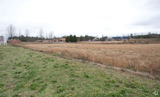
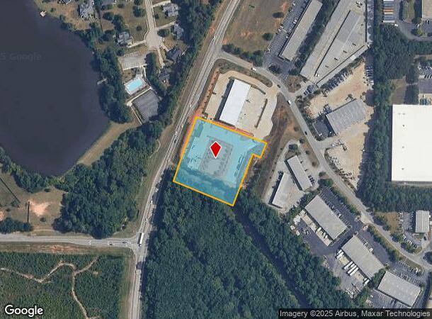
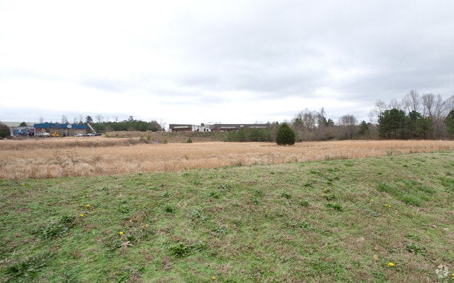
Property Record
1937 Highway 155 Rd S, Mcdonough, GA 30253

NEARBY LISTINGS FOR SALE OR LEASE
Property Detail
1937 Highway 155 Rd S
Atlanta-Sandy Springs-Roswell, GA
Meredith Pk Bus Cntr
096A-01-021-000
LLOT: 243 LDIST:2 LOT:21 UNIT:1
Multitenantindustrial
Henry
A
Georgia
13151C0170D
21
2025
2.32 AC
2025
South Clayton/Henry Cnty
070318
Atlanta
128,000 SF
DEMOGRAPHICS near 1937 Highway 155 Rd S
1 Mile
3 Mile
5 Mile
2024 Total Population
3,113
22,932
62,756
2029 Population
3,431
25,398
69,056
Pop Growth 2024-2029
+ 10.22%
+ 10.75%
+ 10.04%
Average Age
36
36
36
2024 Total Households
1,034
7,927
22,249
HH Growth 2024-2029
+ 10.44%
+ 10.99%
+ 10.18%
Median Household Inc
$72,362
$79,552
$69,532
Avg Household Size
3.00
2.80
2.80
2024 Avg HH Vehicles
2.00
2.00
2.00
Median Home Value
$215,934
$241,225
$223,217
Median Year Built
2006
2006
2004
Nearby Places
Map Layers
Map Styles
 Street
 Aerial
- Restaurants
- Banks
- Shops
- Fitness
- Groceries
PUBLIC TRANSPORTATION
AIRPORT
Hartsfield - Jackson Atlanta International
DRIVE
WALK
Distance
Hartsfield - Jackson Atlanta International
36 min
27.2 mi
SALE & LEASE HISTORY
LISTING DATE
SALE/LEASE

Sep 24, 2016
For Sale
Jun 05, 2019
For Sale
Nearby Properties
Address
Land Use
TOTAL SIZE
Lot Size
Zoning
Address
Land Use
TOTAL SIZE
Lot Size
Zoning
5,174,944 SF
107.34 AC
M1
Address
Land Use
TOTAL SIZE
Lot Size
Zoning
33,565 SF
44.68 AC
Address
Land Use
TOTAL SIZE
Lot Size
Zoning
2,016,606 SF
61.08 AC
M
Address
Land Use
TOTAL SIZE
Lot Size
Zoning
1,079,756 SF
92.38 AC
M1
Address
Land Use
TOTAL SIZE
Lot Size
Zoning
1,010,600 SF
78.40 AC
M1
Address
Land Use
TOTAL SIZE
Lot Size
Zoning
1,126,973 SF
88.82 AC
M1
Address
Land Use
TOTAL SIZE
Lot Size
Zoning
1,226,687 SF
100.81 AC
M2
Address
Land Use
TOTAL SIZE
Lot Size
Zoning
24,633 SF
39.67 AC
RM
Address
Land Use
TOTAL SIZE
Lot Size
Zoning
1,038,514 SF
141.54 AC
M1
Address
Land Use
TOTAL SIZE
Lot Size
Zoning
16,635 SF
24 AC
RM
Address
Land Use
TOTAL SIZE
Lot Size
Zoning
247,544 SF
43.30 AC
Address
Land Use
TOTAL SIZE
Lot Size
Zoning
2,337,242 SF
71.11 AC
M2
Address
Land Use
TOTAL SIZE
Lot Size
Zoning
4,307,236 SF
66.85 AC
M1
Address
Land Use
TOTAL SIZE
Lot Size
Zoning
7,005,327 SF
56.89 AC
M1
Address
Land Use
TOTAL SIZE
Lot Size
Zoning
1,588,692 SF
44.95 AC
M1
Address
Land Use
TOTAL SIZE
Lot Size
Zoning
415,997 SF
41.35 AC
Address
Land Use
TOTAL SIZE
Lot Size
Zoning
6,344 SF
21.40 AC
C1
Address
Land Use
TOTAL SIZE
Lot Size
Zoning
18,084 SF
59.72 AC
M1
Address
Land Use
TOTAL SIZE
Lot Size
Zoning
22,633 SF
31 AC
RM
Address
Land Use
TOTAL SIZE
Lot Size
Zoning
4,982 SF
34.62 AC
RM
Address
Land Use
TOTAL SIZE
Lot Size
Zoning
4,237,908 SF
44.42 AC
M
Address
Land Use
TOTAL SIZE
Lot Size
Zoning
21,308 SF
14.22 AC
M1
Address
Land Use
TOTAL SIZE
Lot Size
Zoning
676,000 SF
40.84 AC
M
Address
Land Use
TOTAL SIZE
Lot Size
Zoning
4,536,950 SF
47.66 AC
C1
Address
Land Use
TOTAL SIZE
Lot Size
Zoning
5,681,569 SF
37.80 AC
M1
Address
Land Use
TOTAL SIZE
Lot Size
Zoning
2,877,520 SF
53.73 AC
C2
Address
Land Use
TOTAL SIZE
Lot Size
Zoning
6,101,324 SF
42.27 AC
M1
Address
Land Use
TOTAL SIZE
Lot Size
Zoning
297,736 SF
57.04 AC
M
Address
Land Use
TOTAL SIZE
Lot Size
Zoning
532,585 SF
67.79 AC
M2
Address
Land Use
TOTAL SIZE
Lot Size
Zoning
1,871,190 SF
46.24 AC
M1
The World's #1 Commercial Real Estate Marketplace
Connect with us
© 2026 CoStar Group
The information above has been obtained from sources believed reliable. While we do not doubt its accuracy we have not verified it and make no guarantee, warranty or representation about it. It is your responsibility to independently confirm its accuracy and completeness. Any projections, opinions, assumptions, or estimates used are for example only and do not represent the current or future performance of the property. The value of this transaction to you depends on tax and other factors which should be evaluated by your tax, financial, and legal advisors. You and your advisors should conduct a careful, independent investigation of the property to determine to your satisfaction the suitability of the property for your needs.