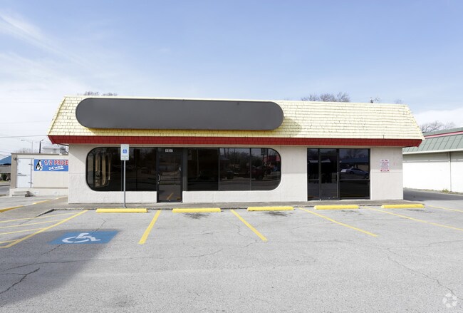
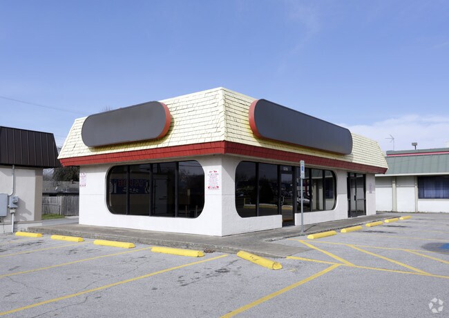
Property Record
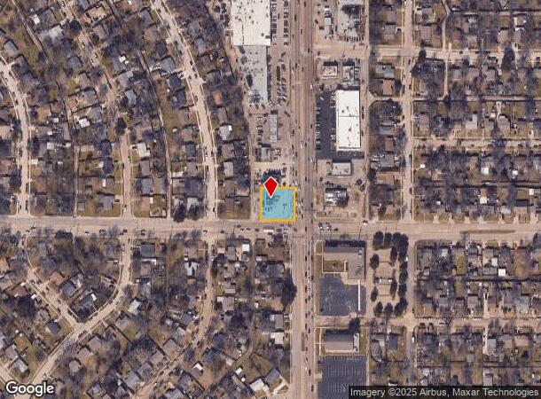
1937 S 1St St, Garland, TX 75040
NEARBY LISTINGS FOR SALE OR LEASE
Property Detail
1937 S 1St St
Dallas-Fort Worth-Arlington, TX
Cresthaven 1
26112500070230000
CRESTHAVEN 1 BLK 7 LOT 23 & S 44.5 LOT 24 LESS 112.47 SF 15836.53 SF INT201400096153 DD10252004 CO-DC 1125000702300 2CG11250007
Storebuilding
Dallas
X
Texas
48113C0220L
23,24
2024
0.36 AC
2025
Garland
018700
Dallas/Ft Worth
1,520 SF
DEMOGRAPHICS near 1937 S 1St St
1 Mile
3 Mile
5 Mile
2024 Total Population
20,811
112,313
323,341
2029 Population
20,532
110,734
318,962
Pop Growth 2024-2029
(1.34%)
(1.41%)
(1.35%)
Average Age
34
37
37
2024 Total Households
5,792
34,649
109,194
HH Growth 2024-2029
(1.54%)
(1.62%)
(1.55%)
Median Household Inc
$53,553
$62,122
$62,939
Avg Household Size
3.50
3.10
2.90
2024 Avg HH Vehicles
2.00
2.00
2.00
Median Home Value
$164,596
$198,777
$231,358
Median Year Built
1961
1971
1976
Nearby Places
Map Layers
Map Styles
 Street
 Aerial
- Restaurants
- Banks
- Shops
- Fitness
- Groceries
PUBLIC TRANSPORTATION
AIRPORT
Dallas Love Field
DRIVE
WALK
Distance
Dallas Love Field
30 min
15.9 mi
Dallas-Fort Worth International
DRIVE
WALK
Distance
Dallas-Fort Worth International
39 min
31.4 mi
Freight Ports
Port of Shreveport
DRIVE
WALK
Distance
Port of Shreveport
210 min
191.8 mi
Nearby Properties
Address
Land Use
TOTAL SIZE
Lot Size
Zoning
Address
Land Use
TOTAL SIZE
Lot Size
Zoning
351,901 SF
11.84 AC
Z239
Address
Land Use
TOTAL SIZE
Lot Size
Zoning
181,854 SF
14.51 AC
Z239
Address
Land Use
TOTAL SIZE
Lot Size
Zoning
491,903 SF
22.48 AC
Z164
Address
Land Use
TOTAL SIZE
Lot Size
Zoning
922,851 SF
52.30 AC
Z144
Address
Land Use
TOTAL SIZE
Lot Size
Zoning
107,686 SF
30.09 AC
Z386
Address
Land Use
TOTAL SIZE
Lot Size
Zoning
480,000 SF
25.27 AC
Z239
Address
Land Use
TOTAL SIZE
Lot Size
Zoning
472,244 SF
25.25 AC
Z144
Address
Land Use
TOTAL SIZE
Lot Size
Zoning
531,950 SF
24.62 AC
Z239
Address
Land Use
TOTAL SIZE
Lot Size
Zoning
922,851 SF
52.28 AC
Z144
Address
Land Use
TOTAL SIZE
Lot Size
Zoning
187,440 SF
1.68 AC
Z25
Address
Land Use
TOTAL SIZE
Lot Size
Zoning
77,102 SF
27.47 AC
Z144
Address
Land Use
TOTAL SIZE
Lot Size
Zoning
392,736 SF
19.58 AC
Z144
Address
Land Use
TOTAL SIZE
Lot Size
Zoning
327,600 SF
17.70 AC
Z144
Address
Land Use
TOTAL SIZE
Lot Size
Zoning
198,488 SF
10.17 AC
Z239
Address
Land Use
TOTAL SIZE
Lot Size
Zoning
870,902 SF
53.53 AC
Z144
Address
Land Use
TOTAL SIZE
Lot Size
Zoning
331,200 SF
15.96 AC
Z144
Address
Land Use
TOTAL SIZE
Lot Size
Zoning
0.12 AC
Z63
Address
Land Use
TOTAL SIZE
Lot Size
Zoning
168,537 SF
2 AC
Address
Land Use
TOTAL SIZE
Lot Size
Zoning
138,865 SF
11.38 AC
Z239
Address
Land Use
TOTAL SIZE
Lot Size
Zoning
139,133 SF
3.34 AC
Z239
Address
Land Use
TOTAL SIZE
Lot Size
Zoning
133,249 SF
9.71 AC
Z239
Address
Land Use
TOTAL SIZE
Lot Size
Zoning
59,546 SF
60.69 AC
Z390
Address
Land Use
TOTAL SIZE
Lot Size
Zoning
65,917 SF
7.99 AC
Z239
Address
Land Use
TOTAL SIZE
Lot Size
Zoning
292,300 SF
12.70 AC
Z144
Address
Land Use
TOTAL SIZE
Lot Size
Zoning
301,686 SF
28.08 AC
Z52
Address
Land Use
TOTAL SIZE
Lot Size
Zoning
216,722 SF
12.15 AC
Z239
Address
Land Use
TOTAL SIZE
Lot Size
Zoning
216,335 SF
11.95 AC
Z144
Address
Land Use
TOTAL SIZE
Lot Size
Zoning
282,758 SF
13.99 AC
Z239
Address
Land Use
TOTAL SIZE
Lot Size
Zoning
117,036 SF
11.89 AC
Z239
Address
Land Use
TOTAL SIZE
Lot Size
Zoning
145,203 SF
12.86 AC
Z239
The World's #1 Commercial Real Estate Marketplace
Connect with us
© 2025 CoStar Group
The information above has been obtained from sources believed reliable. While we do not doubt its accuracy we have not verified it and make no guarantee, warranty or representation about it. It is your responsibility to independently confirm its accuracy and completeness. Any projections, opinions, assumptions, or estimates used are for example only and do not represent the current or future performance of the property. The value of this transaction to you depends on tax and other factors which should be evaluated by your tax, financial, and legal advisors. You and your advisors should conduct a careful, independent investigation of the property to determine to your satisfaction the suitability of the property for your needs.