Property Record
1939 Fillmore St, Twin Falls, ID 83301
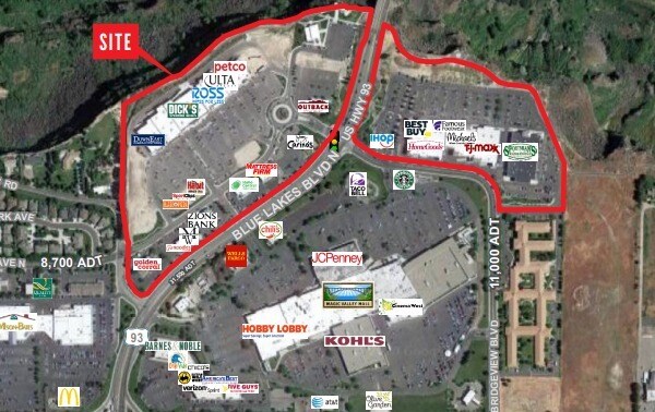

Property Detail
1939 Fillmore St
RPT06190010050A
TWIN FALLS CANYON PARK AMD SUBD PUD LOT 5 BLOCK 1 (34-9-17 SW)
Storebuilding
TWIN FALLS
C-1
Idaho
B and X Area of moderate flood hazard, usually the area between the limits of the 100-year and 500-year floods.
5
2025
15.98 AC
2025
Idaho South Area
000701
Other Market Areas
35,638 SF
Twin Falls, ID
NEARBY LISTINGS FOR SALE OR LEASE
DEMOGRAPHICS near 1939 Fillmore St
1 mile
3 mile
5 mile
2025 Total Population
3,726
45,964
63,375
2030 Population
3,966
48,557
66,890
Pop Growth 2025-2030
+ 6.44%
+ 5.64%
+ 5.55%
Average Age
41
39
38
2025 Total Households
1,336
17,118
23,395
HH Growth 2025-2030
+ 6.81%
+ 5.74%
+ 5.63%
Median Household Inc
$73,714
$65,723
$67,401
Avg Household Size
2.50
2.60
2.60
2025 Avg HH Vehicles
2.00
2.00
2.00
Median Home Value
$372,562
$330,608
$334,729
Median Year Built
1997
1979
1986
Nearby Places
Map Layers
Map Styles
 Street
 Aerial
Transit
 Traffic
 Biking
Places
Listings with unknown addresses are not visible on the map
- Restaurants
- Banks
- Shops
- Fitness
- Groceries
PUBLIC TRANSPORTATION
AIRPORT
Joslin Field-Magic Valley Regional
Drive
Walk
Distance
Joslin Field-Magic Valley Regional
32 min
12.0 mi
Freight Ports
Port of Portland
Drive
Walk
Distance
Port of Portland
598 min
555.4 mi
SALE & LEASE HISTORY
LISTING DATE
SALE/LEASE

Oct 21, 2021
For Lease
Mar 03, 2020
For Lease
Nearby Properties
Address
Land Use
TOTAL SIZE
Lot Size
Zoning
Address
Land Use
TOTAL SIZE
Lot Size
Zoning
38,811 SF
40.92 AC
C-1
Address
Land Use
TOTAL SIZE
Lot Size
Zoning
225,980 SF
24.47 AC
C-1
Address
Land Use
TOTAL SIZE
Lot Size
Zoning
8.53 AC
C-1
Address
Land Use
TOTAL SIZE
Lot Size
Zoning
28,224 SF
7.10 AC
C-1
Address
Land Use
TOTAL SIZE
Lot Size
Zoning
48,191 SF
3.46 AC
C-1
Address
Land Use
TOTAL SIZE
Lot Size
Zoning
167,708 SF
14.90 AC
C-1
Address
Land Use
TOTAL SIZE
Lot Size
Zoning
24,284 SF
3.68 AC
C-1
Address
Land Use
TOTAL SIZE
Lot Size
Zoning
100,034 SF
8.01 AC
C-1
Address
Land Use
TOTAL SIZE
Lot Size
Zoning
160,432 SF
11.25 AC
C-1
Address
Land Use
TOTAL SIZE
Lot Size
Zoning
137,048 SF
12.66 AC
C-1
Address
Land Use
TOTAL SIZE
Lot Size
Zoning
71,798 SF
5.97 AC
C-1
Address
Land Use
TOTAL SIZE
Lot Size
Zoning
76,913 SF
2.88 AC
C-1
Address
Land Use
TOTAL SIZE
Lot Size
Zoning
91,588 SF
3.16 AC
C-1
Address
Land Use
TOTAL SIZE
Lot Size
Zoning
116,676 SF
12.13 AC
C-1
Address
Land Use
TOTAL SIZE
Lot Size
Zoning
48,730 SF
4.67 AC
C-1
Address
Land Use
TOTAL SIZE
Lot Size
Zoning
9,440 SF
7.05 AC
R-6
Address
Land Use
TOTAL SIZE
Lot Size
Zoning
71,900 SF
2.67 AC
C-1
Address
Land Use
TOTAL SIZE
Lot Size
Zoning
114,844 SF
7.70 AC
C-1
Address
Land Use
TOTAL SIZE
Lot Size
Zoning
20,016 SF
4.40 AC
R-6
Address
Land Use
TOTAL SIZE
Lot Size
Zoning
65,565 SF
2.14 AC
C-1
Address
Land Use
TOTAL SIZE
Lot Size
Zoning
24,650 SF
2.13 AC
C-1
Address
Land Use
TOTAL SIZE
Lot Size
Zoning
9,220 SF
5.92 AC
R-4
Address
Land Use
TOTAL SIZE
Lot Size
Zoning
5,234 SF
5 AC
R-6
Address
Land Use
TOTAL SIZE
Lot Size
Zoning
27,652 SF
4.64 AC
C-1
Address
Land Use
TOTAL SIZE
Lot Size
Zoning
34,494 SF
44 SF
C-1
Address
Land Use
TOTAL SIZE
Lot Size
Zoning
34,494 SF
0.01 AC
C-1
Address
Land Use
TOTAL SIZE
Lot Size
Zoning
34,494 SF
131 SF
C-1
Address
Land Use
TOTAL SIZE
Lot Size
Zoning
34,494 SF
0.17 AC
C-1
Address
Land Use
TOTAL SIZE
Lot Size
Zoning
34,494 SF
C-1
The World's #1 Commercial Real Estate Marketplace
Connect with us
© 2026 CoStar Group
The information above has been obtained from sources believed reliable. While we do not doubt its accuracy we have not verified it and make no guarantee, warranty or representation about it. It is your responsibility to independently confirm its accuracy and completeness. Any projections, opinions, assumptions, or estimates used are for example only and do not represent the current or future performance of the property. The value of this transaction to you depends on tax and other factors which should be evaluated by your tax, financial, and legal advisors. You and your advisors should conduct a careful, independent investigation of the property to determine to your satisfaction the suitability of the property for your needs.