Property Record
1939 N Gilbert Rd, Mesa, AZ 85203


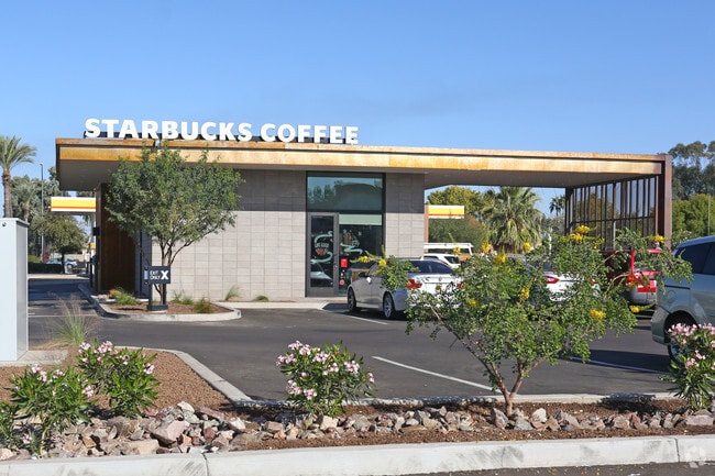
Property Detail
1939 N Gilbert Rd
141-10-511
SEC E MCKELLIPS ROAD AND N GILBERT ROAD MCR 1315-05
Foodprocessing
MARICOPA
LC
Arizona
B and X Area of moderate flood hazard, usually the area between the limits of the 100-year and 500-year floods.
2
2025
0.43 AC
2025
Red Mountain/Mesa
420603
Phoenix
2,228 SF
Phoenix-Mesa-Chandler, AZ
NEARBY LISTINGS FOR SALE OR LEASE
DEMOGRAPHICS near 1939 N Gilbert Rd
1 mile
3 mile
5 mile
2025 Total Population
13,565
108,580
259,068
2030 Population
14,004
113,291
269,579
Pop Growth 2025-2030
+ 3.24%
+ 4.34%
+ 4.06%
Average Age
39
38
39
2025 Total Households
4,462
38,607
96,604
HH Growth 2025-2030
+ 3.20%
+ 4.69%
+ 4.46%
Median Household Inc
$120,340
$78,978
$70,281
Avg Household Size
2.90
2.70
2.60
2025 Avg HH Vehicles
2.00
2.00
2.00
Median Home Value
$599,414
$441,827
$385,354
Median Year Built
1983
1984
1983
Nearby Places
Map Layers
Map Styles
 Street
 Aerial
Transit
 Traffic
 Biking
Places
Listings with unknown addresses are not visible on the map
- Restaurants
- Banks
- Shops
- Fitness
- Groceries
PUBLIC TRANSPORTATION
AIRPORT
Phoenix Sky Harbor International
Drive
Walk
Distance
Phoenix Sky Harbor International
21 min
13.4 mi
Phoenix-Mesa Gateway
Drive
Walk
Distance
Phoenix-Mesa Gateway
28 min
17.1 mi
Freight Ports
Port of San Diego
Drive
Walk
Distance
Port of San Diego
417 min
372.7 mi
SALE & LEASE HISTORY
LISTING DATE
SALE/LEASE

May 05, 2017
For Sale
Nearby Properties
Address
Land Use
TOTAL SIZE
Lot Size
Zoning
Address
Land Use
TOTAL SIZE
Lot Size
Zoning
181.80 AC
Address
Land Use
TOTAL SIZE
Lot Size
Zoning
125,356 SF
21.63 AC
R-9
Address
Land Use
TOTAL SIZE
Lot Size
Zoning
400,798 SF
55.94 AC
PF
Address
Land Use
TOTAL SIZE
Lot Size
Zoning
579,506 SF
17.78 AC
PF
Address
Land Use
TOTAL SIZE
Lot Size
Zoning
20.08 AC
Address
Land Use
TOTAL SIZE
Lot Size
Zoning
161,388 SF
32.52 AC
R-35
Address
Land Use
TOTAL SIZE
Lot Size
Zoning
1.46 AC
C-G
Address
Land Use
TOTAL SIZE
Lot Size
Zoning
79,452 SF
37.59 AC
PF
Address
Land Use
TOTAL SIZE
Lot Size
Zoning
169,128 SF
27.30 AC
R-9
Address
Land Use
TOTAL SIZE
Lot Size
Zoning
147,408 SF
34.58 AC
PF
Address
Land Use
TOTAL SIZE
Lot Size
Zoning
536,470 SF
28.81 AC
M-H
Address
Land Use
TOTAL SIZE
Lot Size
Zoning
349,318 SF
18.47 AC
M-H
Address
Land Use
TOTAL SIZE
Lot Size
Zoning
266,240 SF
9.75 AC
M-H
Address
Land Use
TOTAL SIZE
Lot Size
Zoning
321,591 SF
15.68 AC
M-H
Address
Land Use
TOTAL SIZE
Lot Size
Zoning
81,000 SF
15.70 AC
AG
Address
Land Use
TOTAL SIZE
Lot Size
Zoning
103,086 SF
31.49 AC
PF
Address
Land Use
TOTAL SIZE
Lot Size
Zoning
72,598 SF
38.83 AC
AG
Address
Land Use
TOTAL SIZE
Lot Size
Zoning
133,219 SF
8.65 AC
I-1
Address
Land Use
TOTAL SIZE
Lot Size
Zoning
10 SF
0.91 AC
AG
Address
Land Use
TOTAL SIZE
Lot Size
Zoning
189,043 SF
2.99 AC
M-H
Address
Land Use
TOTAL SIZE
Lot Size
Zoning
191,871 SF
9.51 AC
M-H
Address
Land Use
TOTAL SIZE
Lot Size
Zoning
265,888 SF
2.92 AC
M-H
Address
Land Use
TOTAL SIZE
Lot Size
Zoning
57,048 SF
5.19 AC
C-G
Address
Land Use
TOTAL SIZE
Lot Size
Zoning
80,320 SF
11.11 AC
R-9
Address
Land Use
TOTAL SIZE
Lot Size
Zoning
110,396 SF
8.40 AC
C-G
Address
Land Use
TOTAL SIZE
Lot Size
Zoning
65,034 SF
10.88 AC
PF
Address
Land Use
TOTAL SIZE
Lot Size
Zoning
171,225 SF
5.03 AC
M-H
Address
Land Use
TOTAL SIZE
Lot Size
Zoning
55,614 SF
9.24 AC
AG
Address
Land Use
TOTAL SIZE
Lot Size
Zoning
120,986 SF
3.09 AC
M-H
Address
Land Use
TOTAL SIZE
Lot Size
Zoning
60,000 SF
12.48 AC
RS-9
The World's #1 Commercial Real Estate Marketplace
Connect with us
© 2026 CoStar Group
The information above has been obtained from sources believed reliable. While we do not doubt its accuracy we have not verified it and make no guarantee, warranty or representation about it. It is your responsibility to independently confirm its accuracy and completeness. Any projections, opinions, assumptions, or estimates used are for example only and do not represent the current or future performance of the property. The value of this transaction to you depends on tax and other factors which should be evaluated by your tax, financial, and legal advisors. You and your advisors should conduct a careful, independent investigation of the property to determine to your satisfaction the suitability of the property for your needs.