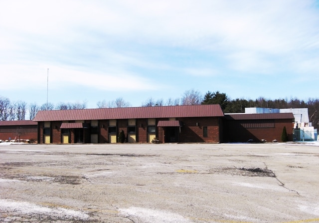
Property Record
194 Chestnut Ridge Rd, Latrobe, PA 15650


NEARBY LISTINGS FOR SALE OR LEASE
Property Detail
194 Chestnut Ridge Rd
Pittsburgh, PA
Kennametal Subdivision
45-41-00-0-088
VAC BLDGS KENNAMETAL SUBDIVDIVISION
Industrialgeneral
Westmoreland
X
Pennsylvania
42129C0462F
1
2025
22.44 AC
2025
Westmoreland County
807404
Pittsburgh
DEMOGRAPHICS near 194 Chestnut Ridge Rd
1 Mile
3 Mile
5 Mile
2024 Total Population
415
13,355
28,434
2029 Population
413
13,257
28,189
Pop Growth 2024-2029
(0.48%)
(0.73%)
(0.86%)
Average Age
47
45
46
2024 Total Households
183
5,953
12,549
HH Growth 2024-2029
(1.09%)
(0.84%)
(0.93%)
Median Household Inc
$53,913
$53,602
$53,186
Avg Household Size
2.20
2.20
2.20
2024 Avg HH Vehicles
2.00
2.00
2.00
Median Home Value
$157,042
$147,835
$156,959
Median Year Built
1959
1955
1957
Nearby Places
Map Layers
Map Styles
 Street
 Aerial
- Restaurants
- Banks
- Shops
- Fitness
- Groceries
PUBLIC TRANSPORTATION
COMMUTER RAIL
Latrobe Amtrak (Pennsylvanian - Amtrak)
DRIVE
WALK
Distance
Latrobe Amtrak (Pennsylvanian - Amtrak)
10 min
4.6 mi
AIRPORT
Arnold Palmer Regional
DRIVE
WALK
Distance
Arnold Palmer Regional
14 min
6.0 mi
Freight Ports
Port of Baltimore
DRIVE
WALK
Distance
Port of Baltimore
259 min
197.9 mi
SALE & LEASE HISTORY
LISTING DATE
SALE/LEASE

Nov 25, 2019
For Lease
Nov 25, 2019
For Sale
May 04, 2022
For Lease
Nearby Properties
Address
Land Use
TOTAL SIZE
Lot Size
Zoning
Address
Land Use
TOTAL SIZE
Lot Size
Zoning
43.50 AC
Address
Land Use
TOTAL SIZE
Lot Size
Zoning
Address
Land Use
TOTAL SIZE
Lot Size
Zoning
5.74 AC
Address
Land Use
TOTAL SIZE
Lot Size
Zoning
52.70 AC
Address
Land Use
TOTAL SIZE
Lot Size
Zoning
149,920 SF
30.53 AC
Address
Land Use
TOTAL SIZE
Lot Size
Zoning
56,822 SF
9.08 AC
Address
Land Use
TOTAL SIZE
Lot Size
Zoning
474.30 AC
Address
Land Use
TOTAL SIZE
Lot Size
Zoning
9.10 AC
Address
Land Use
TOTAL SIZE
Lot Size
Zoning
7.80 AC
Address
Land Use
TOTAL SIZE
Lot Size
Zoning
40,671 SF
3.30 AC
Address
Land Use
TOTAL SIZE
Lot Size
Zoning
Address
Land Use
TOTAL SIZE
Lot Size
Zoning
17.80 AC
Address
Land Use
TOTAL SIZE
Lot Size
Zoning
18.85 AC
Address
Land Use
TOTAL SIZE
Lot Size
Zoning
4.20 AC
Address
Land Use
TOTAL SIZE
Lot Size
Zoning
55,410 SF
4.40 AC
Address
Land Use
TOTAL SIZE
Lot Size
Zoning
29.10 AC
Address
Land Use
TOTAL SIZE
Lot Size
Zoning
2.90 AC
Address
Land Use
TOTAL SIZE
Lot Size
Zoning
52,900 SF
41.50 AC
Address
Land Use
TOTAL SIZE
Lot Size
Zoning
27.80 AC
Address
Land Use
TOTAL SIZE
Lot Size
Zoning
31.65 AC
Address
Land Use
TOTAL SIZE
Lot Size
Zoning
44,750 SF
8.50 AC
Address
Land Use
TOTAL SIZE
Lot Size
Zoning
34.60 AC
Address
Land Use
TOTAL SIZE
Lot Size
Zoning
1.79 AC
Address
Land Use
TOTAL SIZE
Lot Size
Zoning
2.80 AC
Address
Land Use
TOTAL SIZE
Lot Size
Zoning
0.65 AC
Address
Land Use
TOTAL SIZE
Lot Size
Zoning
12.90 AC
Address
Land Use
TOTAL SIZE
Lot Size
Zoning
49,200 SF
30.53 AC
Address
Land Use
TOTAL SIZE
Lot Size
Zoning
27,072 SF
39.10 AC
Address
Land Use
TOTAL SIZE
Lot Size
Zoning
5,060 SF
2.25 AC
Address
Land Use
TOTAL SIZE
Lot Size
Zoning
38,200 SF
30.53 AC
The World's #1 Commercial Real Estate Marketplace
Connect with us
© 2025 CoStar Group
The information above has been obtained from sources believed reliable. While we do not doubt its accuracy we have not verified it and make no guarantee, warranty or representation about it. It is your responsibility to independently confirm its accuracy and completeness. Any projections, opinions, assumptions, or estimates used are for example only and do not represent the current or future performance of the property. The value of this transaction to you depends on tax and other factors which should be evaluated by your tax, financial, and legal advisors. You and your advisors should conduct a careful, independent investigation of the property to determine to your satisfaction the suitability of the property for your needs.