Property Record
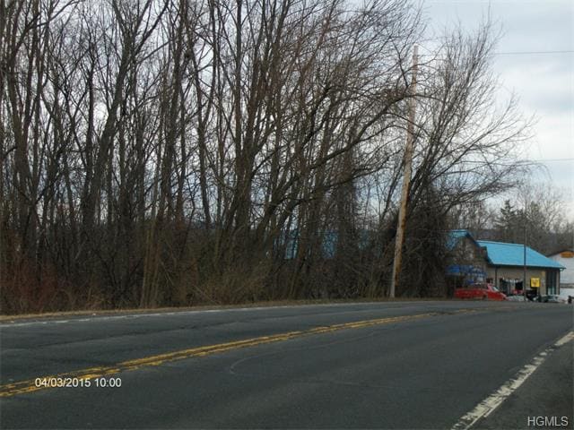
State Route 17M, Monroe, NY 10950

Property Detail
State Route 17M
Kiryas Joel-Poughkeepsie-Newburgh, NY
LT 2 ABBATINE MAP 492 PT LT2 19 CT ST MAP 74-98& PARCEL
334089-003-000-0001-004.100-0000
ORANGE
Residentialacreage
New York
RR-1.0AC
4.100
B and X Area of moderate flood hazard, usually the area between the limits of the 100-year and 500-year floods.
66.82 AC
2024
Monroe
2024
Northern New Jersey
014101
NEARBY LISTINGS FOR SALE OR LEASE
DEMOGRAPHICS near State Route 17M
1 mile
3 mile
5 mile
2025 Total Population
9,185
62,381
80,910
2030 Population
9,372
64,327
83,292
Pop Growth 2025-2030
+ 2.04%
+ 3.12%
+ 2.94%
Average Age
35
29
31
2025 Total Households
2,933
15,008
20,729
HH Growth 2025-2030
+ 1.74%
+ 3.28%
+ 3.02%
Median Household Inc
$102,439
$80,516
$89,905
Avg Household Size
3.10
4.00
3.70
2025 Avg HH Vehicles
2.00
1.00
2.00
Median Home Value
$428,388
$545,346
$496,876
Median Year Built
1984
1992
1988
Nearby Places
Map Layers
Map Styles
 Street
 Aerial
Transit
 Traffic
 Biking
Places
Listings with unknown addresses are not visible on the map
- Restaurants
- Banks
- Shops
- Fitness
- Groceries
PUBLIC TRANSPORTATION
COMMUTER RAIL
Harriman (Bergen County/Port Jervis Line - NJ Transit Commuter Rail (NJ Transit), Main/Port Jervis Line - NJ Transit Commuter Rail (NJ Transit))
Drive
Walk
Distance
Harriman (Bergen County/Port Jervis Line - NJ Transit Commuter Rail (NJ Transit), Main/Port Jervis Line - NJ Transit Commuter Rail (NJ Transit))
9 min
4.8 mi
AIRPORT
New York Stewart International
Drive
Walk
Distance
New York Stewart International
29 min
15.4 mi
Freight Ports
Port Newark Container Terminal
Drive
Walk
Distance
Port Newark Container Terminal
76 min
56.4 mi
SALE & LEASE HISTORY
LISTING DATE
SALE/LEASE

Sep 24, 2016
For Sale
Sep 24, 2016
For Sale
Nearby Properties
Address
Land Use
TOTAL SIZE
Lot Size
Zoning
Address
Land Use
TOTAL SIZE
Lot Size
Zoning
125,636 SF
19.91 AC
SR-20
Address
Land Use
TOTAL SIZE
Lot Size
Zoning
31,507 SF
10.50 AC
UR-M
Address
Land Use
TOTAL SIZE
Lot Size
Zoning
86,696 SF
153.50 AC
A1OP
Address
Land Use
TOTAL SIZE
Lot Size
Zoning
23,534 SF
6.60 AC
PD
Address
Land Use
TOTAL SIZE
Lot Size
Zoning
124,928 SF
12.14 AC
GB
Address
Land Use
TOTAL SIZE
Lot Size
Zoning
70,760 SF
17.20 AC
GB
Address
Land Use
TOTAL SIZE
Lot Size
Zoning
91,472 SF
6.42 AC
SR-10
Address
Land Use
TOTAL SIZE
Lot Size
Zoning
88,240 SF
3.02 AC
R-1
Address
Land Use
TOTAL SIZE
Lot Size
Zoning
113,910 SF
15 AC
PD
Address
Land Use
TOTAL SIZE
Lot Size
Zoning
159,857 SF
24.59 AC
LI
Address
Land Use
TOTAL SIZE
Lot Size
Zoning
92,868 SF
1.22 AC
PD
Address
Land Use
TOTAL SIZE
Lot Size
Zoning
88,855 SF
5 AC
PD
Address
Land Use
TOTAL SIZE
Lot Size
Zoning
126,112 SF
3.30 AC
R-1
Address
Land Use
TOTAL SIZE
Lot Size
Zoning
117,855 SF
3.20 AC
PD
Address
Land Use
TOTAL SIZE
Lot Size
Zoning
132,928 SF
2.60 AC
PD
Address
Land Use
TOTAL SIZE
Lot Size
Zoning
39,548 SF
13.87 AC
SR-20
Address
Land Use
TOTAL SIZE
Lot Size
Zoning
110,219 SF
10.88 AC
LI
Address
Land Use
TOTAL SIZE
Lot Size
Zoning
114,667 SF
22.50 AC
PD
Address
Land Use
TOTAL SIZE
Lot Size
Zoning
120,054 SF
168.80 AC
04
Address
Land Use
TOTAL SIZE
Lot Size
Zoning
172,584 SF
13.40 AC
LI
Address
Land Use
TOTAL SIZE
Lot Size
Zoning
105,554 SF
2.90 AC
R-1
Address
Land Use
TOTAL SIZE
Lot Size
Zoning
160,774 SF
8.46 AC
LI
Address
Land Use
TOTAL SIZE
Lot Size
Zoning
60.70 AC
Address
Land Use
TOTAL SIZE
Lot Size
Zoning
89,166 SF
0.68 AC
R-M
Address
Land Use
TOTAL SIZE
Lot Size
Zoning
82,232 SF
2 AC
PD
Address
Land Use
TOTAL SIZE
Lot Size
Zoning
173,665 SF
2.40 AC
R-2
Address
Land Use
TOTAL SIZE
Lot Size
Zoning
173,665 SF
2.40 AC
R-2
Address
Land Use
TOTAL SIZE
Lot Size
Zoning
46,897 SF
18.60 AC
Address
Land Use
TOTAL SIZE
Lot Size
Zoning
122,913 SF
12.89 AC
LI
Address
Land Use
TOTAL SIZE
Lot Size
Zoning
107,305 SF
2.80 AC
PD
The World's #1 Commercial Real Estate Marketplace
Connect with us
© 2026 CoStar Group
The information above has been obtained from sources believed reliable. While we do not doubt its accuracy we have not verified it and make no guarantee, warranty or representation about it. It is your responsibility to independently confirm its accuracy and completeness. Any projections, opinions, assumptions, or estimates used are for example only and do not represent the current or future performance of the property. The value of this transaction to you depends on tax and other factors which should be evaluated by your tax, financial, and legal advisors. You and your advisors should conduct a careful, independent investigation of the property to determine to your satisfaction the suitability of the property for your needs.