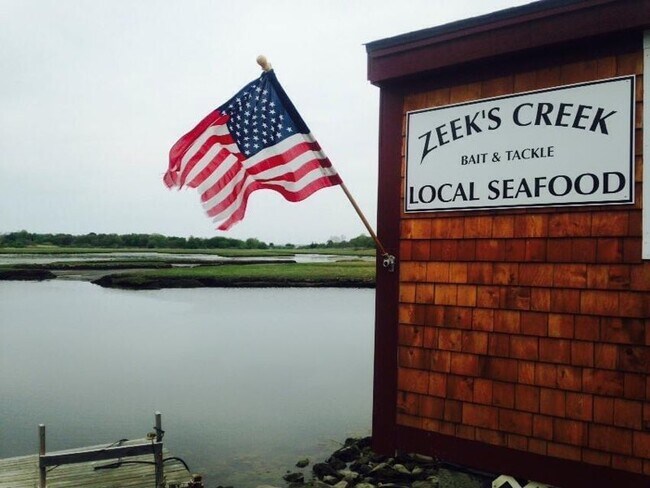
Property Record
194 North Rd, Jamestown, RI 02835


Property Detail
194 North Rd
JAME-000008-000000-000615
Newport
Commercialbuilding
Rhode Island
R40
615
VE and V1-30 Coastal areas with a 1% or greater chance of flooding and an additional hazard associated with storm waves. These areas have a 26% chance of flooding over the life of a 30-year mortgage.
0.06 AC
2024
Newport County
2025
Providence
041300
Providence-Warwick, RI-MA
680 SF
NEARBY LISTINGS FOR SALE OR LEASE
-
-
View all Jamestown listings for sale on LoopNet.com
DEMOGRAPHICS near 194 North Rd
1 mile
3 mile
5 mile
2025 Total Population
1,788
11,331
54,097
2030 Population
1,760
11,434
53,684
Pop Growth 2025-2030
(1.57%)
+ 0.91%
(0.76%)
Average Age
53
45
44
2025 Total Households
855
4,747
23,232
HH Growth 2025-2030
(0.82%)
+ 1.71%
(1.73%)
Median Household Inc
$124,736
$93,521
$99,926
Avg Household Size
2.10
2.20
2.20
2025 Avg HH Vehicles
2.00
2.00
2.00
Median Home Value
$936,006
$874,166
$714,480
Median Year Built
1959
1975
1964
Nearby Places
Map Layers
Map Styles
 Street
 Aerial
Layers
 Traffic
 Biking
Places
Listings with unknown addresses are not visible on the map
- Restaurants
- Banks
- Shops
- Fitness
- Groceries
PUBLIC TRANSPORTATION
AIRPORT
Rhode Island Tf Green International
Drive
Walk
Distance
Rhode Island Tf Green International
39 min
24.2 mi
Freight Ports
Port of Davisville, RI
Drive
Walk
Distance
Port of Davisville, RI
24 min
13.0 mi
SALE & LEASE HISTORY
LISTING DATE
SALE/LEASE

May 23, 2023
For Sale
Feb 15, 2023
For Sale
Nearby Properties
Address
Land Use
TOTAL SIZE
Lot Size
Zoning
Address
Land Use
TOTAL SIZE
Lot Size
Zoning
237,976 SF
8.99 AC
WB
Address
Land Use
TOTAL SIZE
Lot Size
Zoning
17,739 SF
103.90 AC
P
Address
Land Use
TOTAL SIZE
Lot Size
Zoning
217,212 SF
10.46 AC
R10
Address
Land Use
TOTAL SIZE
Lot Size
Zoning
21.21 AC
RR20
Address
Land Use
TOTAL SIZE
Lot Size
Zoning
36,984 SF
10 AC
R10
Address
Land Use
TOTAL SIZE
Lot Size
Zoning
24 AC
R120
Address
Land Use
TOTAL SIZE
Lot Size
Zoning
77.46 AC
R80
Address
Land Use
TOTAL SIZE
Lot Size
Zoning
10.64 AC
P
Address
Land Use
TOTAL SIZE
Lot Size
Zoning
9,744 SF
15 AC
R120
Address
Land Use
TOTAL SIZE
Lot Size
Zoning
52.56 AC
R120
Address
Land Use
TOTAL SIZE
Lot Size
Zoning
1,929 SF
2.70 AC
R80
Address
Land Use
TOTAL SIZE
Lot Size
Zoning
43,454 SF
3.68 AC
P
Address
Land Use
TOTAL SIZE
Lot Size
Zoning
14,844 SF
1.75 AC
WB
Address
Land Use
TOTAL SIZE
Lot Size
Zoning
5.80 AC
R80
Address
Land Use
TOTAL SIZE
Lot Size
Zoning
4,223 SF
1.98 AC
R120
Address
Land Use
TOTAL SIZE
Lot Size
Zoning
114,608 SF
5.20 AC
R10
Address
Land Use
TOTAL SIZE
Lot Size
Zoning
6,085 SF
81.59 AC
R120
Address
Land Use
TOTAL SIZE
Lot Size
Zoning
2,388 SF
258.88 AC
R80
Address
Land Use
TOTAL SIZE
Lot Size
Zoning
26.40 AC
R80
Address
Land Use
TOTAL SIZE
Lot Size
Zoning
9,409 SF
2 AC
R80
Address
Land Use
TOTAL SIZE
Lot Size
Zoning
5,807 SF
2.61 AC
R40
Address
Land Use
TOTAL SIZE
Lot Size
Zoning
5.64 AC
R80
Address
Land Use
TOTAL SIZE
Lot Size
Zoning
7,130 SF
0.28 AC
R10
Address
Land Use
TOTAL SIZE
Lot Size
Zoning
2,458 SF
13.51 AC
R80
Address
Land Use
TOTAL SIZE
Lot Size
Zoning
1,680 SF
2.80 AC
R80
Address
Land Use
TOTAL SIZE
Lot Size
Zoning
5,177 SF
0.43 AC
R10
Address
Land Use
TOTAL SIZE
Lot Size
Zoning
6,555 SF
30.78 AC
R80
Address
Land Use
TOTAL SIZE
Lot Size
Zoning
5,813 SF
7.47 AC
R80
Address
Land Use
TOTAL SIZE
Lot Size
Zoning
10.70 AC
R120
Address
Land Use
TOTAL SIZE
Lot Size
Zoning
10.01 AC
R120
The World's #1 Commercial Real Estate Marketplace
Connect with us
© 2026 CoStar Group
The information above has been obtained from sources believed reliable. While we do not doubt its accuracy we have not verified it and make no guarantee, warranty or representation about it. It is your responsibility to independently confirm its accuracy and completeness. Any projections, opinions, assumptions, or estimates used are for example only and do not represent the current or future performance of the property. The value of this transaction to you depends on tax and other factors which should be evaluated by your tax, financial, and legal advisors. You and your advisors should conduct a careful, independent investigation of the property to determine to your satisfaction the suitability of the property for your needs.