Property Record
1940 Bluff Rd, Columbia, SC 29201


Property Detail
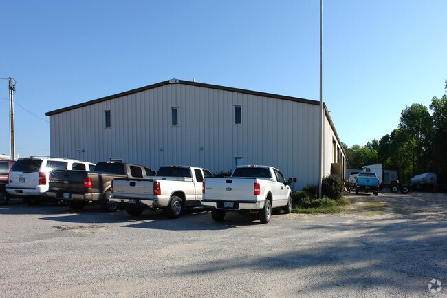
1940 Bluff Rd
13603-06-71
#PR W-2
Commercialnec
Richland
M-1
South Carolina
B and X Area of moderate flood hazard, usually the area between the limits of the 100-year and 500-year floods.
1.52 AC
2025
Southeast Columbia
2024
Columbia
011701
Columbia, SC
8,100 SF
NEARBY LISTINGS FOR SALE OR LEASE
DEMOGRAPHICS near 1940 Bluff Rd
1 mile
3 mile
5 mile
2025 Total Population
4,000
50,539
125,094
2030 Population
4,156
52,578
129,812
Pop Growth 2025-2030
+ 3.90%
+ 4.03%
+ 3.77%
Average Age
30
34
36
2025 Total Households
1,887
22,416
53,406
HH Growth 2025-2030
+ 4.93%
+ 4.48%
+ 4.20%
Median Household Inc
$24,750
$54,221
$55,333
Avg Household Size
2.10
2.00
2.00
2025 Avg HH Vehicles
2.00
2.00
2.00
Median Home Value
$144,000
$288,678
$269,198
Median Year Built
2000
1976
1973
Nearby Places
Map Layers
Map Styles
 Street
 Aerial
Transit
 Traffic
 Biking
Places
Listings with unknown addresses are not visible on the map
- Restaurants
- Banks
- Shops
- Fitness
- Groceries
PUBLIC TRANSPORTATION
COMMUTER RAIL
Drive
Walk
Distance
8 min
3.9 mi
AIRPORT
Columbia Metro
Drive
Walk
Distance
Columbia Metro
23 min
12.6 mi
Nearby Properties
Address
Land Use
TOTAL SIZE
Lot Size
Zoning
Address
Land Use
TOTAL SIZE
Lot Size
Zoning
100 SF
15.17 AC
C-1
Address
Land Use
TOTAL SIZE
Lot Size
Zoning
440,418 SF
7.23 AC
M-1
Address
Land Use
TOTAL SIZE
Lot Size
Zoning
30,100 SF
3.45 AC
M-2
Address
Land Use
TOTAL SIZE
Lot Size
Zoning
603,525 SF
26.45 AC
RM-HD
Address
Land Use
TOTAL SIZE
Lot Size
Zoning
604,350 SF
10.33 AC
EC
Address
Land Use
TOTAL SIZE
Lot Size
Zoning
490,633 SF
13.20 AC
RM-2
Address
Land Use
TOTAL SIZE
Lot Size
Zoning
316,116 SF
21.73 AC
RG-2
Address
Land Use
TOTAL SIZE
Lot Size
Zoning
241,878 SF
14.03 AC
C-3
Address
Land Use
TOTAL SIZE
Lot Size
Zoning
100 SF
0.52 AC
C-1
Address
Land Use
TOTAL SIZE
Lot Size
Zoning
100 SF
4.49 AC
INS-GEN
Address
Land Use
TOTAL SIZE
Lot Size
Zoning
3,000 SF
52.49 AC
O-I
Address
Land Use
TOTAL SIZE
Lot Size
Zoning
300,636 SF
21.58 AC
LI
Address
Land Use
TOTAL SIZE
Lot Size
Zoning
316,822 SF
1.53 AC
C-1
Address
Land Use
TOTAL SIZE
Lot Size
Zoning
13,028 SF
31.69 AC
RG-1
Address
Land Use
TOTAL SIZE
Lot Size
Zoning
175,000 SF
5.30 AC
C-1
Address
Land Use
TOTAL SIZE
Lot Size
Zoning
95.26 AC
C-1
Address
Land Use
TOTAL SIZE
Lot Size
Zoning
486,050 SF
24.18 AC
RM-HD
Address
Land Use
TOTAL SIZE
Lot Size
Zoning
254,900 SF
14 AC
M-1
Address
Land Use
TOTAL SIZE
Lot Size
Zoning
216,180 SF
15.66 AC
C-1
Address
Land Use
TOTAL SIZE
Lot Size
Zoning
114,137 SF
0.80 AC
C-3
Address
Land Use
TOTAL SIZE
Lot Size
Zoning
230,053 SF
18.35 AC
C-3
Address
Land Use
TOTAL SIZE
Lot Size
Zoning
167,168 SF
1.37 AC
RG-2
Address
Land Use
TOTAL SIZE
Lot Size
Zoning
32,640 SF
23.73 AC
RSF-2
Address
Land Use
TOTAL SIZE
Lot Size
Zoning
138,832 SF
3.47 AC
C-1
Address
Land Use
TOTAL SIZE
Lot Size
Zoning
2,908 SF
87.03 AC
C-3
Address
Land Use
TOTAL SIZE
Lot Size
Zoning
4 AC
M-2
Address
Land Use
TOTAL SIZE
Lot Size
Zoning
4.85 AC
MC
Address
Land Use
TOTAL SIZE
Lot Size
Zoning
100 SF
4.94 AC
C-1
Address
Land Use
TOTAL SIZE
Lot Size
Zoning
121,560 SF
8.46 AC
RM-2
Address
Land Use
TOTAL SIZE
Lot Size
Zoning
196,800 SF
5.83 AC
HI
The World's #1 Commercial Real Estate Marketplace
Connect with us
© 2026 CoStar Group
The information above has been obtained from sources believed reliable. While we do not doubt its accuracy we have not verified it and make no guarantee, warranty or representation about it. It is your responsibility to independently confirm its accuracy and completeness. Any projections, opinions, assumptions, or estimates used are for example only and do not represent the current or future performance of the property. The value of this transaction to you depends on tax and other factors which should be evaluated by your tax, financial, and legal advisors. You and your advisors should conduct a careful, independent investigation of the property to determine to your satisfaction the suitability of the property for your needs.