Property Record
1940 Charleston Rd, Mountain View, CA 94043
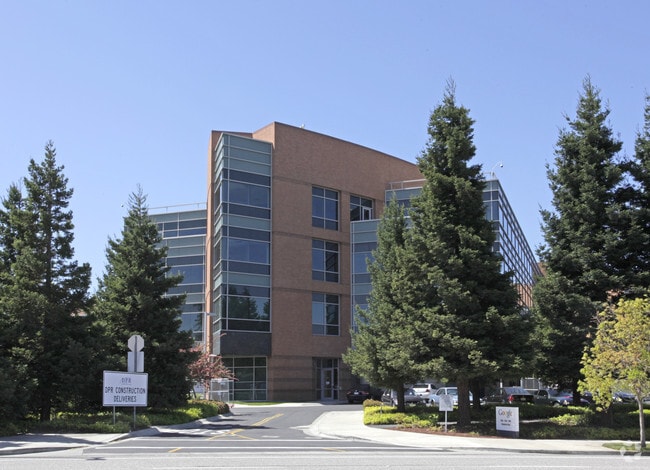


Property Detail
1940 Charleston Rd
116-04-016
LOT 2 RECORDERS BOOK 654 PAGE 8
Financialbuilding
SANTA CLARA
P(39)
California
C and X Area of minimal flood hazard, usually depicted on FIRMs as above the 500-year flood level.
13.48 AC
2024
Mountain View
2025
South Bay/San Jose
509202
San Jose-Sunnyvale-Santa Clara, CA
373,702 SF
NEARBY LISTINGS FOR SALE OR LEASE
DEMOGRAPHICS near 1940 Charleston Rd
1 mile
3 mile
5 mile
2025 Total Population
8,600
126,693
318,323
2030 Population
8,991
131,824
327,856
Pop Growth 2025-2030
+ 4.55%
+ 4.05%
+ 2.99%
Average Age
40
40
39
2025 Total Households
3,429
50,585
116,667
HH Growth 2025-2030
+ 4.46%
+ 4.12%
+ 3.24%
Median Household Inc
$189,524
$192,018
$183,316
Avg Household Size
2.40
2.40
2.50
2025 Avg HH Vehicles
2.00
2.00
2.00
Median Home Value
$1,097,066
$1,130,094
$1,124,277
Median Year Built
1979
1972
1972
Nearby Places
Map Layers
Map Styles
 Street
 Aerial
Layers
 Traffic
 Biking
Places
Listings with unknown addresses are not visible on the map
- Restaurants
- Banks
- Shops
- Fitness
- Groceries
PUBLIC TRANSPORTATION
COMMUTER RAIL
San Antonio Caltrain Station Southbound (Limited - Caltrain (Caltrain), Local Weekday - Caltrain (Caltrain), Local Weekend - Caltrain (Caltrain))
Drive
Walk
Distance
San Antonio Caltrain Station Southbound (Limited - Caltrain (Caltrain), Local Weekday - Caltrain (Caltrain), Local Weekend - Caltrain (Caltrain))
7 min
2.4 mi
Mountain View Caltrain Station Southbound (Express - Caltrain (Caltrain), Limited - Caltrain (Caltrain), Local Weekday - Caltrain (Caltrain), Local Weekend - Caltrain (Caltrain))
Drive
Walk
Distance
Mountain View Caltrain Station Southbound (Express - Caltrain (Caltrain), Limited - Caltrain (Caltrain), Local Weekday - Caltrain (Caltrain), Local Weekend - Caltrain (Caltrain))
8 min
3.0 mi
AIRPORT
Norman Y Mineta San Jose International
Drive
Walk
Distance
Norman Y Mineta San Jose International
16 min
10.9 mi
San Francisco International
Drive
Walk
Distance
San Francisco International
29 min
23.0 mi
Metro Oakland International
Drive
Walk
Distance
Metro Oakland International
42 min
31.8 mi
Freight Ports
Port of Redwood City
Drive
Walk
Distance
Port of Redwood City
14 min
9.9 mi
Nearby Properties
Address
Land Use
TOTAL SIZE
Lot Size
Zoning
Address
Land Use
TOTAL SIZE
Lot Size
Zoning
42.28 AC
PF
Address
Land Use
TOTAL SIZE
Lot Size
Zoning
499,360 SF
31.95 AC
MM40
Address
Land Use
TOTAL SIZE
Lot Size
Zoning
0.33 AC
PF
Address
Land Use
TOTAL SIZE
Lot Size
Zoning
450,575 SF
3.73 AC
P(9)
Address
Land Use
TOTAL SIZE
Lot Size
Zoning
355,490 SF
26.49 AC
P39
Address
Land Use
TOTAL SIZE
Lot Size
Zoning
440,173 SF
25.33 AC
P39
Address
Land Use
TOTAL SIZE
Lot Size
Zoning
584,389 SF
5.25 AC
P(40)
Address
Land Use
TOTAL SIZE
Lot Size
Zoning
595,000 SF
7.42 AC
P(34)
Address
Land Use
TOTAL SIZE
Lot Size
Zoning
233,124 SF
9.18 AC
P(7)
Address
Land Use
TOTAL SIZE
Lot Size
Zoning
4.13 AC
P39
Address
Land Use
TOTAL SIZE
Lot Size
Zoning
372,859 SF
4.71 AC
P
Address
Land Use
TOTAL SIZE
Lot Size
Zoning
298,463 SF
7 AC
P(19)
Address
Land Use
TOTAL SIZE
Lot Size
Zoning
640,105 SF
7.90 AC
R3-2*
Address
Land Use
TOTAL SIZE
Lot Size
Zoning
340,913 SF
15.64 AC
ML
Address
Land Use
TOTAL SIZE
Lot Size
Zoning
224,505 SF
5.15 AC
CORE
Address
Land Use
TOTAL SIZE
Lot Size
Zoning
20,160.50 AC
P
Address
Land Use
TOTAL SIZE
Lot Size
Zoning
322,264 SF
3.92 AC
P
Address
Land Use
TOTAL SIZE
Lot Size
Zoning
20,140.41 AC
MV
Address
Land Use
TOTAL SIZE
Lot Size
Zoning
208.82 AC
MV
Address
Land Use
TOTAL SIZE
Lot Size
Zoning
357,481 SF
1.04 AC
MP-TO
Address
Land Use
TOTAL SIZE
Lot Size
Zoning
89,237 SF
5.51 AC
P(9)
Address
Land Use
TOTAL SIZE
Lot Size
Zoning
652,964 SF
14.99 AC
GM
Address
Land Use
TOTAL SIZE
Lot Size
Zoning
266,088 SF
16.20 AC
P(29)
Address
Land Use
TOTAL SIZE
Lot Size
Zoning
247,846 SF
11.36 AC
ML
Address
Land Use
TOTAL SIZE
Lot Size
Zoning
224,086 SF
10.80 AC
R3-1.
Address
Land Use
TOTAL SIZE
Lot Size
Zoning
2.90 AC
P(17)
Address
Land Use
TOTAL SIZE
Lot Size
Zoning
276,538 SF
2.19 AC
ML
Address
Land Use
TOTAL SIZE
Lot Size
Zoning
162,552 SF
9.78 AC
R3-2*
Address
Land Use
TOTAL SIZE
Lot Size
Zoning
140,761 SF
4.83 AC
P
Address
Land Use
TOTAL SIZE
Lot Size
Zoning
173,166 SF
10.58 AC
MLT
The World's #1 Commercial Real Estate Marketplace
Connect with us
© 2026 CoStar Group
The information above has been obtained from sources believed reliable. While we do not doubt its accuracy we have not verified it and make no guarantee, warranty or representation about it. It is your responsibility to independently confirm its accuracy and completeness. Any projections, opinions, assumptions, or estimates used are for example only and do not represent the current or future performance of the property. The value of this transaction to you depends on tax and other factors which should be evaluated by your tax, financial, and legal advisors. You and your advisors should conduct a careful, independent investigation of the property to determine to your satisfaction the suitability of the property for your needs.