Property Record
1940 E Twin Hills Dr, Howell, MI 48843

Property Detail
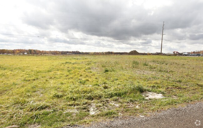
1940 E Twin Hills Dr
07-27-200-041
SEC 27 T3N R5E BEG PART OF NE 1/4 SEC 27, COMM AT N 1/4 CORN SEC 27; TH ALG N LN OF SEC 27 & M-59, N89*57'17" E 195.81' TO
Commercialnec
LIVINGSTON
MI
Michigan
B and X Area of moderate flood hazard, usually the area between the limits of the 100-year and 500-year floods.
3.45 AC
2025
Livingston County
2025
Detroit
712602
Detroit-Warren-Dearborn, MI
20,000 SF
NEARBY LISTINGS FOR SALE OR LEASE
-
-
View all Howell listings for sale on LoopNet.com
DEMOGRAPHICS near 1940 E Twin Hills Dr
1 mile
3 mile
5 mile
2025 Total Population
665
12,500
43,979
2030 Population
669
12,677
44,557
Pop Growth 2025-2030
+ 0.60%
+ 1.42%
+ 1.31%
Average Age
40
42
42
2025 Total Households
221
4,653
17,360
HH Growth 2025-2030
+ 0.45%
+ 1.50%
+ 1.34%
Median Household Inc
$134,642
$123,712
$96,670
Avg Household Size
3.00
2.60
2.50
2025 Avg HH Vehicles
3.00
2.00
2.00
Median Home Value
$393,999
$372,419
$333,937
Median Year Built
1994
2000
1994
Nearby Places
Map Layers
Map Styles
 Street
 Aerial
Layers
 Traffic
 Biking
Places
Listings with unknown addresses are not visible on the map
- Restaurants
- Banks
- Shops
- Fitness
- Groceries
PUBLIC TRANSPORTATION
AIRPORT
Bishop International
Drive
Walk
Distance
Bishop International
47 min
30.7 mi
Freight Ports
Port of Toledo
Drive
Walk
Distance
Port of Toledo
112 min
90.2 mi
SALE & LEASE HISTORY
LISTING DATE
SALE/LEASE

Aug 19, 2020
For Sale
Nearby Properties
Address
Land Use
TOTAL SIZE
Lot Size
Zoning
Address
Land Use
TOTAL SIZE
Lot Size
Zoning
15.74 AC
RM
Address
Land Use
TOTAL SIZE
Lot Size
Zoning
87,349 SF
9.68 AC
C,RM,PUD
Address
Land Use
TOTAL SIZE
Lot Size
Zoning
57,582 SF
5.32 AC
C,RM,PUD
Address
Land Use
TOTAL SIZE
Lot Size
Zoning
92,475 SF
18.66 AC
MI
Address
Land Use
TOTAL SIZE
Lot Size
Zoning
12,870 SF
5.04 AC
C,RM,PUD
Address
Land Use
TOTAL SIZE
Lot Size
Zoning
3.86 AC
C,RM,PUD
Address
Land Use
TOTAL SIZE
Lot Size
Zoning
1,529 SF
42.07 AC
PRF
Address
Land Use
TOTAL SIZE
Lot Size
Zoning
59.56 AC
AR
Address
Land Use
TOTAL SIZE
Lot Size
Zoning
24,000 SF
18.59 AC
MI
Address
Land Use
TOTAL SIZE
Lot Size
Zoning
15.54 AC
C,RM,PUD
Address
Land Use
TOTAL SIZE
Lot Size
Zoning
39,862 SF
1.73 AC
R3
Address
Land Use
TOTAL SIZE
Lot Size
Zoning
13,008 SF
1.91 AC
C,RM,PUD
Address
Land Use
TOTAL SIZE
Lot Size
Zoning
1,216 SF
161.35 AC
AR
Address
Land Use
TOTAL SIZE
Lot Size
Zoning
1,440 SF
148.16 AC
AR
Address
Land Use
TOTAL SIZE
Lot Size
Zoning
10,589 SF
1.33 AC
C,RM,PUD
Address
Land Use
TOTAL SIZE
Lot Size
Zoning
2,784 SF
160.44 AC
AR
Address
Land Use
TOTAL SIZE
Lot Size
Zoning
4,176 SF
80 AC
CR1
Address
Land Use
TOTAL SIZE
Lot Size
Zoning
2,256 SF
150.50 AC
AR
Address
Land Use
TOTAL SIZE
Lot Size
Zoning
11.64 AC
C,RM,PUD
Address
Land Use
TOTAL SIZE
Lot Size
Zoning
29.84 AC
R2 & R3
Address
Land Use
TOTAL SIZE
Lot Size
Zoning
115.25 AC
AR
Address
Land Use
TOTAL SIZE
Lot Size
Zoning
13.37 AC
R2 & R3
Address
Land Use
TOTAL SIZE
Lot Size
Zoning
152 AC
AR
Address
Land Use
TOTAL SIZE
Lot Size
Zoning
7.88 AC
RM
Address
Land Use
TOTAL SIZE
Lot Size
Zoning
30.70 AC
R1
Address
Land Use
TOTAL SIZE
Lot Size
Zoning
83.06 AC
AR
Address
Land Use
TOTAL SIZE
Lot Size
Zoning
16.72 AC
R2 & R3
Address
Land Use
TOTAL SIZE
Lot Size
Zoning
26.86 AC
R2 & R3
Address
Land Use
TOTAL SIZE
Lot Size
Zoning
1,584 SF
79.04 AC
AR
The World's #1 Commercial Real Estate Marketplace
Connect with us
© 2026 CoStar Group
The information above has been obtained from sources believed reliable. While we do not doubt its accuracy we have not verified it and make no guarantee, warranty or representation about it. It is your responsibility to independently confirm its accuracy and completeness. Any projections, opinions, assumptions, or estimates used are for example only and do not represent the current or future performance of the property. The value of this transaction to you depends on tax and other factors which should be evaluated by your tax, financial, and legal advisors. You and your advisors should conduct a careful, independent investigation of the property to determine to your satisfaction the suitability of the property for your needs.