Property Record
1940 N State St, Belvidere, IL 61008


Property Detail
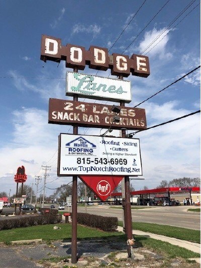
1940 N State St
05-22-476-008
22-44-3 PT E1/2 SE-BEG INTER CNTR DAVIS DR & APPLETON RD, NW 491.44' NE 333 SE 289.5' SW 131.5' SE 189.93' SW 202.23' TO POB
Commercialnec
Boone
B and X Area of moderate flood hazard, usually the area between the limits of the 100-year and 500-year floods.
Illinois
2024
2.25 AC
2024
Boone County
010102
Chicago
24,373 SF
Rockford, IL
NEARBY LISTINGS FOR SALE OR LEASE
DEMOGRAPHICS near 1940 N State St
1 mile
3 mile
5 mile
2025 Total Population
4,752
26,654
37,840
2030 Population
4,710
26,489
37,749
Pop Growth 2025-2030
(0.88%)
(0.62%)
(0.24%)
Average Age
37
40
41
2025 Total Households
1,722
9,743
13,829
HH Growth 2025-2030
(0.81%)
(0.61%)
(0.20%)
Median Household Inc
$69,574
$67,881
$78,282
Avg Household Size
2.70
2.70
2.70
2025 Avg HH Vehicles
2.00
2.00
2.00
Median Home Value
$170,422
$173,982
$203,557
Median Year Built
1968
1974
1980
Nearby Places
Map Layers
Map Styles
 Street
 Aerial
Layers
 Traffic
 Biking
Places
Listings with unknown addresses are not visible on the map
- Restaurants
- Banks
- Shops
- Fitness
- Groceries
PUBLIC TRANSPORTATION
AIRPORT
Chicago/Rockford International
Drive
Walk
Distance
Chicago/Rockford International
32 min
20.0 mi
SALE & LEASE HISTORY
LISTING DATE
SALE/LEASE

Jun 23, 2022
For Sale
Dec 10, 2019
For Sale
Nearby Properties
Address
Land Use
TOTAL SIZE
Lot Size
Zoning
Address
Land Use
TOTAL SIZE
Lot Size
Zoning
131,468 SF
110.99 AC
Address
Land Use
TOTAL SIZE
Lot Size
Zoning
4,004,221 SF
249.03 AC
Address
Land Use
TOTAL SIZE
Lot Size
Zoning
80.50 AC
Address
Land Use
TOTAL SIZE
Lot Size
Zoning
221,802 SF
22.61 AC
Address
Land Use
TOTAL SIZE
Lot Size
Zoning
336,204 SF
26.66 AC
Address
Land Use
TOTAL SIZE
Lot Size
Zoning
180,020 SF
21.26 AC
Address
Land Use
TOTAL SIZE
Lot Size
Zoning
178.10 AC
Address
Land Use
TOTAL SIZE
Lot Size
Zoning
7,529 SF
1.77 AC
Address
Land Use
TOTAL SIZE
Lot Size
Zoning
1,539 SF
34.13 AC
Address
Land Use
TOTAL SIZE
Lot Size
Zoning
76,993 SF
7.76 AC
Address
Land Use
TOTAL SIZE
Lot Size
Zoning
172,500 SF
5.96 AC
Address
Land Use
TOTAL SIZE
Lot Size
Zoning
177,080 SF
9.19 AC
Address
Land Use
TOTAL SIZE
Lot Size
Zoning
105,000 SF
16 AC
Address
Land Use
TOTAL SIZE
Lot Size
Zoning
100,000 SF
7.90 AC
Address
Land Use
TOTAL SIZE
Lot Size
Zoning
122,500 SF
9.37 AC
Address
Land Use
TOTAL SIZE
Lot Size
Zoning
382,082 SF
34.81 AC
Address
Land Use
TOTAL SIZE
Lot Size
Zoning
96,000 SF
6.48 AC
Address
Land Use
TOTAL SIZE
Lot Size
Zoning
105,000 SF
7.51 AC
Address
Land Use
TOTAL SIZE
Lot Size
Zoning
81,250 SF
6.38 AC
Address
Land Use
TOTAL SIZE
Lot Size
Zoning
100,000 SF
10.32 AC
Address
Land Use
TOTAL SIZE
Lot Size
Zoning
105,000 SF
8.65 AC
Address
Land Use
TOTAL SIZE
Lot Size
Zoning
100,000 SF
5.81 AC
Address
Land Use
TOTAL SIZE
Lot Size
Zoning
82,500 SF
12.64 AC
Address
Land Use
TOTAL SIZE
Lot Size
Zoning
8,750 SF
11.16 AC
Address
Land Use
TOTAL SIZE
Lot Size
Zoning
24,480 SF
3.26 AC
Address
Land Use
TOTAL SIZE
Lot Size
Zoning
90,000 SF
6.53 AC
Address
Land Use
TOTAL SIZE
Lot Size
Zoning
99,619 SF
7.84 AC
Address
Land Use
TOTAL SIZE
Lot Size
Zoning
55,687 SF
9.51 AC
The World's #1 Commercial Real Estate Marketplace
Connect with us
© 2026 CoStar Group
The information above has been obtained from sources believed reliable. While we do not doubt its accuracy we have not verified it and make no guarantee, warranty or representation about it. It is your responsibility to independently confirm its accuracy and completeness. Any projections, opinions, assumptions, or estimates used are for example only and do not represent the current or future performance of the property. The value of this transaction to you depends on tax and other factors which should be evaluated by your tax, financial, and legal advisors. You and your advisors should conduct a careful, independent investigation of the property to determine to your satisfaction the suitability of the property for your needs.