Property Record
1940 Us Highway 22, Bound Brook, NJ 08805


Save to a Folder
{{folder.Name}}
{{folder.ListingIds.length}} Properties
{{folder.ListingIds.length}} Property
Create a New Folder
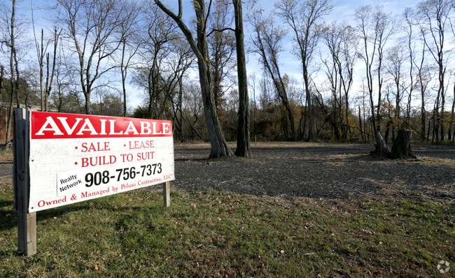
Property Detail
1940 Us Highway 22
06-00382-0000-00004
Somerset
Commercialnec
New Jersey
C3
4
AE The base floodplain where base flood elevations are provided. AE Zones are now used on new format FIRMs instead of A1-A30 Zones.
1.37 AC
2025
Route 78 East
2026
Northern New Jersey
050902
Lakewood-New Brunswick, NJ
NEARBY LISTINGS FOR SALE OR LEASE
DEMOGRAPHICS near 1940 Us Highway 22
1 mile
3 mile
5 mile
2025 Total Population
8,668
70,534
192,427
2030 Population
8,894
72,924
199,983
Pop Growth 2025-2030
+ 2.61%
+ 3.39%
+ 3.93%
Average Age
43
41
41
2025 Total Households
3,148
24,912
66,955
HH Growth 2025-2030
+ 2.67%
+ 3.54%
+ 4.16%
Median Household Inc
$142,924
$119,460
$120,670
Avg Household Size
2.80
2.80
2.80
2025 Avg HH Vehicles
2.00
2.00
2.00
Median Home Value
$480,336
$471,553
$472,911
Median Year Built
1963
1967
1968
Nearby Places
Map Layers
Map Styles
 Street
 Aerial
Layers
 Traffic
 Biking
Places
Listings with unknown addresses are not visible on the map
- Restaurants
- Banks
- Shops
- Fitness
- Groceries
PUBLIC TRANSPORTATION
COMMUTER RAIL
Bound Brook (Raritan Valley Line - NJ Transit Commuter Rail (NJ Transit))
Drive
Walk
Distance
Bound Brook (Raritan Valley Line - NJ Transit Commuter Rail (NJ Transit))
9 min
3.2 mi
Dunellen (Raritan Valley Line - NJ Transit Commuter Rail (NJ Transit))
Drive
Walk
Distance
Dunellen (Raritan Valley Line - NJ Transit Commuter Rail (NJ Transit))
8 min
3.7 mi
AIRPORT
Newark Liberty International
Drive
Walk
Distance
Newark Liberty International
34 min
25.5 mi
LaGuardia
Drive
Walk
Distance
LaGuardia
68 min
46.3 mi
SALE & LEASE HISTORY
LISTING DATE
SALE/LEASE

Sep 25, 2016
For Lease
Nov 14, 2016
For Sale
Nearby Properties
Address
Land Use
TOTAL SIZE
Lot Size
Zoning
Address
Land Use
TOTAL SIZE
Lot Size
Zoning
31.49 AC
LI5
Address
Land Use
TOTAL SIZE
Lot Size
Zoning
41.40 AC
LI5
Address
Land Use
TOTAL SIZE
Lot Size
Zoning
39.10 AC
C3
Address
Land Use
TOTAL SIZE
Lot Size
Zoning
64.99 AC
LI5
Address
Land Use
TOTAL SIZE
Lot Size
Zoning
22.75 AC
LC
Address
Land Use
TOTAL SIZE
Lot Size
Zoning
Address
Land Use
TOTAL SIZE
Lot Size
Zoning
21.60 AC
LI5
Address
Land Use
TOTAL SIZE
Lot Size
Zoning
30.43 AC
M1A
Address
Land Use
TOTAL SIZE
Lot Size
Zoning
24.34 AC
IND
Address
Land Use
TOTAL SIZE
Lot Size
Zoning
277,731 SF
17.91 AC
LI5
Address
Land Use
TOTAL SIZE
Lot Size
Zoning
237,360 SF
14.48 AC
B-I
Address
Land Use
TOTAL SIZE
Lot Size
Zoning
230,022 SF
15.48 AC
LI5
Address
Land Use
TOTAL SIZE
Lot Size
Zoning
4.05 AC
Address
Land Use
TOTAL SIZE
Lot Size
Zoning
13.38 AC
B2
Address
Land Use
TOTAL SIZE
Lot Size
Zoning
19.90 AC
IND
Address
Land Use
TOTAL SIZE
Lot Size
Zoning
Address
Land Use
TOTAL SIZE
Lot Size
Zoning
190,708 SF
10.73 AC
B-I
Address
Land Use
TOTAL SIZE
Lot Size
Zoning
Address
Land Use
TOTAL SIZE
Lot Size
Zoning
18.31 AC
LI5
Address
Land Use
TOTAL SIZE
Lot Size
Zoning
158,966 SF
13.92 AC
LI5
Address
Land Use
TOTAL SIZE
Lot Size
Zoning
14.24 AC
RM
Address
Land Use
TOTAL SIZE
Lot Size
Zoning
10.95 AC
LC
Address
Land Use
TOTAL SIZE
Lot Size
Zoning
Address
Land Use
TOTAL SIZE
Lot Size
Zoning
96,102 SF
23.60 AC
ER
Address
Land Use
TOTAL SIZE
Lot Size
Zoning
152,424 SF
7.84 AC
B-I
Address
Land Use
TOTAL SIZE
Lot Size
Zoning
167,861 SF
9.75 AC
LI5
Address
Land Use
TOTAL SIZE
Lot Size
Zoning
32 AC
M2
Address
Land Use
TOTAL SIZE
Lot Size
Zoning
12.57 AC
Address
Land Use
TOTAL SIZE
Lot Size
Zoning
17.69 AC
PRCP
Address
Land Use
TOTAL SIZE
Lot Size
Zoning
137,228 SF
15 AC
R75
The World's #1 Commercial Real Estate Marketplace
Connect with us
© 2026 CoStar Group
The information above has been obtained from sources believed reliable. While we do not doubt its accuracy we have not verified it and make no guarantee, warranty or representation about it. It is your responsibility to independently confirm its accuracy and completeness. Any projections, opinions, assumptions, or estimates used are for example only and do not represent the current or future performance of the property. The value of this transaction to you depends on tax and other factors which should be evaluated by your tax, financial, and legal advisors. You and your advisors should conduct a careful, independent investigation of the property to determine to your satisfaction the suitability of the property for your needs.