Property Record
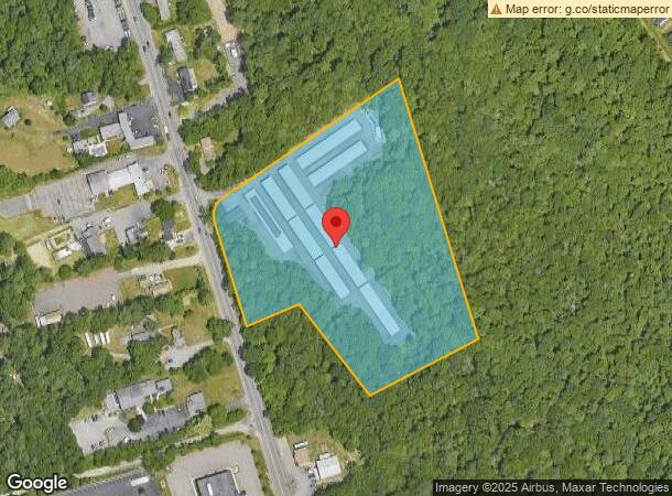
1940 Washington St, Stoughton, MA 02072

NEARBY LISTINGS FOR SALE OR LEASE
-
-
View all Stoughton listings for sale on LoopNet.com
Property Detail
1940 Washington St
Commercialnec
Norfolk
X
Massachusetts
25021C0379E
7.51 AC
0
I-95 Corridor South
2025
Boston
456101
Boston-Cambridge-Newton, MA-NH
51,150 SF
STOU-000060-000040
DEMOGRAPHICS near 1940 Washington St
1 Mile
3 Mile
5 Mile
2024 Total Population
3,293
48,117
162,862
2029 Population
3,290
47,622
161,064
Pop Growth 2024-2029
(0.09%)
(1.03%)
(1.10%)
Average Age
40
41
40
2024 Total Households
1,103
17,144
57,354
HH Growth 2024-2029
(0.18%)
(1.11%)
(1.12%)
Median Household Inc
$105,165
$91,084
$89,935
Avg Household Size
2.90
2.60
2.70
2024 Avg HH Vehicles
2.00
2.00
2.00
Median Home Value
$475,976
$450,857
$440,734
Median Year Built
1968
1969
1963
Nearby Places
Map Layers
Map Styles
 Street
 Aerial
- Restaurants
- Banks
- Shops
- Fitness
- Groceries
PUBLIC TRANSPORTATION
COMMUTER RAIL
Stoughton (Providence/Stoughton Line - Massachusetts Bay Transportation Authority Commuter Rail (Purple Line))
DRIVE
WALK
Distance
Stoughton (Providence/Stoughton Line - Massachusetts Bay Transportation Authority Commuter Rail (Purple Line))
5 min
2.7 mi
Brockton (Middleborough/Lakeville Line - Massachusetts Bay Transportation Authority Commuter Rail (Purple Line))
DRIVE
WALK
Distance
Brockton (Middleborough/Lakeville Line - Massachusetts Bay Transportation Authority Commuter Rail (Purple Line))
9 min
4.6 mi
AIRPORT
General Edward Lawrence Logan International
DRIVE
WALK
Distance
General Edward Lawrence Logan International
39 min
25.1 mi
Rhode Island Tf Green International
DRIVE
WALK
Distance
Rhode Island Tf Green International
64 min
42.1 mi
Freight Ports
Port of Boston
DRIVE
WALK
Distance
Port of Boston
37 min
22.9 mi
Nearby Properties
Address
Land Use
TOTAL SIZE
Lot Size
Zoning
Address
Land Use
TOTAL SIZE
Lot Size
Zoning
Address
Land Use
TOTAL SIZE
Lot Size
Zoning
1,352 SF
66.81 AC
R1B
Address
Land Use
TOTAL SIZE
Lot Size
Zoning
1,292 SF
36.06 AC
C5
Address
Land Use
TOTAL SIZE
Lot Size
Zoning
22.56 AC
Address
Land Use
TOTAL SIZE
Lot Size
Zoning
8.09 AC
R1C
Address
Land Use
TOTAL SIZE
Lot Size
Zoning
270,179 SF
51 AC
Address
Land Use
TOTAL SIZE
Lot Size
Zoning
4,524 SF
12.31 AC
R1C
Address
Land Use
TOTAL SIZE
Lot Size
Zoning
214,600 SF
20.30 AC
RU
Address
Land Use
TOTAL SIZE
Lot Size
Zoning
2,600 SF
334.97 AC
R1C
Address
Land Use
TOTAL SIZE
Lot Size
Zoning
1,660 SF
31.95 AC
R1B
Address
Land Use
TOTAL SIZE
Lot Size
Zoning
97,262 SF
6.46 AC
Address
Land Use
TOTAL SIZE
Lot Size
Zoning
6,110 SF
14.03 AC
R1A
Address
Land Use
TOTAL SIZE
Lot Size
Zoning
254,946 SF
11.22 AC
R2
Address
Land Use
TOTAL SIZE
Lot Size
Zoning
253,912 SF
10.33 AC
R3
Address
Land Use
TOTAL SIZE
Lot Size
Zoning
126,237 SF
20.42 AC
R3
Address
Land Use
TOTAL SIZE
Lot Size
Zoning
285,036 SF
20.45 AC
R3
Address
Land Use
TOTAL SIZE
Lot Size
Zoning
1,871 SF
39.63 AC
C2
Address
Land Use
TOTAL SIZE
Lot Size
Zoning
130,080 SF
2.82 AC
R3
Address
Land Use
TOTAL SIZE
Lot Size
Zoning
133,108 SF
4.48 AC
R3
Address
Land Use
TOTAL SIZE
Lot Size
Zoning
1,576 SF
5.83 AC
C5
Address
Land Use
TOTAL SIZE
Lot Size
Zoning
118,207 SF
10.90 AC
NB
Address
Land Use
TOTAL SIZE
Lot Size
Zoning
126,035 SF
2.71 AC
R3
Address
Land Use
TOTAL SIZE
Lot Size
Zoning
235,752 SF
18.58 AC
I
Address
Land Use
TOTAL SIZE
Lot Size
Zoning
265,013 SF
16.31 AC
I
Address
Land Use
TOTAL SIZE
Lot Size
Zoning
81,325 SF
1.93 AC
R2
Address
Land Use
TOTAL SIZE
Lot Size
Zoning
120,887 SF
7.02 AC
RU
Address
Land Use
TOTAL SIZE
Lot Size
Zoning
5 AC
RU
Address
Land Use
TOTAL SIZE
Lot Size
Zoning
3,750 SF
80.39 AC
R1B
Address
Land Use
TOTAL SIZE
Lot Size
Zoning
334,800 SF
18.02 AC
C2
Address
Land Use
TOTAL SIZE
Lot Size
Zoning
79,132 SF
21.54 AC
The World's #1 Commercial Real Estate Marketplace
Connect with us
© 2026 CoStar Group
The information above has been obtained from sources believed reliable. While we do not doubt its accuracy we have not verified it and make no guarantee, warranty or representation about it. It is your responsibility to independently confirm its accuracy and completeness. Any projections, opinions, assumptions, or estimates used are for example only and do not represent the current or future performance of the property. The value of this transaction to you depends on tax and other factors which should be evaluated by your tax, financial, and legal advisors. You and your advisors should conduct a careful, independent investigation of the property to determine to your satisfaction the suitability of the property for your needs.