Property Record
1941 Lynnhaven Pky, Virginia Beach, VA 23453


Property Detail
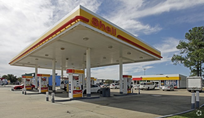
1941 Lynnhaven Pky
1485-07-3769
GREEN RUN PUD SEC F-4 PAR F-4A .764 AC + OR-
Servicestationmarket
Virginia Beach City
PDH1
Virginia
B and X Area of moderate flood hazard, usually the area between the limits of the 100-year and 500-year floods.
f4a00
2024
0.73 AC
2025
Princess Anne
046018
Hampton Roads
3,936 SF
Virginia Beach-Chesapeake-Norfolk, VA-NC
NEARBY LISTINGS FOR SALE OR LEASE
DEMOGRAPHICS near 1941 Lynnhaven Pky
1 mile
3 mile
5 mile
2025 Total Population
20,832
130,084
244,872
2030 Population
20,610
127,532
241,100
Pop Growth 2025-2030
(1.07%)
(1.96%)
(1.54%)
Average Age
37
39
39
2025 Total Households
7,625
48,082
90,751
HH Growth 2025-2030
(1.09%)
(2.00%)
(1.63%)
Median Household Inc
$93,562
$89,152
$90,236
Avg Household Size
2.70
2.60
2.60
2025 Avg HH Vehicles
2.00
2.00
2.00
Median Home Value
$318,202
$332,297
$347,546
Median Year Built
1986
1983
1982
Nearby Places
Map Layers
Map Styles
 Street
 Aerial
Layers
 Traffic
 Biking
Places
Listings with unknown addresses are not visible on the map
- Restaurants
- Banks
- Shops
- Fitness
- Groceries
Nearby Properties
Address
Land Use
TOTAL SIZE
Lot Size
Zoning
Address
Land Use
TOTAL SIZE
Lot Size
Zoning
693,172 SF
O2
Address
Land Use
TOTAL SIZE
Lot Size
Zoning
100 SF
13.35 AC
B2
Address
Land Use
TOTAL SIZE
Lot Size
Zoning
536,135 SF
115.04 AC
P1
Address
Land Use
TOTAL SIZE
Lot Size
Zoning
1 SF
44.31 AC
A18
Address
Land Use
TOTAL SIZE
Lot Size
Zoning
23.06 AC
A36
Address
Land Use
TOTAL SIZE
Lot Size
Zoning
1 SF
42.35 AC
A18
Address
Land Use
TOTAL SIZE
Lot Size
Zoning
1 SF
24.56 AC
A18
Address
Land Use
TOTAL SIZE
Lot Size
Zoning
4 SF
19.85 AC
A12
Address
Land Use
TOTAL SIZE
Lot Size
Zoning
153 SF
88.33 AC
R75
Address
Land Use
TOTAL SIZE
Lot Size
Zoning
309,512 SF
65.15 AC
P1
Address
Land Use
TOTAL SIZE
Lot Size
Zoning
349,667 SF
35.30 AC
Address
Land Use
TOTAL SIZE
Lot Size
Zoning
3 SF
13.58 AC
A12
Address
Land Use
TOTAL SIZE
Lot Size
Zoning
9.62 AC
A36
Address
Land Use
TOTAL SIZE
Lot Size
Zoning
287,520 SF
13.10 AC
A18
Address
Land Use
TOTAL SIZE
Lot Size
Zoning
289,581 SF
49.99 AC
R5D
Address
Land Use
TOTAL SIZE
Lot Size
Zoning
1 SF
18.64 AC
PDH1
Address
Land Use
TOTAL SIZE
Lot Size
Zoning
366,189 SF
55.78 AC
B2
Address
Land Use
TOTAL SIZE
Lot Size
Zoning
1 SF
16.15 AC
PDH1
Address
Land Use
TOTAL SIZE
Lot Size
Zoning
73,244 SF
11.60 AC
B4C
Address
Land Use
TOTAL SIZE
Lot Size
Zoning
Address
Land Use
TOTAL SIZE
Lot Size
Zoning
1 SF
12.01 AC
PDH1
Address
Land Use
TOTAL SIZE
Lot Size
Zoning
252,686 SF
50.05 AC
PDH1
Address
Land Use
TOTAL SIZE
Lot Size
Zoning
174,868 SF
65.46 AC
AG1
Address
Land Use
TOTAL SIZE
Lot Size
Zoning
1 SF
10.64 AC
PDH1
Address
Land Use
TOTAL SIZE
Lot Size
Zoning
128,577 SF
15.28 AC
I1
Address
Land Use
TOTAL SIZE
Lot Size
Zoning
1 SF
12.42 AC
A18
Address
Land Use
TOTAL SIZE
Lot Size
Zoning
259,135 SF
50.10 AC
R10
Address
Land Use
TOTAL SIZE
Lot Size
Zoning
1 SF
11.50 AC
PDH1
Address
Land Use
TOTAL SIZE
Lot Size
Zoning
68,731 SF
5.80 AC
Address
Land Use
TOTAL SIZE
Lot Size
Zoning
177,802 SF
4.90 AC
A36
The World's #1 Commercial Real Estate Marketplace
Connect with us
© 2026 CoStar Group
The information above has been obtained from sources believed reliable. While we do not doubt its accuracy we have not verified it and make no guarantee, warranty or representation about it. It is your responsibility to independently confirm its accuracy and completeness. Any projections, opinions, assumptions, or estimates used are for example only and do not represent the current or future performance of the property. The value of this transaction to you depends on tax and other factors which should be evaluated by your tax, financial, and legal advisors. You and your advisors should conduct a careful, independent investigation of the property to determine to your satisfaction the suitability of the property for your needs.