Property Record
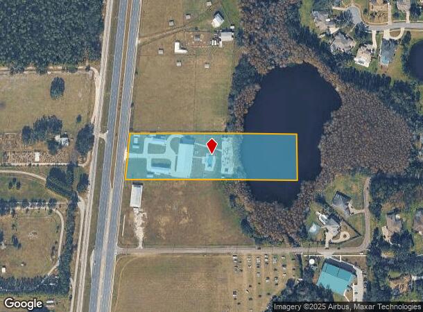
19421 N Us Highway 41, Lutz, FL 33549


NEARBY LISTINGS FOR SALE OR LEASE
-
-
View all Lutz listings for sale on LoopNet.com
Property Detail
19421 N Us Highway 41
Tampa/St Petersburg
Oasis Lot 41
Tampa-St. Petersburg-Clearwater, FL
OASIS LOT 41 LOT 1
U-01-27-18-C1M-000000-00001.0
Hillsborough
Commercialofficeresidentialmixeduse
Florida
2024
1
2024
4.43 AC
011005
NW Hillsborough
18,900 SF
DEMOGRAPHICS near 19421 N Us Highway 41
1 Mile
3 Mile
5 Mile
2024 Total Population
2,697
38,443
113,920
2029 Population
2,975
43,993
130,620
Pop Growth 2024-2029
+ 10.31%
+ 14.44%
+ 14.66%
Average Age
44
42
40
2024 Total Households
1,013
14,341
42,566
HH Growth 2024-2029
+ 10.56%
+ 14.90%
+ 14.81%
Median Household Inc
$115,208
$106,289
$96,445
Avg Household Size
2.60
2.60
2.60
2024 Avg HH Vehicles
2.00
2.00
2.00
Median Home Value
$462,911
$388,161
$365,966
Median Year Built
1989
1997
1998
Nearby Places
Map Layers
Map Styles
 Street
 Aerial
- Restaurants
- Banks
- Shops
- Fitness
- Groceries
PUBLIC TRANSPORTATION
AIRPORT
Tampa International
DRIVE
WALK
Distance
Tampa International
34 min
22.7 mi
St Pete-Clearwater International
DRIVE
WALK
Distance
St Pete-Clearwater International
53 min
32.4 mi
Freight Ports
Port of Tampa Bay
DRIVE
WALK
Distance
Port of Tampa Bay
32 min
18.9 mi
Nearby Properties
Address
Land Use
TOTAL SIZE
Lot Size
Zoning
Address
Land Use
TOTAL SIZE
Lot Size
Zoning
444,470 SF
147.09 AC
AR
Address
Land Use
TOTAL SIZE
Lot Size
Zoning
366,691 SF
51.90 AC
MPUD
Address
Land Use
TOTAL SIZE
Lot Size
Zoning
285,532 SF
57.73 AC
MF1
Address
Land Use
TOTAL SIZE
Lot Size
Zoning
207,337 SF
11.54 AC
PD
Address
Land Use
TOTAL SIZE
Lot Size
Zoning
138,949 SF
11.74 AC
MPUD
Address
Land Use
TOTAL SIZE
Lot Size
Zoning
2,850 SF
68.38 AC
PD
Address
Land Use
TOTAL SIZE
Lot Size
Zoning
89,269 SF
9.42 AC
C2
Address
Land Use
TOTAL SIZE
Lot Size
Zoning
62,050 SF
11.17 AC
PD
Address
Land Use
TOTAL SIZE
Lot Size
Zoning
85,151 SF
23.18 AC
C2
Address
Land Use
TOTAL SIZE
Lot Size
Zoning
74,366 SF
22.46 AC
PD
Address
Land Use
TOTAL SIZE
Lot Size
Zoning
88,803 SF
6.46 AC
C2
Address
Land Use
TOTAL SIZE
Lot Size
Zoning
63,500 SF
32.29 AC
PD
Address
Land Use
TOTAL SIZE
Lot Size
Zoning
129,324 SF
4.95 AC
C2
Address
Land Use
TOTAL SIZE
Lot Size
Zoning
80,719 SF
8.14 AC
PD
Address
Land Use
TOTAL SIZE
Lot Size
Zoning
195,182 SF
22.91 AC
MPUD
Address
Land Use
TOTAL SIZE
Lot Size
Zoning
133,367 SF
11.98 AC
CG
Address
Land Use
TOTAL SIZE
Lot Size
Zoning
104,406 SF
16.81 AC
PD
Address
Land Use
TOTAL SIZE
Lot Size
Zoning
91,241 SF
8.38 AC
ASC-1
Address
Land Use
TOTAL SIZE
Lot Size
Zoning
98,701 SF
2.09 AC
MPUD
Address
Land Use
TOTAL SIZE
Lot Size
Zoning
65,365 SF
8.68 AC
PD
Address
Land Use
TOTAL SIZE
Lot Size
Zoning
75,630 SF
8.17 AC
PD
Address
Land Use
TOTAL SIZE
Lot Size
Zoning
129,365 SF
5 AC
C2
Address
Land Use
TOTAL SIZE
Lot Size
Zoning
104,550 SF
14.03 AC
C2
Address
Land Use
TOTAL SIZE
Lot Size
Zoning
120,547 SF
40.64 AC
C2
Address
Land Use
TOTAL SIZE
Lot Size
Zoning
96,779 SF
7.10 AC
MPUD
Address
Land Use
TOTAL SIZE
Lot Size
Zoning
97,656 SF
1.87 AC
C2
Address
Land Use
TOTAL SIZE
Lot Size
Zoning
85,626 SF
14.47 AC
PD
Address
Land Use
TOTAL SIZE
Lot Size
Zoning
52,275 SF
4.98 AC
MPUD
Address
Land Use
TOTAL SIZE
Lot Size
Zoning
95,769 SF
12.96 AC
RSC-6
Address
Land Use
TOTAL SIZE
Lot Size
Zoning
69,956 SF
3.87 AC
PD
The World's #1 Commercial Real Estate Marketplace
Connect with us
© 2025 CoStar Group
The information above has been obtained from sources believed reliable. While we do not doubt its accuracy we have not verified it and make no guarantee, warranty or representation about it. It is your responsibility to independently confirm its accuracy and completeness. Any projections, opinions, assumptions, or estimates used are for example only and do not represent the current or future performance of the property. The value of this transaction to you depends on tax and other factors which should be evaluated by your tax, financial, and legal advisors. You and your advisors should conduct a careful, independent investigation of the property to determine to your satisfaction the suitability of the property for your needs.