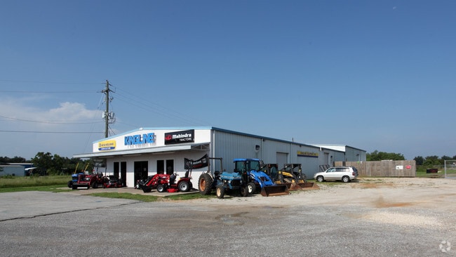
Property Record
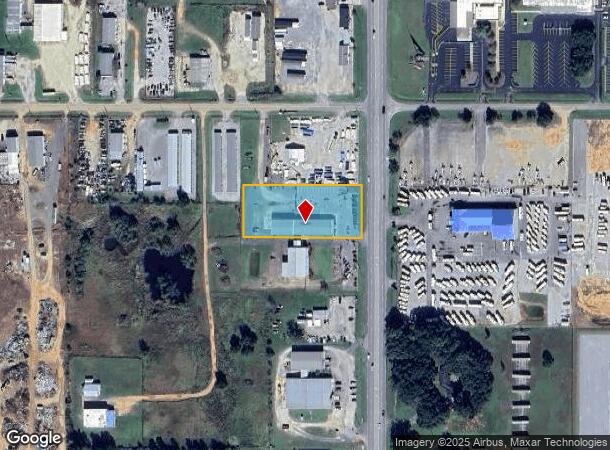
19425 State Highway 59, Summerdale, AL 36580

NEARBY LISTINGS FOR SALE OR LEASE
Property Detail
19425 State Highway 59
Daphne-Fairhope-Foley, AL
Parkway Estates
48-04-19-0-000-004.038
LOT 6A A RESUBDIVISION OF PARKWAY ESTATES SUBDIVISION - UNIT TWO SLIDE 2876-B, SLIDE 1289-A
Autorepair
Baldwin
X
Alabama
01003C0690M
6a
2024
1.60 AC
2024
Baldwin County
011000
Mobile
10,102 SF
DEMOGRAPHICS near 19425 State Highway 59
1 Mile
3 Mile
5 Mile
2024 Total Population
252
5,223
16,744
2029 Population
288
5,903
19,030
Pop Growth 2024-2029
+ 14.29%
+ 13.02%
+ 13.65%
Average Age
40
38
39
2024 Total Households
94
1,931
6,200
HH Growth 2024-2029
+ 13.83%
+ 12.48%
+ 13.21%
Median Household Inc
$52,000
$58,580
$58,348
Avg Household Size
2.50
2.60
2.60
2024 Avg HH Vehicles
2.00
2.00
2.00
Median Home Value
$211,765
$220,861
$205,104
Median Year Built
1993
1995
1996
Nearby Places
Map Layers
Map Styles
 Street
 Aerial
- Restaurants
- Banks
- Shops
- Fitness
- Groceries
PUBLIC TRANSPORTATION
AIRPORT
Mobile International
DRIVE
WALK
Distance
Mobile International
45 min
33.2 mi
Freight Ports
Port of Mobile
DRIVE
WALK
Distance
Port of Mobile
40 min
29.8 mi
Nearby Properties
Address
Land Use
TOTAL SIZE
Lot Size
Zoning
Address
Land Use
TOTAL SIZE
Lot Size
Zoning
129,533 SF
17 AC
Address
Land Use
TOTAL SIZE
Lot Size
Zoning
46,778 SF
3.65 AC
Address
Land Use
TOTAL SIZE
Lot Size
Zoning
39,816 SF
3.80 AC
Address
Land Use
TOTAL SIZE
Lot Size
Zoning
Address
Land Use
TOTAL SIZE
Lot Size
Zoning
11,810 SF
17 AC
Address
Land Use
TOTAL SIZE
Lot Size
Zoning
Address
Land Use
TOTAL SIZE
Lot Size
Zoning
9,272 SF
8.30 AC
Address
Land Use
TOTAL SIZE
Lot Size
Zoning
4,442 SF
10 AC
Address
Land Use
TOTAL SIZE
Lot Size
Zoning
33,925 SF
4.40 AC
Address
Land Use
TOTAL SIZE
Lot Size
Zoning
54,922 SF
11 AC
Address
Land Use
TOTAL SIZE
Lot Size
Zoning
28,590 SF
2.86 AC
Address
Land Use
TOTAL SIZE
Lot Size
Zoning
7,875 SF
6.50 AC
Address
Land Use
TOTAL SIZE
Lot Size
Zoning
31,359 SF
19 AC
Address
Land Use
TOTAL SIZE
Lot Size
Zoning
32,361 SF
8.50 AC
Address
Land Use
TOTAL SIZE
Lot Size
Zoning
44,289 SF
8.30 AC
Address
Land Use
TOTAL SIZE
Lot Size
Zoning
10,240 SF
20 AC
Address
Land Use
TOTAL SIZE
Lot Size
Zoning
11,825 SF
6.60 AC
Address
Land Use
TOTAL SIZE
Lot Size
Zoning
30,490 SF
4.51 AC
Address
Land Use
TOTAL SIZE
Lot Size
Zoning
13,036 SF
4.90 AC
Address
Land Use
TOTAL SIZE
Lot Size
Zoning
53,144 SF
13 AC
Address
Land Use
TOTAL SIZE
Lot Size
Zoning
13,721 SF
1.04 AC
Address
Land Use
TOTAL SIZE
Lot Size
Zoning
58,099 SF
6.70 AC
Address
Land Use
TOTAL SIZE
Lot Size
Zoning
11,090 SF
3.30 AC
Address
Land Use
TOTAL SIZE
Lot Size
Zoning
51,241 SF
25 AC
Address
Land Use
TOTAL SIZE
Lot Size
Zoning
36,639 SF
19 AC
Address
Land Use
TOTAL SIZE
Lot Size
Zoning
2,909 SF
3 AC
Address
Land Use
TOTAL SIZE
Lot Size
Zoning
20,074 SF
4 AC
Address
Land Use
TOTAL SIZE
Lot Size
Zoning
5,902 SF
18 AC
Address
Land Use
TOTAL SIZE
Lot Size
Zoning
8,542 SF
1.12 AC
Address
Land Use
TOTAL SIZE
Lot Size
Zoning
9,450 SF
4.77 AC
The World's #1 Commercial Real Estate Marketplace
Connect with us
© 2026 CoStar Group
The information above has been obtained from sources believed reliable. While we do not doubt its accuracy we have not verified it and make no guarantee, warranty or representation about it. It is your responsibility to independently confirm its accuracy and completeness. Any projections, opinions, assumptions, or estimates used are for example only and do not represent the current or future performance of the property. The value of this transaction to you depends on tax and other factors which should be evaluated by your tax, financial, and legal advisors. You and your advisors should conduct a careful, independent investigation of the property to determine to your satisfaction the suitability of the property for your needs.